
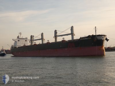
ARMONIA.GR
Cargo
Current Trip
| Time Travelled | 5 days |
|---|---|
| Remaining Time | --- |
| Distance Travelled | 243.72 nm |
| Remaining Distance | --- |
| AVG Speed | 9.6 Knots |
| MAX Speed | 14.2 Knots |
| AVG Wind | 8.9 knots |
| MAX Wind | 26.9 knots |
| MIN Temp | 12.4°C / 54.32°F |
| MAX Temp | 24.1°C / 75.38°F |
| Draught | 10.1 m |
| Position Received | 9 h, 29 m ago |
Current Position
| Longitude | -57.81523° |
|---|---|
| Latitude | -34.73533° |
| Status | At anchor |
| Speed | |
| Course | 307° |
| Area | Rio de La Plata |
| Station | T-AIS |
| Position Received | 9 h, 29 m ago |
Info
Information
The current position of ARMONIA.GR is in Rio de La Plata with coordinates -34.73533° / -57.81523° as reported on 2024-04-23 01:44 by AIS to our vessel tracker app. The vessel's current speed is 0 Knots and is heading at the port of CORUNA. The estimated time of arrival as calculated by MyShipTracking vessel tracking app is 2024-05-08 10:00 LT
The vessel ARMONIA.GR (IMO: 9758868, MMSI: 538009119) is a Cargo It's sailing under the flag of [MH] Marshall Is.
In this page you can find informations about the vessels current position, last detected port calls, and current voyage information. If the vessels is not in coverage by AIS you will find the latest position.
The current position of ARMONIA.GR is detected by our AIS receivers and we are not responsible for the reliability of the data. The last position was recorded while the vessel was in Coverage by the Ais receivers of our vessel tracking app.
The current draught of ARMONIA.GR as reported by AIS is 10.1 meters
Weather
| Temperature | 18.7°C / 65.66°F |
|---|---|
| Wind Speed | 11 knots |
| Direction | 230° SW |
| Pressure | 1011.3 hPa |
| Humidity | 95.2 % |
| Cloud Coverage | 70 % |
Featured Company
Last Port Calls
| Port | Arrival | Departure | Time In Port |
|---|---|---|---|
| 2024-04-11 19:02 | 2024-04-17 19:02 | 6 d | |
| 2024-03-28 17:14 | 2024-03-30 03:37 | 1 d | |
| 2024-03-23 20:45 | 2024-03-27 00:09 | 3 d | |
| 2024-03-09 03:12 | 2024-03-15 01:50 | 5 d | |
| 2024-02-17 20:21 | 2024-02-18 18:27 | 22 h | |
| 2024-02-07 05:57 | 2024-02-13 13:31 | 6 d | |
| 2024-02-02 20:42 |
Most Visited Ports (Last year)
| Port | Arrivals | |
|---|---|---|
| 2 | ||
| 2 | ||
| 1 | ||
| 1 | ||
| 1 | ||
| 1 |
Last Trips
| Origin | Departure | Destination | Arrival | Distance | |
|---|---|---|---|---|---|
| 2024-03-30 00:37 | 2024-04-11 16:02 | 986.35 nm | |||
| 2024-03-26 21:09 | 2024-03-28 14:14 | 59.43 nm | |||
| 2024-03-14 22:50 | 2024-03-23 17:45 | 605.22 nm | |||
| 2024-02-18 13:27 | 2024-03-09 00:12 | 3824.68 nm | |||
| 2024-02-13 08:31 | 2024-02-17 15:21 | 1380.40 nm | |||
| 2024-02-02 14:42 | 2024-02-07 00:57 | 1215.18 nm |
Events
| Time | Event | Details | Position / Dest | Info |
|---|---|---|---|---|
| 2024-04-23 01:52 | Status Changed | Default At anchor |
-34.73500 / -57.81500
ES LCG
|
Speed: Course: 307° |
| 2024-04-23 01:44 | Status Changed | At anchor Default |
-34.73533 / -57.81523
ES LCG
|
Speed: Course: -1° |
| 2024-04-23 01:44 | OUT of Coverage |
-34.73533 / -57.81523
Rio de La Plata
ES LCG
|
Speed: Course: 99.7° |
|
| 2024-04-23 01:28 | Status Changed | Default At anchor |
-34.73500 / -57.81500
ES LCG
|
Speed: Course: 304° |
| 2024-04-23 01:23 | Status Changed | At anchor Default |
-34.73526 / -57.81515
ES LCG
|
Speed: Course: -1° |
| 2024-04-23 01:16 | IN Coverage |
-34.73526 / -57.81515
Rio de La Plata
ES LCG
|
Speed: Course: 99.7° |
|
| 2024-04-22 18:52 | Status Changed | Default At anchor |
-34.73500 / -57.81500
ES LCG
|
Speed: Course: 3° |
| 2024-04-22 18:41 | OUT of Coverage |
-34.73610 / -57.81670
Rio de La Plata
ES LCG
|
Speed: Course: 99.7° |
|
| 2024-04-22 18:29 | Status Changed | At anchor Default |
-34.73611 / -57.81683
ES LCG
|
Speed: Course: -1° |
| 2024-04-22 18:29 | IN Coverage |
-34.73611 / -57.81683
Rio de La Plata
ES LCG
|
Speed: Course: 99.7° |