
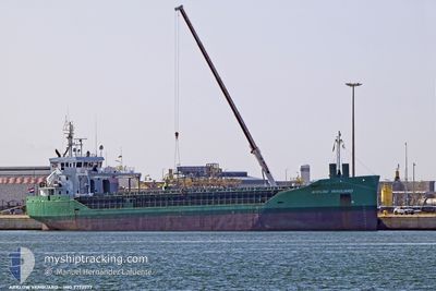
ARKLOW VANGUARD
Cargo
Current Trip
| Time Travelled | 1 day |
|---|---|
| Remaining Time | --- |
| Distance Travelled | 346.82 nm |
| Remaining Distance | --- |
| AVG Speed | 11 Knots |
| MAX Speed | 12.9 Knots |
| AVG Wind | 12.9 knots |
| MAX Wind | 25 knots |
| MIN Temp | 12.8°C / 55.04°F |
| MAX Temp | 19.6°C / 67.28°F |
| Draught | 6.4 m |
| Position Received | 11 h, 53 m ago |
Current Position
| Longitude | -9.74410° |
|---|---|
| Latitude | 41.68618° |
| Status | Under way using engine |
| Speed | 11.4 Knots |
| Course | 0.8° |
| Area | North Atlantic Ocean |
| Station | T-AIS |
| Position Received | 11 h, 53 m ago |
Info
Information
The current position of ARKLOW VANGUARD is in North Atlantic Ocean with coordinates 41.68618° / -9.74410° as reported on 2024-04-25 04:58 by AIS to our vessel tracker app. The vessel's current speed is 11.4 Knots and is heading at the port of SUNDERLAND. The estimated time of arrival as calculated by MyShipTracking vessel tracking app is 2024-04-29 07:00 LT
The vessel ARKLOW VANGUARD (IMO: 9772577, MMSI: 244050844) is a Cargo It's sailing under the flag of [NL] Netherlands.
In this page you can find informations about the vessels current position, last detected port calls, and current voyage information. If the vessels is not in coverage by AIS you will find the latest position.
The current position of ARKLOW VANGUARD is detected by our AIS receivers and we are not responsible for the reliability of the data. The last position was recorded while the vessel was in Coverage by the Ais receivers of our vessel tracking app.
The current draught of ARKLOW VANGUARD as reported by AIS is 6.4 meters
Weather
| Temperature | 13°C / 55.4°F |
|---|---|
| Wind Speed | 15 knots |
| Direction | 291° WNW |
| Pressure | 1010.1 hPa |
| Humidity | 80.4 % |
| Cloud Coverage | 56 % |
Featured Company
Last Port Calls
| Port | Arrival | Departure | Time In Port |
|---|---|---|---|
| 2024-04-21 08:08 | 2024-04-24 09:02 | 3 d | |
| 2024-04-19 13:17 | 2024-04-20 13:33 | 1 d | |
| 2024-04-14 19:06 | 2024-04-16 10:19 | 1 d | |
| 2024-04-13 01:54 | 2024-04-13 12:43 | 10 h | |
| 2024-04-11 18:49 | 2024-04-12 16:21 | 21 h | |
| 2024-04-09 17:19 | 2024-04-11 10:03 | 1 d | |
| 2024-04-03 05:04 | 2024-04-06 00:06 | 2 d | |
| 2024-04-01 14:07 | 2024-04-02 15:21 | 1 d | |
| 2024-03-23 05:27 | 2024-03-23 20:23 | 14 h | |
| 2024-03-20 21:22 | 2024-03-21 18:44 | 21 h |
Last Trips
| Origin | Departure | Destination | Arrival | Distance | |
|---|---|---|---|---|---|
| 2024-04-20 14:33 | 2024-04-21 09:08 | 192.28 nm | |||
| 2024-04-16 12:19 | 2024-04-19 14:17 | 586.09 nm | |||
| 2024-04-13 14:43 | 2024-04-14 21:06 | 268.26 nm | |||
| 2024-04-12 18:21 | 2024-04-13 03:54 | 100.17 nm | |||
| 2024-04-11 12:03 | 2024-04-11 20:49 | 43.20 nm | |||
| 2024-04-06 02:06 | 2024-04-09 19:19 | 800.13 nm | |||
| 2024-04-02 17:21 | 2024-04-03 07:04 | 122.99 nm | |||
| 2024-03-23 20:23 | 2024-04-01 16:07 | 1413.55 nm | |||
| 2024-03-21 18:44 | 2024-03-23 05:27 | 302.76 nm | |||
| 2024-03-20 05:03 | 2024-03-20 21:22 | 144.63 nm |
Events
| Time | Event | Details | Position / Dest | Info |
|---|---|---|---|---|
| 2024-04-25 05:05 | Status Changed | Default Under way using engine |
41.70667 / -9.74500
GBSUN
|
Speed: 11.4 kn Course: 0.8° |
| 2024-04-25 04:58 | Status Changed | Under way using engine Default |
41.68618 / -9.74410
GBSUN
|
Speed: 12 kn Course: 359° |
| 2024-04-25 04:58 | IN Coverage |
41.68618 / -9.74410
North Atlantic Ocean
GBSUN
|
Speed: 11.4 kn Course: 0.8° |
|
| 2024-04-25 04:58 | OUT of Coverage |
41.68618 / -9.74410
North Atlantic Ocean
GBSUN
|
Speed: 11.4 kn Course: 0.8° |
|
| 2024-04-25 02:46 | Status Changed | Default Under way using engine |
41.26833 / -9.73500
GBSUN
|
Speed: 11.2 kn Course: 2° |
| 2024-04-25 02:33 | OUT of Coverage |
41.20872 / -9.73603
North Atlantic Ocean
GBSUN
|
Speed: 11.2 kn Course: 2° |
|
| 2024-04-25 02:26 | Status Changed | Under way using engine Default |
41.19925 / -9.73642
GBSUN
|
Speed: 11 kn Course: 3° |
| 2024-04-25 02:01 | Status Changed | Default Under way using engine |
41.12638 / -9.74022
GBSUN
|
Speed: 11.1 kn Course: 1.5° |
| 2024-04-25 01:54 | Status Changed | Under way using engine Default |
41.10293 / -9.74082
GBSUN
|
Speed: 11 kn Course: 1° |
| 2024-04-25 01:45 | Status Changed | Default Under way using engine |
41.07535 / -9.74110
GBSUN
|
Speed: 10.5 kn Course: 359.6° |