
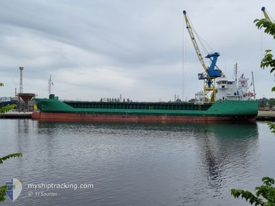
ARKLOW FALCON
General Cargo
Current Trip
| Time Travelled | 15 h, 5 mins |
|---|---|
| Remaining Time | 2 days |
| Distance Travelled | 135.06 nm |
| Remaining Distance | 645.23 nm |
| AVG Speed | 9.7 Knots |
| MAX Speed | 12.2 Knots |
| AVG Wind | 20 knots |
| MAX Wind | 27 knots |
| MIN Temp | 7.5°C / 45.5°F |
| MAX Temp | 10.4°C / 50.72°F |
| Draught | 4.7 m |
| Position Received | 1 m ago |
Current Position
| Longitude | 1.83650° |
|---|---|
| Latitude | 51.32383° |
| Status | Under way using engine |
| Speed | 9 Knots |
| Course | 207° |
| Area | North Sea |
| Station | T-AIS |
| Position Received | 1 m ago |
Info
Information
The current position of ARKLOW FALCON is in North Sea with coordinates 51.32383° / 1.83650° as reported on 2024-04-19 09:03 by AIS to our vessel tracker app. The vessel's current speed is 9 Knots and is heading at the port of SANTANDER. The estimated time of arrival as calculated by MyShipTracking vessel tracking app is 2024-04-22 07:52 LT
The vessel ARKLOW FALCON (IMO: 9527659, MMSI: 250002033) is a General Cargo that was built in 2010 ( 14 years old ). It's sailing under the flag of [IE] Ireland.
In this page you can find informations about the vessels current position, last detected port calls, and current voyage information. If the vessels is not in coverage by AIS you will find the latest position.
The current position of ARKLOW FALCON is detected by our AIS receivers and we are not responsible for the reliability of the data. The last position was recorded while the vessel was in Coverage by the Ais receivers of our vessel tracking app.
The current draught of ARKLOW FALCON as reported by AIS is 4.7 meters
Weather
| Temperature | 10.4°C / 50.72°F |
|---|---|
| Wind Speed | 24 knots |
| Direction | 300° WNW |
| Pressure | 1013.7 hPa |
| Humidity | 81.5 % |
| Cloud Coverage | 100 % |
Featured Company
Last Port Calls
| Port | Arrival | Departure | Time In Port |
|---|---|---|---|
| 2024-04-16 22:44 | 2024-04-18 17:59 | 1 d | |
| 2024-04-08 14:24 | 2024-04-10 20:59 | 2 d | |
| 2024-04-05 18:20 | |||
| 2024-03-28 06:51 | 2024-03-29 14:38 | 1 d | |
| 2024-03-28 06:15 | 2024-03-28 06:26 | 11 m | |
| 2024-03-27 23:22 | 2024-03-28 02:09 | 2 h | |
| 2024-03-25 01:39 | 2024-03-27 21:57 | 2 d | |
| 2024-03-24 23:11 | 2024-03-25 01:03 | 1 h | |
| 2024-03-19 22:38 | 2024-03-22 16:12 | 2 d | |
| 2024-03-12 16:09 | 2024-03-14 13:29 | 1 d |
Last Trips
| Origin | Departure | Destination | Arrival | Distance | |
|---|---|---|---|---|---|
| 2024-04-10 22:59 | 2024-04-17 00:44 | 1419.61 nm | |||
| 2024-04-05 19:20 | 2024-04-08 16:24 | 511.36 nm | |||
| 2024-03-28 07:26 | 2024-03-28 07:51 | 1.39 nm | |||
| 2024-03-28 03:09 | 2024-03-28 07:15 | 27.61 nm | |||
| 2024-03-27 22:57 | 2024-03-28 00:22 | 6.22 nm | |||
| 2024-03-25 02:03 | 2024-03-25 02:39 | 3.21 nm | |||
| 2024-03-22 16:12 | 2024-03-25 00:11 | 530.03 nm | |||
| 2024-03-14 14:29 | 2024-03-19 22:38 | 625.53 nm | |||
| 2024-03-09 07:15 | 2024-03-12 17:09 | 699.24 nm | |||
| 2024-02-22 14:55 | 2024-03-02 02:07 | 1623.29 nm |
Events
| Time | Event | Details | Position / Dest | Info |
|---|---|---|---|---|
| 2024-04-19 06:02 | ETA Changed | 2024/04/22 05:00 2024/04/22 03:00 |
51.69700 / 2.33025
ESSDR
|
Speed: 10 kn Course: 225° |
| 2024-04-19 05:40 | Change Sea Area | United Kingdom part of the North Sea Belgian part of the North Sea |
51.73950 / 2.40150
North Sea
ESSDR
|
Speed: 9.9 kn Course: 227° |
| 2024-04-19 04:46 | Change Sea Area | Belgian part of the North Sea Dutch part of the North Sea |
51.84258 / 2.57069
North Sea
ESSDR
|
Speed: 9.9 kn Course: 228° |
| 2024-04-18 23:52 | IN Coverage |
52.04400 / 3.45717
North Sea
ESSDR
|
Speed: 7.3 kn Course: 266° |
|
| 2024-04-18 22:43 | OUT of Coverage |
52.05300 / 3.68817
North Sea
ESSDR
|
Speed: 7.2 kn Course: 265° |
|
| 2024-04-18 17:59 | PORT DEPARTURE |
|
51.70750 / 4.61467
ESSDR
|
Speed: 7.8 kn Course: 34° |
| 2024-04-18 17:53 | Draught Changed | 4.7 6.2 |
51.69800 / 4.59700
[NL] MOERDIJK
|
Speed: 8.1 kn Course: 65° |
| 2024-04-18 17:53 | Destination Changed | ESSDR NLMOE |
51.69800 / 4.59700
[NL] MOERDIJK
|
Speed: 8.1 kn Course: 65° |
| 2024-04-18 17:53 | ETA Changed | 2024/04/22 03:00 2024/04/16 07:00 |
51.69800 / 4.59700
[NL] MOERDIJK
|
Speed: 8.1 kn Course: 65° |
| 2024-04-18 17:43 | START Moving |
51.68933 / 4.59517
[NL] MOERDIJK
|
Speed: 3.4 kn Course: 284° |