
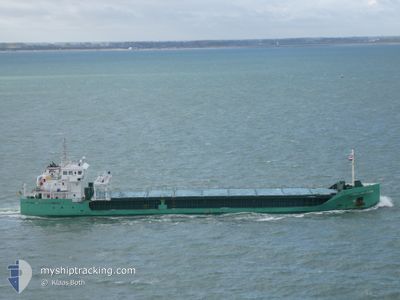
ARKLOW CLAN
Cargo
Current Trip
| Time Travelled | 3 days |
|---|---|
| Remaining Time | --- |
| Distance Travelled | 737.69 nm |
| Remaining Distance | --- |
| AVG Speed | 9.8 Knots |
| MAX Speed | 11.9 Knots |
| AVG Wind | 11.3 knots |
| MAX Wind | 23.6 knots |
| MIN Temp | -7.8°C / 17.96°F |
| MAX Temp | 5.9°C / 42.62°F |
| Draught | 6.1 m |
| Position Received | 18 h, 55 m ago |
Current Position
| Longitude | 0.16880° |
|---|---|
| Latitude | 61.51275° |
| Status | Under way using engine |
| Speed | 10.7 Knots |
| Course | 226.1° |
| Area | Norwegian Sea |
| Station | T-AIS |
| Position Received | 18 h, 55 m ago |
Info
Information
The current position of ARKLOW CLAN is in Norwegian Sea with coordinates 61.51275° / 0.16880° as reported on 2024-04-23 13:39 by AIS to our vessel tracker app. The vessel's current speed is 10.7 Knots and is heading at the port of WATERFORD. The estimated time of arrival as calculated by MyShipTracking vessel tracking app is 2024-04-26 07:00 LT
The vessel ARKLOW CLAN (IMO: 9757113, MMSI: 250004424) is a Cargo It's sailing under the flag of [IE] Ireland.
In this page you can find informations about the vessels current position, last detected port calls, and current voyage information. If the vessels is not in coverage by AIS you will find the latest position.
The current position of ARKLOW CLAN is detected by our AIS receivers and we are not responsible for the reliability of the data. The last position was recorded while the vessel was in Coverage by the Ais receivers of our vessel tracking app.
The current draught of ARKLOW CLAN as reported by AIS is 6.1 meters
Weather
| Temperature | 5.8°C / 42.44°F |
|---|---|
| Wind Speed | 9 knots |
| Direction | 336° NNW |
| Pressure | 1020.8 hPa |
| Humidity | 66.3 % |
| Cloud Coverage | 6 % |
Featured Company
Last Port Calls
| Port | Arrival | Departure | Time In Port |
|---|---|---|---|
| 2024-04-17 10:31 | 2024-04-21 04:19 | 3 d | |
| 2024-04-10 04:02 | 2024-04-11 16:04 | 1 d | |
| 2024-04-05 05:54 | 2024-04-06 23:49 | 1 d | |
| 2024-04-04 18:00 | 2024-04-04 18:32 | 32 m | |
| 2024-03-30 02:27 | 2024-03-30 03:06 | 38 m | |
| 2024-03-29 10:45 | 2024-03-29 22:55 | 12 h | |
| 2024-03-25 10:30 | 2024-03-26 18:30 | 1 d | |
| 2024-03-19 10:36 | 2024-03-24 15:12 | 5 d | |
| 2024-03-15 11:53 | 2024-03-15 13:50 | 1 h | |
| 2024-03-12 15:41 |
Most Visited Ports (Last year)
| Port | Arrivals | |
|---|---|---|
| 6 | ||
| 4 | ||
| 3 | ||
| 3 | ||
| 3 | ||
| 3 |
Last Trips
| Origin | Departure | Destination | Arrival | Distance | |
|---|---|---|---|---|---|
| 2024-04-11 17:04 | 2024-04-17 12:31 | 1109.53 nm | |||
| 2024-04-07 00:49 | 2024-04-10 05:02 | 597.79 nm | |||
| 2024-04-04 19:32 | 2024-04-05 06:54 | 125.29 nm | |||
| 2024-03-30 03:06 | 2024-04-04 19:00 | 4.37 nm | |||
| 2024-03-26 19:30 | 2024-03-30 02:27 | 678.42 nm | |||
| 2024-03-26 19:30 | 2024-03-29 10:45 | 650.58 nm | |||
| 2024-03-24 16:12 | 2024-03-25 11:30 | 214.51 nm | |||
| 2024-03-15 14:50 | 2024-03-19 11:36 | 897.17 nm | |||
| 2024-03-12 16:41 | 2024-03-15 12:53 | 701.68 nm | |||
| 2024-02-15 16:56 | 2024-02-18 16:38 | 759.74 nm |
Events
| Time | Event | Details | Position / Dest | Info |
|---|---|---|---|---|
| 2024-04-23 13:47 | Status Changed | Default Under way using engine |
61.49667 / .13500
IEWAT
|
Speed: 10.7 kn Course: 226.1° |
| 2024-04-23 13:39 | Detected in Sea | United Kingdom part of the Norwegian Sea |
61.51275 / .16880
Norwegian Sea
IEWAT
|
Speed: 10.7 kn Course: 226.1° |
| 2024-04-23 13:39 | Status Changed | Under way using engine Default |
61.51275 / .16880
IEWAT
|
Speed: 10.5 kn Course: 225° |
| 2024-04-23 13:39 | IN Coverage |
61.51275 / .16880
Norwegian Sea
IEWAT
|
Speed: 10.7 kn Course: 226.1° |
|
| 2024-04-23 13:39 | OUT of Coverage |
61.51275 / .16880
Norwegian Sea
IEWAT
|
Speed: 10.7 kn Course: 226.1° |
|
| 2024-04-23 06:28 | Status Changed | Default Under way using engine |
62.20667 / 2.19833
IEWAT
|
Speed: 10.2 kn Course: 246.2° |
| 2024-04-23 06:16 | OUT of Coverage |
62.22058 / 2.26103
Norwegian Sea
IEWAT
|
Speed: 10.2 kn Course: 246.2° |
|
| 2024-04-22 12:48 | START Moving | 1.03 nm, North East of KRISTIANSUND |
63.12387 / 7.77357
IEWAT
|
Speed: 3.2 kn Course: 51° |
| 2024-04-22 12:41 | Status Changed | Under way using engine Moored |
63.12138 / 7.77515
IEWAT
|
Speed: 0.3 kn Course: 245° |
| 2024-04-22 12:09 | Draught Changed | 6.1 5.9 |
63.12123 / 7.77558
IEWAT
|
Speed: Course: 253° |