
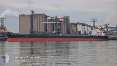
ARIANA
Bulk Carrier
Current Trip
| Time Travelled | 14 days |
|---|---|
| Remaining Time | 23 days |
| Distance Travelled | 4013.81 nm |
| Remaining Distance | 7592.26 nm |
| AVG Speed | 11 Knots |
| MAX Speed | 14.2 Knots |
| AVG Wind | 10.8 knots |
| MAX Wind | 29.8 knots |
| MIN Temp | 8.8°C / 47.84°F |
| MAX Temp | 30.2°C / 86.36°F |
| Draught | 7.5 m |
| Position Received | 4 d ago |
Current Position
| Longitude | 103.47590° |
|---|---|
| Latitude | 1.22500° |
| Status | Under way using engine |
| Speed | 12.7 Knots |
| Course | 284° |
| Area | Singapore Strait |
| Station | T-AIS |
| Position Received | 4 d ago |
Info
Information
The current position of ARIANA is in Singapore Strait with coordinates 1.22500° / 103.47590° as reported on 2024-04-15 10:16 by AIS to our vessel tracker app. The vessel's current speed is 12.7 Knots and is heading at the port of SANTOS. The estimated time of arrival as calculated by MyShipTracking vessel tracking app is 2024-05-14 00:15 LT
The vessel ARIANA (IMO: 9316048, MMSI: 538006857) is a Bulk Carrier that was built in 2005 ( 19 years old ). It's sailing under the flag of [MH] Marshall Is.
In this page you can find informations about the vessels current position, last detected port calls, and current voyage information. If the vessels is not in coverage by AIS you will find the latest position.
The current position of ARIANA is detected by our AIS receivers and we are not responsible for the reliability of the data. The last position was recorded while the vessel was in Coverage by the Ais receivers of our vessel tracking app.
The current draught of ARIANA as reported by AIS is 7.5 meters
Weather
| Temperature | 28.6°C / 83.48°F |
|---|---|
| Wind Speed | 7 knots |
| Direction | 99° E |
| Pressure | 1006.6 hPa |
| Humidity | 76.7 % |
| Cloud Coverage | 100 % |
Featured Company
Most Visited Ports (Last year)
| Port | Arrivals | |
|---|---|---|
| 29 | ||
| 2 | ||
| 2 | ||
| 1 | ||
| 1 |
Last Trips
| Origin | Departure | Destination | Arrival | Distance | |
|---|---|---|---|---|---|
| 2024-02-17 17:17 | 2024-04-03 11:13 | 8131.40 nm | |||
| 2023-12-03 14:48 | 2024-02-13 13:32 | 11052.65 nm |
Events
| Time | Event | Details | Position / Dest | Info |
|---|---|---|---|---|
| 2024-04-15 10:22 | Status Changed | Default Under way using engine |
1.23058 / 103.45473
SANTOS
|
Speed: 12.7 kn Course: 284° |
| 2024-04-15 10:16 | OUT of Coverage |
1.22500 / 103.47590
Singapore Strait
|
Speed: 12.7 kn Course: 284° |
|
| 2024-04-15 09:44 | Change Sea Area | Malaysian part of the Singapore Strait Indonesian part of the Singapore Strait |
1.19682 / 103.58550
Singapore Strait
|
Speed: 12.3 kn Course: 293° |
| 2024-04-15 08:59 | Change Sea Area | Indonesian part of the Singapore Strait Singaporean part of the Singapore Strait |
1.14017 / 103.72482
Singapore Strait
|
Speed: 12.8 kn Course: 286° |
| 2024-04-15 07:14 | START Moving | 3.35 nm, East of SINGAPORE |
1.27440 / 103.90775
SANTOS
|
Speed: 3.1 kn Course: 104° |
| 2024-04-15 07:11 | Status Changed | Under way using engine At anchor |
1.27490 / 103.90592
SANTOS
|
Speed: 0.4 kn Course: 87° |
| 2024-04-15 04:55 | Destination Changed | SANTOS PEBGC SIN |
1.27487 / 103.90438
SANTOS
|
Speed: Course: 104° |
| 2024-04-15 04:55 | ETA Changed | 2024/05/16 12:00 2024/04/14 14:15 |
1.27487 / 103.90438
SANTOS
|
Speed: Course: 104° |
| 2024-04-14 15:24 | Status Changed | At anchor Under way using engine |
1.27365 / 103.90568
PEBGC SIN
|
Speed: 0.5 kn Course: 50° |
| 2024-04-14 15:23 | STOP Moving | 3.23 nm, East of SINGAPORE |
1.27363 / 103.90583
PEBGC SIN
|
Speed: 0.3 kn Course: 49° |