
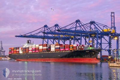
ARGUS
Container Ship
Current Trip
| Time Travelled | 3 days |
|---|---|
| Remaining Time | --- |
| Distance Travelled | 1148.37 nm |
| Remaining Distance | --- |
| AVG Speed | 15.2 Knots |
| MAX Speed | 21.2 Knots |
| AVG Wind | 11.2 knots |
| MAX Wind | 28 knots |
| MIN Temp | 4.3°C / 39.74°F |
| MAX Temp | 11.7°C / 53.06°F |
| Draught | 12.2 m |
| Position Received | 2 d ago |
Current Position
| Longitude | -127.03425° |
|---|---|
| Latitude | 49.11234° |
| Status | Under way using engine |
| Speed | 13.1 Knots |
| Course | 296.5° |
| Area | North Pacific Ocean |
| Station | T-AIS |
| Position Received | 2 d ago |
Info
Information
The current position of ARGUS is in North Pacific Ocean with coordinates 49.11234° / -127.03425° as reported on 2024-04-22 14:44 by AIS to our vessel tracker app. The vessel's current speed is 13.1 Knots and is heading at the port of TOKYO. The estimated time of arrival as calculated by MyShipTracking vessel tracking app is 2024-05-04 20:00 LT
The vessel ARGUS (IMO: 9262716, MMSI: 636020476) is a Container Ship that was built in 2004 ( 20 years old ). It's sailing under the flag of [LR] Liberia.
In this page you can find informations about the vessels current position, last detected port calls, and current voyage information. If the vessels is not in coverage by AIS you will find the latest position.
The current position of ARGUS is detected by our AIS receivers and we are not responsible for the reliability of the data. The last position was recorded while the vessel was in Coverage by the Ais receivers of our vessel tracking app.
The current draught of ARGUS as reported by AIS is 12.2 meters
Weather
| Temperature | 4.9°C / 40.82°F |
|---|---|
| Wind Speed | 22 knots |
| Direction | 296° WNW |
| Pressure | 1010.5 hPa |
| Humidity | 80.9 % |
| Cloud Coverage | 100 % |
Featured Company
Last Port Calls
| Port | Arrival | Departure | Time In Port |
|---|---|---|---|
| 2024-04-19 16:09 | 2024-04-22 00:04 | 2 d | |
| 2024-04-15 20:53 | 2024-04-19 05:56 | 3 d | |
| 2024-04-03 21:56 | 2024-04-04 12:15 | 14 h | |
| 2024-04-02 01:39 | 2024-04-02 17:13 | 15 h | |
| 2024-03-28 10:53 | 2024-03-29 13:17 | 1 d | |
| 2024-03-23 22:51 | 2024-03-24 19:58 | 21 h | |
| 2024-03-15 20:27 | 2024-03-16 20:15 | 23 h | |
| 2024-02-01 04:36 | 2024-02-01 13:46 | 9 h |
Most Visited Ports (Last year)
| Port | Arrivals | |
|---|---|---|
| 10 | ||
| 8 | ||
| 5 | ||
| 5 | ||
| 4 | ||
| 4 |
Last Trips
| Origin | Departure | Destination | Arrival | Distance | |
|---|---|---|---|---|---|
| 2024-04-18 22:56 | 2024-04-19 09:09 | 154.15 nm | |||
| 2024-04-04 21:15 | 2024-04-15 13:53 | 4295.54 nm | |||
| 2024-04-03 02:13 | 2024-04-04 06:56 | 251.52 nm | |||
| 2024-03-29 21:17 | 2024-04-02 10:39 | 919.92 nm | |||
| 2024-03-25 03:58 | 2024-03-28 18:53 | 550.42 nm | |||
| 2024-03-17 04:15 | 2024-03-24 06:51 | 1840.72 nm | |||
| 2024-01-29 12:19 | 2024-03-16 04:27 | 13144.74 nm | |||
| 2024-01-29 12:19 | 2024-02-01 06:36 | 636.03 nm |
Events
| Time | Event | Details | Position / Dest | Info |
|---|---|---|---|---|
| 2024-04-22 14:50 | Status Changed | Default Under way using engine |
49.12113 / -127.05997
JPTYO
|
Speed: 13.1 kn Course: 296.5° |
| 2024-04-22 14:44 | OUT of Coverage |
49.11234 / -127.03425
North Pacific Ocean
JPTYO
|
Speed: 13.1 kn Course: 296.5° |
|
| 2024-04-22 12:14 | ETA Changed | 2024/05/04 20:00 2024/05/15 12:00 |
48.85713 / -126.26762
JPTYO
|
Speed: 14 kn Course: 296.9° |
| 2024-04-22 12:13 | IN Coverage |
48.85763 / -126.26913
North Pacific Ocean
JPTYO
|
Speed: 14 kn Course: 296.7° |
|
| 2024-04-22 11:02 | OUT of Coverage |
48.73444 / -125.89424
North Pacific Ocean
JPTYO
|
Speed: 13.5 kn Course: 296.4° |
|
| 2024-04-22 08:01 | Status Changed | Under way using engine Default |
48.51958 / -124.95447
JPTYO
|
Speed: 13.4 kn Course: 270° |
| 2024-04-22 07:58 | Status Changed | Default Under way using engine |
48.51955 / -124.93856
JPTYO
|
Speed: 13.6 kn Course: 269.4° |
| 2024-04-22 07:52 | Status Changed | Under way using engine Default |
48.51961 / -124.90355
JPTYO
|
Speed: 13.7 kn Course: 270° |
| 2024-04-22 07:40 | Status Changed | Default Under way using engine |
48.51959 / -124.83677
JPTYO
|
Speed: 13.7 kn Course: 269.7° |
| 2024-04-22 07:35 | Change Sea Area | Canadian part of the North Pacific Ocean Canadian part of the The Coastal Waters of Southeast Alaska and British Columbia |
48.51968 / -124.81079
North Pacific Ocean
JPTYO
|
Speed: 13.7 kn Course: 269.7° |