
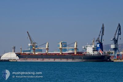
ARGO I
Bulk Carrier
Current Trip
Unknown
| Time Travelled | 5 days |
|---|---|
| Remaining Time | --- |
| Distance Travelled | 748.81 nm |
| Remaining Distance | --- |
| AVG Speed | 10.1 Knots |
| MAX Speed | 12.9 Knots |
| AVG Wind | 15.6 knots |
| MAX Wind | 33.6 knots |
| MIN Temp | 12.6°C / 54.68°F |
| MAX Temp | 19.6°C / 67.28°F |
| Draught | 0 m |
| Position Received | Now |
Current Position
| Longitude | 23.52492° |
|---|---|
| Latitude | 37.86589° |
| Status | Default |
| Speed | 0.7 Knots |
| Course | 321° |
| Area | Aegean Sea |
| Station | T-AIS |
| Position Received | Now |
Info
Information
The current position of ARGO I is in Aegean Sea with coordinates 37.86589° / 23.52492° as reported on 2024-04-20 06:15 by AIS to our vessel tracker app. The vessel's current speed is 0.7 Knots
The vessel ARGO I (IMO: 9583897, MMSI: 370543000) is a Bulk Carrier that was built in 2010 ( 14 years old ). It's sailing under the flag of [PA] Panama.
In this page you can find informations about the vessels current position, last detected port calls, and current voyage information. If the vessels is not in coverage by AIS you will find the latest position.
The current position of ARGO I is detected by our AIS receivers and we are not responsible for the reliability of the data. The last position was recorded while the vessel was in Coverage by the Ais receivers of our vessel tracking app.
Weather
| Temperature | 13.4°C / 56.12°F |
|---|---|
| Wind Speed | 23 knots |
| Direction | 321° NW |
| Pressure | 1005.6 hPa |
| Humidity | 78 % |
| Cloud Coverage | 57 % |
Featured Company
Last Port Calls
| Port | Arrival | Departure | Time In Port |
|---|---|---|---|
| 2024-04-04 12:19 | 2024-04-15 05:10 | 10 d | |
| 2024-03-24 05:34 | 2024-03-24 14:34 | 8 h | |
| 2024-03-04 21:43 | 2024-03-08 21:04 | 3 d | |
| 2024-03-01 09:01 | 2024-03-04 04:49 | 2 d | |
| 2024-02-05 05:58 | 2024-02-05 15:09 | 9 h |
Last Trips
| Origin | Departure | Destination | Arrival | Distance | |
|---|---|---|---|---|---|
| 2024-03-09 00:04 | 2024-04-04 13:19 | 4537.91 nm | |||
| 2024-03-09 00:04 | 2024-03-24 07:34 | 3301.29 nm | |||
| 2024-03-04 07:49 | 2024-03-05 00:43 | 9.91 nm | |||
| 2023-12-06 06:21 | 2024-03-01 12:01 | 5365.00 nm | |||
| 2023-12-06 06:21 | 2024-02-05 07:58 | 1413.70 nm |
Events
| Time | Event | Details | Position / Dest | Info |
|---|---|---|---|---|
| 2024-04-18 11:44 | Draught Changed | 0 5.9 |
37.86772 / 23.52485
|
Speed: 0.2 kn Course: 270° |
| 2024-04-18 11:43 | Status Changed | Default Under way using engine |
37.86771 / 23.52485
PIRAEUS
|
Speed: 0.1 kn Course: 273° |
| 2024-04-18 11:36 | Status Changed | Under way using engine At anchor |
37.86752 / 23.52491
PIRAEUS
|
Speed: Course: 258° |
| 2024-04-18 08:15 | ETA Changed | 2024/04/18 08:00 2025/01/01 08:00 |
37.86676 / 23.52513
PIRAEUS
|
Speed: 0.2 kn Course: 286° |
| 2024-04-18 08:09 | ETA Changed | 2025/01/01 08:00 2024/04/18 08:00 |
37.86652 / 23.52454
PIRAEUS
|
Speed: 0.2 kn Course: 314° |
| 2024-04-18 05:34 | ETA Changed | 2024/04/18 08:00 2025/01/01 08:00 |
37.86615 / 23.52463
PIRAEUS
|
Speed: 0.1 kn Course: 310° |
| 2024-04-18 05:28 | ETA Changed | 2025/01/01 08:00 2024/04/18 08:00 |
37.86630 / 23.52464
PIRAEUS
|
Speed: 0.1 kn Course: 298° |
| 2024-04-18 04:28 | STOP Moving | 2.51 nm, South East of MAROUDI |
37.86533 / 23.52402
PIRAEUS
|
Speed: 0.2 kn Course: 329° |
| 2024-04-18 04:16 | Status Changed | At anchor Under way using engine |
37.86770 / 23.52350
PIRAEUS
|
Speed: 0.7 kn Course: 275° |
| 2024-04-17 21:57 | ETA Changed | 2024/04/18 08:00 2024/04/18 00:00 |
36.94696 / 23.39478
PIRAEUS
|
Speed: 11.8 kn Course: 21.5° |