
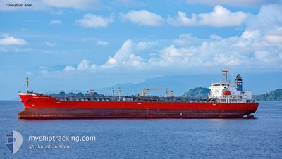
ARGENT HIBISCUS
Oil/Chemical Tanker
Current Trip
| Time Travelled | 5 days |
|---|---|
| Remaining Time | --- |
| Distance Travelled | 1313.26 nm |
| Remaining Distance | --- |
| AVG Speed | 12.3 Knots |
| MAX Speed | 14.8 Knots |
| AVG Wind | 7.9 knots |
| MAX Wind | 19 knots |
| MIN Temp | 7.5°C / 45.5°F |
| MAX Temp | 16.3°C / 61.34°F |
| Draught | 7.1 m |
| Position Received | 1 m ago |
Current Position
| Longitude | -123.18498° |
|---|---|
| Latitude | 49.29198° |
| Status | At anchor |
| Speed | 0.2 Knots |
| Course | 274° |
| Area | The Coastal Waters of Southeast Alaska and British Columbia |
| Station | T-AIS |
| Position Received | 1 m ago |
Info
Information
The current position of ARGENT HIBISCUS is in The Coastal Waters of Southeast Alaska and British Columbia with coordinates 49.29198° / -123.18498° as reported on 2024-04-24 08:45 by AIS to our vessel tracker app. The vessel's current speed is 0.2 Knots
The vessel ARGENT HIBISCUS (IMO: 9414266, MMSI: 357441000) is a Oil/Chemical Tanker that was built in 2010 ( 14 years old ). It's sailing under the flag of [PA] Panama.
In this page you can find informations about the vessels current position, last detected port calls, and current voyage information. If the vessels is not in coverage by AIS you will find the latest position.
The current position of ARGENT HIBISCUS is detected by our AIS receivers and we are not responsible for the reliability of the data. The last position was recorded while the vessel was in Coverage by the Ais receivers of our vessel tracking app.
The current draught of ARGENT HIBISCUS as reported by AIS is 7.1 meters
Weather
| Temperature | 11°C / 51.8°F |
|---|---|
| Wind Speed | 7 knots |
| Direction | 99° E |
| Pressure | 1013.3 hPa |
| Humidity | 66.3 % |
| Cloud Coverage | 100 % |
Featured Company
Last Trips
| Origin | Departure | Destination | Arrival | Distance | |
|---|---|---|---|---|---|
| 2024-04-11 21:06 | 2024-04-17 04:34 | 1248.03 nm | |||
| 2024-03-25 14:13 | 2024-04-09 19:32 | 4514.73 nm | |||
| 2024-03-12 09:06 | 2024-03-24 08:09 | 1932.94 nm | |||
| 2024-02-06 21:40 | 2024-03-09 14:29 | 6058.83 nm | |||
| 2024-01-24 09:14 | 2024-02-01 18:03 | 1551.46 nm |
Events
| Time | Event | Details | Position / Dest | Info |
|---|---|---|---|---|
| 2024-04-23 07:06 | STOP Moving | 3.76 nm, West of VANCOUVER |
49.29192 / -123.19078
CAVAN
|
Speed: 0.3 kn Course: 90° |
| 2024-04-23 06:57 | Status Changed | At anchor Under way using engine |
49.29197 / -123.18892
CAVAN
|
Speed: 0.4 kn Course: 99° |
| 2024-04-23 04:56 | Change Sea Area | Canadian part of the The Coastal Waters of Southeast Alaska and British Columbia United States part of the The Coastal Waters of Southeast Alaska and British Columbia |
49.00608 / -123.25163
The Coastal Waters of Southeast Alaska and British Columbia
CAVAN
|
Speed: 13.1 kn Course: 316° |
| 2024-04-23 03:56 | Change Sea Area | United States part of the The Coastal Waters of Southeast Alaska and British Columbia Canadian part of the The Coastal Waters of Southeast Alaska and British Columbia |
48.84803 / -123.03983
The Coastal Waters of Southeast Alaska and British Columbia
CAVAN
|
Speed: 12.5 kn Course: 328° |
| 2024-04-23 03:47 | Change Sea Area | Canadian part of the The Coastal Waters of Southeast Alaska and British Columbia United States part of the The Coastal Waters of Southeast Alaska and British Columbia |
48.82162 / -123.01645
The Coastal Waters of Southeast Alaska and British Columbia
CAVAN
|
Speed: 12.2 kn Course: 332° |
| 2024-04-23 03:35 | Change Sea Area | United States part of the The Coastal Waters of Southeast Alaska and British Columbia Canadian part of the The Coastal Waters of Southeast Alaska and British Columbia |
48.78618 / -123.00047
The Coastal Waters of Southeast Alaska and British Columbia
CAVAN
|
Speed: 10.8 kn Course: 13° |
| 2024-04-23 03:17 | Change Sea Area | Canadian part of the The Coastal Waters of Southeast Alaska and British Columbia United States part of the The Coastal Waters of Southeast Alaska and British Columbia |
48.74950 / -123.07005
The Coastal Waters of Southeast Alaska and British Columbia
CAVAN
|
Speed: 12 kn Course: 59° |
| 2024-04-23 01:50 | Change Sea Area | United States part of the The Coastal Waters of Southeast Alaska and British Columbia Canadian part of the The Coastal Waters of Southeast Alaska and British Columbia |
48.50632 / -123.19332
The Coastal Waters of Southeast Alaska and British Columbia
CAVAN
|
Speed: 14.8 kn Course: 339° |
| 2024-04-22 23:41 | Change Sea Area | Canadian part of the The Coastal Waters of Southeast Alaska and British Columbia United States part of the The Coastal Waters of Southeast Alaska and British Columbia |
48.23973 / -123.45992
The Coastal Waters of Southeast Alaska and British Columbia
CAVAN
|
Speed: 11.8 kn Course: 44° |
| 2024-04-22 23:26 | Detected in Sea | United States part of the The Coastal Waters of Southeast Alaska and British Columbia |
48.22230 / -123.52108
The Coastal Waters of Southeast Alaska and British Columbia
CAVAN
|
Speed: 11.5 kn Course: 85° |