
ARETEA
Tanker D
Current Trip
| Trip Time | 59 days |
|---|---|
| Trip Distance | 13688.35 nm |
| AVG Speed | 11.4 Knots |
| MAX Speed | 15.5 Knots |
| Draught | 13 m |
| AVG Wind | 11.8 knots |
| MAX Wind | 28 knots |
| MIN Temp | 3°C / 37.4°F |
| MAX Temp | 30.9°C / 87.62°F |
| Position Received | 2 m ago |
Current Position
| Longitude | 126.33177° |
|---|---|
| Latitude | 37.00460° |
| Status | Moored |
| Speed | |
| Course | 64° |
| Area | Yellow Sea |
| Station | T-AIS |
| Position Received | 2 m ago |
Info
Information
The current position of ARETEA is in Yellow Sea with coordinates 37.00460° / 126.33177° as reported on 2024-04-19 03:24 by AIS to our vessel tracker app. The vessel's current speed is 0 Knots and is currently inside the port of DAESAN.
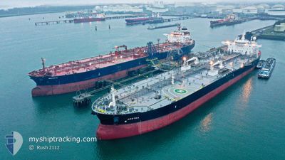
The vessel ARETEA (IMO: 9711456, MMSI: 241348000) is a Tanker D It's sailing under the flag of [GR] Greece.
In this page you can find informations about the vessels current position, last detected port calls, and current voyage information. If the vessels is not in coverage by AIS you will find the latest position.
The current position of ARETEA is detected by our AIS receivers and we are not responsible for the reliability of the data. The last position was recorded while the vessel was in Coverage by the Ais receivers of our vessel tracking app.
The current draught of ARETEA as reported by AIS is 13 meters
Weather
| Temperature | 11.6°C / 52.88°F |
|---|---|
| Wind Speed | 8 knots |
| Direction | 227° SW |
| Pressure | 1013.3 hPa |
| Humidity | 75.6 % |
| Cloud Coverage | 72 % |
Featured Company
Events
| Time | Event | Details | Position / Dest | Info |
|---|---|---|---|---|
| 2024-04-18 05:27 | Status Changed | Moored Under way using engine |
37.00453 / 126.33184
[KR] DAESAN
|
Speed: Course: 64° |
| 2024-04-18 05:12 | STOP Moving |
37.00478 / 126.33188
[KR] DAESAN
|
Speed: 0.3 kn Course: 65° |
|
| 2024-04-18 05:05 | PORT ARRIVAL |
|
37.00636 / 126.32886
[KR] DAESAN
|
Speed: 2.4 kn Course: 109° |
| 2024-04-18 02:11 | START Moving | 7.56 nm, North West of TAEAN-GUN |
37.00584 / 126.12880
SGSIN>KRTSN
|
Speed: 3.1 kn Course: 203° |
| 2024-04-18 02:00 | Status Changed | Under way using engine At anchor |
37.00764 / 126.13375
SGSIN>KRTSN
|
Speed: 0.2 kn Course: 220° |
| 2024-04-18 01:50 | Status Changed | At anchor Default |
37.00802 / 126.13433
SGSIN>KRTSN
|
Speed: 0.1 kn Course: 224° |
| 2024-04-18 01:41 | Status Changed | Default At anchor |
37.00796 / 126.13443
SGSIN>KRTSN
|
Speed: Course: 225° |
| 2024-04-18 01:23 | Status Changed | At anchor Default |
37.00810 / 126.13450
SGSIN>KRTSN
|
Speed: 0.1 kn Course: 216° |
| 2024-04-18 01:08 | Status Changed | Default At anchor |
37.00790 / 126.13427
SGSIN>KRTSN
|
Speed: 0.4 kn Course: 247° |
| 2024-04-18 00:32 | STOP Moving | 7.43 nm, North West of TAEAN-GUN |
37.00555 / 126.13236
SGSIN>KRTSN
|
Speed: 0.3 kn Course: 26° |