
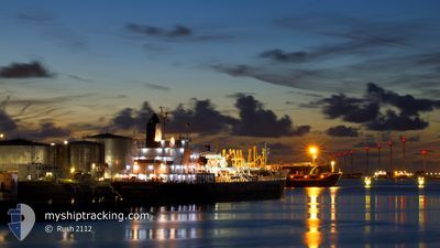
ARDMORE CHEROKEE
Tanker
Current Trip
| Trip Time | 15 days |
|---|---|
| Trip Distance | 3667.40 nm |
| AVG Speed | 13.5 Knots |
| MAX Speed | 15.2 Knots |
| Draught | 6.4 m |
| AVG Wind | 7.5 knots |
| MAX Wind | 16.9 knots |
| MIN Temp | 25.2°C / 77.36°F |
| MAX Temp | 30.5°C / 86.9°F |
| Position Received | 5 d ago |
Current Position
| Longitude | 104.38482° |
|---|---|
| Latitude | 1.33054° |
| Status | Under way using engine |
| Speed | 13.8 Knots |
| Course | 44.9° |
| Area | South China Sea |
| Station | T-AIS |
| Position Received | 5 d ago |
Info
Information
The current position of ARDMORE CHEROKEE is in South China Sea with coordinates 1.33054° / 104.38482° as reported on 2024-04-17 20:42 by AIS to our vessel tracker app. The vessel's current speed is 13.8 Knots and is currently inside the port of BINTULU.
The vessel ARDMORE CHEROKEE (IMO: 9707845, MMSI: 538005865) is a Tanker It's sailing under the flag of [MH] Marshall Is.
In this page you can find informations about the vessels current position, last detected port calls, and current voyage information. If the vessels is not in coverage by AIS you will find the latest position.
The current position of ARDMORE CHEROKEE is detected by our AIS receivers and we are not responsible for the reliability of the data. The last position was recorded while the vessel was in Coverage by the Ais receivers of our vessel tracking app.
The current draught of ARDMORE CHEROKEE as reported by AIS is 6.4 meters
Weather
| Temperature | 27.3°C / 81.14°F |
|---|---|
| Wind Speed | 9 knots |
| Direction | 37° NE |
| Pressure | 1008.7 hPa |
| Humidity | 87.3 % |
| Cloud Coverage | 100 % |
Featured Company
Last Port Calls
| Port | Arrival | Departure | Time In Port |
|---|---|---|---|
| 2024-04-23 03:14 | |||
| 2024-04-06 05:59 | 2024-04-08 01:15 | 1 d | |
| 2024-03-20 09:47 | 2024-03-22 16:35 | 2 d | |
| 2024-02-24 11:58 | 2024-02-26 04:38 | 1 d | |
| 2024-02-06 12:33 | 2024-02-08 07:04 | 1 d |
Most Visited Ports (Last year)
| Port | Arrivals | |
|---|---|---|
| 4 | ||
| 4 | ||
| 2 | ||
| 2 | ||
| 1 | ||
| 1 |
Last Trips
| Origin | Departure | Destination | Arrival | Distance | |
|---|---|---|---|---|---|
| 2024-04-08 06:15 | 2024-04-23 11:14 | 3667.40 nm | |||
| 2024-03-22 23:35 | 2024-04-06 10:59 | 2769.16 nm | |||
| 2024-02-26 11:38 | 2024-03-20 16:47 | 5477.74 nm | |||
| 2024-02-08 12:04 | 2024-02-24 18:58 | 2798.00 nm | |||
| 2024-01-11 04:28 | 2024-02-06 17:33 | 6706.87 nm |
Events
| Time | Event | Details | Position / Dest | Info |
|---|---|---|---|---|
| 2024-04-23 03:14 | STOP Moving |
3.24736 / 113.07408
[MY] BINTULU
|
Speed: Course: 270° |
|
| 2024-04-23 03:14 | PORT ARRIVAL |
|
3.24736 / 113.07408
[MY] BINTULU
|
Speed: 1.5 kn Course: 255° |
| 2024-04-20 04:52 | STOP Moving | 4.75 nm, North East of KUCHING |
1.62344 / 110.45535
MYKCN
|
Speed: Course: 39° |
| 2024-04-20 03:05 | START Moving | 12.46 nm, North East of KUCHING |
1.71053 / 110.55145
MYKCN
|
Speed: 7.5 kn Course: 168° |
| 2024-04-17 20:45 | Status Changed | Default Under way using engine |
1.33953 / 104.39401
MYKCN
|
Speed: 13.8 kn Course: 44.9° |
| 2024-04-17 20:42 | Change Sea Area | Malaysian part of the South China Sea Malaysian part of the Singapore Strait |
1.33054 / 104.38482
South China Sea
MYKCN
|
Speed: 13.8 kn Course: 44.9° |
| 2024-04-17 20:42 | Status Changed | Under way using engine Default |
1.33054 / 104.38482
MYKCN
|
Speed: 13.9 kn Course: 48° |
| 2024-04-17 20:42 | OUT of Coverage |
1.33054 / 104.38482
South China Sea
MYKCN
|
Speed: 13.8 kn Course: 44.9° |
|
| 2024-04-17 20:25 | Status Changed | Default Under way using engine |
1.28810 / 104.33717
MYKCN
|
Speed: 13.3 kn Course: 59.3° |
| 2024-04-17 19:35 | Change Sea Area | Malaysian part of the Singapore Strait Indonesian part of the Singapore Strait |
1.25977 / 104.15497
Singapore Strait
MYKCN
|
Speed: 13.5 kn Course: 77.2° |