
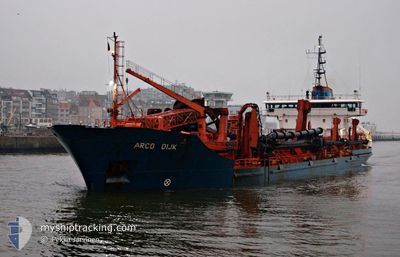
ARCO DIJK
Trailing Suction Hopper Dredger
Current Trip
DREDGE AREA 106
| Time Travelled | 14 h, 7 mins |
|---|---|
| Remaining Time | --- |
| Distance Travelled | 68.13 nm |
| Remaining Distance | --- |
| AVG Speed | 10.8 Knots |
| MAX Speed | 12 Knots |
| AVG Wind | 20.5 knots |
| MAX Wind | 23.9 knots |
| MIN Temp | 8.4°C / 47.12°F |
| MAX Temp | 9.5°C / 49.1°F |
| Draught | 4.5 m |
| Position Received | 7 h, 38 m ago |
Current Position
| Longitude | 0.24000° |
|---|---|
| Latitude | 53.89074° |
| Status | Under way using engine |
| Speed | 11.5 Knots |
| Course | 146.2° |
| Area | North Sea |
| Station | T-AIS |
| Position Received | 7 h, 38 m ago |
Info
Information
The current position of ARCO DIJK is in North Sea with coordinates 53.89074° / 0.24000° as reported on 2024-04-19 01:24 by AIS to our vessel tracker app. The vessel's current speed is 11.5 Knots
The vessel ARCO DIJK (IMO: 9034092, MMSI: 308165000) is a Trailing Suction Hopper Dredger that was built in 1992 ( 32 years old ). It's sailing under the flag of [BS] Bahamas.
In this page you can find informations about the vessels current position, last detected port calls, and current voyage information. If the vessels is not in coverage by AIS you will find the latest position.
The current position of ARCO DIJK is detected by our AIS receivers and we are not responsible for the reliability of the data. The last position was recorded while the vessel was in Coverage by the Ais receivers of our vessel tracking app.
The current draught of ARCO DIJK as reported by AIS is 4.5 meters
Weather
| Temperature | 9.3°C / 48.74°F |
|---|---|
| Wind Speed | 20 knots |
| Direction | 292° WNW |
| Pressure | 1011.1 hPa |
| Humidity | 84.4 % |
| Cloud Coverage | 100 % |
Featured Company
Last Port Calls
| Port | Arrival | Departure | Time In Port |
|---|---|---|---|
| 2024-04-18 18:37 | 2024-04-18 18:56 | 18 m | |
| 2024-04-18 08:26 | 2024-04-18 09:07 | 41 m | |
| 2024-04-15 17:12 | 2024-04-15 17:42 | 29 m | |
| 2024-04-15 06:04 | 2024-04-15 17:09 | 11 h | |
| 2024-04-15 05:27 | 2024-04-15 06:00 | 33 m | |
| 2024-04-13 15:30 | 2024-04-13 15:53 | 22 m | |
| 2024-04-13 05:06 | 2024-04-13 15:20 | 10 h | |
| 2024-04-13 04:25 | 2024-04-13 05:00 | 34 m | |
| 2024-04-10 23:09 | 2024-04-11 07:11 | 8 h | |
| 2024-04-08 22:34 | 2024-04-09 07:16 | 8 h |
Most Visited Ports (Last year)
| Port | Arrivals | |
|---|---|---|
| 47 | ||
| 40 | ||
| 17 | ||
| 8 | ||
| 3 | ||
| 1 |
Last Trips
| Origin | Departure | Destination | Arrival | Distance | |
|---|---|---|---|---|---|
| 2024-04-18 10:07 | 2024-04-18 19:37 | 2.53 nm | |||
| 2024-04-15 18:42 | 2024-04-18 09:26 | 324.26 nm | |||
| 2024-04-15 18:09 | 2024-04-15 18:12 | 0.38 nm | |||
| 2024-04-15 07:00 | 2024-04-15 07:04 | 0.37 nm | |||
| 2024-04-13 16:53 | 2024-04-15 06:27 | 229.60 nm | |||
| 2024-04-13 16:20 | 2024-04-13 16:30 | 1.33 nm | |||
| 2024-04-13 06:00 | 2024-04-13 06:06 | 0.55 nm | |||
| 2024-04-11 08:11 | 2024-04-13 05:25 | 318.38 nm | |||
| 2024-04-09 08:16 | 2024-04-11 00:09 | 268.37 nm | |||
| 2024-03-27 14:54 | 2024-04-08 23:34 | 381.92 nm |
Events
| Time | Event | Details | Position / Dest | Info |
|---|---|---|---|---|
| 2024-04-19 01:24 | OUT of Coverage |
53.89074 / .24000
North Sea
DREDGE AREA 106
|
Speed: 11.5 kn Course: 146.2° |
|
| 2024-04-18 23:34 | Status Changed | Under way using engine Default |
54.19059 / -.08065
DREDGE AREA 106
|
Speed: 11.3 kn Course: 142° |
| 2024-04-18 23:34 | IN Coverage |
54.18852 / -.07793
North Sea
DREDGE AREA 106
|
Speed: 11.6 kn Course: 143° |
|
| 2024-04-18 21:21 | Status Changed | Default Under way using engine |
54.51833 / -.50667
DREDGE AREA 106
|
Speed: 10.4 kn Course: 143.6° |
| 2024-04-18 21:19 | OUT of Coverage |
54.52173 / -.51113
North Sea
DREDGE AREA 106
|
Speed: 10.4 kn Course: 143.6° |
|
| 2024-04-18 20:26 | Status Changed | Under way using engine Default |
54.59044 / -.74325
DREDGE AREA 106
|
Speed: 10 kn Course: 113° |
| 2024-04-18 19:50 | Status Changed | Default Under way using engine |
54.63500 / -.90167
DREDGE AREA 106
|
Speed: 10.2 kn Course: 113.1° |
| 2024-04-18 18:56 | PORT DEPARTURE |
|
54.64838 / -1.14076
DREDGE AREA 106
|
Speed: 10.3 kn Course: 28° |
| 2024-04-18 18:37 | PORT ARRIVAL |
|
54.60476 / -1.16281
[GB] TEES
|
Speed: 8.6 kn Course: 43.6° |
| 2024-04-18 18:28 | Status Changed | Under way using engine Default |
54.58836 / -1.18901
DREDGE AREA 106
|
Speed: Course: 82° |