
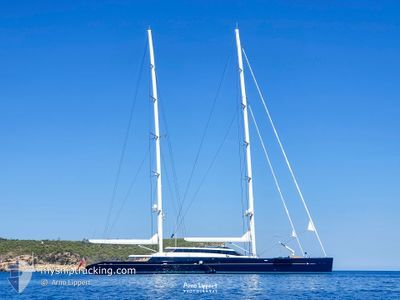
AQUIJO
Sailing
Current Trip
| Time Travelled | 1 day |
|---|---|
| Remaining Time | --- |
| Distance Travelled | 31.80 nm |
| Remaining Distance | --- |
| AVG Speed | 12.1 Knots |
| MAX Speed | 15.3 Knots |
| AVG Wind | 5 knots |
| MAX Wind | 7.6 knots |
| MIN Temp | 14.5°C / 58.1°F |
| MAX Temp | 14.9°C / 58.82°F |
| Draught | 5.4 m |
| Position Received | 1 d ago |
Current Position
| Longitude | -117.15928° |
|---|---|
| Latitude | 32.20388° |
| Status | Under way using engine |
| Speed | 14.9 Knots |
| Course | 141° |
| Area | North Pacific Ocean |
| Station | T-AIS |
| Position Received | 1 d ago |
Info
Information
The current position of AQUIJO is in North Pacific Ocean with coordinates 32.20388° / -117.15928° as reported on 2024-04-23 18:46 by AIS to our vessel tracker app. The vessel's current speed is 14.9 Knots and is heading at the port of ROTTERDAM.
The vessel AQUIJO (IMO: 1012529, MMSI: 319085900) is a Sailing It's sailing under the flag of [KY] Cayman Is.
In this page you can find informations about the vessels current position, last detected port calls, and current voyage information. If the vessels is not in coverage by AIS you will find the latest position.
The current position of AQUIJO is detected by our AIS receivers and we are not responsible for the reliability of the data. The last position was recorded while the vessel was in Coverage by the Ais receivers of our vessel tracking app.
The current draught of AQUIJO as reported by AIS is 5.4 meters
Weather
| Temperature | 14.7°C / 58.46°F |
|---|---|
| Wind Speed | 7 knots |
| Direction | 295° WNW |
| Pressure | 1017.3 hPa |
| Humidity | 74.6 % |
| Cloud Coverage | 100 % |
Featured Company
Last Port Calls
| Port | Arrival | Departure | Time In Port |
|---|---|---|---|
| 2024-04-10 20:38 | 2024-04-23 16:25 | 12 d | |
| 2024-03-23 03:11 | 2024-04-10 16:03 | 18 d | |
| 2024-02-24 14:58 | 2024-03-23 00:53 | 27 d | |
| 2024-02-18 17:34 | 2024-02-18 18:21 | 47 m | |
| 2024-02-09 16:07 | 2024-02-12 05:13 | 2 d | |
| 2024-02-09 08:40 |
Most Visited Ports (Last year)
| Port | Arrivals | |
|---|---|---|
| 6 | ||
| 1 | ||
| 1 | ||
| 1 | ||
| 1 |
Last Trips
| Origin | Departure | Destination | Arrival | Distance | |
|---|---|---|---|---|---|
| 2024-04-10 09:03 | 2024-04-10 13:38 | 36.65 nm | |||
| 2024-03-22 17:53 | 2024-03-22 20:11 | 21.12 nm | |||
| 2024-02-18 11:21 | 2024-02-24 06:58 | 941.59 nm | |||
| 2024-02-11 21:13 | 2024-02-18 10:34 | 725.92 nm | |||
| 2024-02-09 00:40 | 2024-02-09 08:07 | 88.14 nm |
Events
| Time | Event | Details | Position / Dest | Info |
|---|---|---|---|---|
| 2024-04-23 18:46 | OUT of Coverage |
32.20388 / -117.15928
North Pacific Ocean
|
Speed: 14.9 kn Course: 141° |
|
| 2024-04-23 17:10 | Change Sea Area | Mexican part of the North Pacific Ocean United States part of the North Pacific Ocean |
32.54486 / -117.28192
North Pacific Ocean
|
Speed: 14.5 kn Course: 201.1° |
| 2024-04-23 16:47 | Draught Changed | 5.4 5 |
32.62068 / -117.23954
|
Speed: 9.4 kn Course: 220.1° |
| 2024-04-23 16:29 | Draught Changed | 5 5.4 |
32.66348 / -117.22615
|
Speed: 7.2 kn Course: 134° |
| 2024-04-23 16:25 | PORT DEPARTURE |
|
32.67579 / -117.22961
|
Speed: 10.7 kn Course: 173° |
| 2024-04-23 16:17 | Draught Changed | 5.4 5 |
32.69419 / -117.23181
[US] SAN DIEGO
|
Speed: 9.8 kn Course: 175° |
| 2024-04-23 16:11 | Draught Changed | 5 5.4 |
32.70867 / -117.22464
[US] SAN DIEGO
|
Speed: 9.5 kn Course: 222° |
| 2024-04-23 15:59 | Draught Changed | 5.4 5 |
32.71677 / -117.19041
[US] SAN DIEGO
|
Speed: 9.8 kn Course: 294° |
| 2024-04-23 15:56 | Status Changed | Under way using engine Moored |
32.71131 / -117.18176
[US] SAN DIEGO
|
Speed: 9.1 kn Course: 309° |
| 2024-04-23 15:53 | Draught Changed | 5 5.4 |
32.70756 / -117.17625
[US] SAN DIEGO
|
Speed: 6.8 kn Course: 308° |