
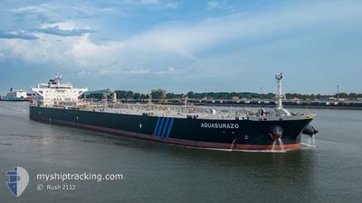
AQUASURAZO
Tanker
Current Trip
| Time Travelled | 9 days |
|---|---|
| Remaining Time | --- |
| Distance Travelled | 1747.28 nm |
| Remaining Distance | --- |
| AVG Speed | 11.6 Knots |
| MAX Speed | 14 Knots |
| AVG Wind | 12.7 knots |
| MAX Wind | 23.8 knots |
| MIN Temp | 22°C / 71.6°F |
| MAX Temp | 28.1°C / 82.58°F |
| Draught | 8.5 m |
| Position Received | 2 d ago |
Current Position
| Longitude | -82.79385° |
|---|---|
| Latitude | 19.10011° |
| Status | Under way using engine |
| Speed | 12.8 Knots |
| Course | 126.3° |
| Area | Caribbean Sea |
| Station | T-AIS |
| Position Received | 2 d ago |
Info
Information
The current position of AQUASURAZO is in Caribbean Sea with coordinates 19.10011° / -82.79385° as reported on 2024-04-22 17:45 by AIS to our vessel tracker app. The vessel's current speed is 12.8 Knots and is heading at the port of COVENAS. The estimated time of arrival as calculated by MyShipTracking vessel tracking app is 2024-04-25 08:00 LT
The vessel AQUASURAZO (IMO: 9785720, MMSI: 636017858) is a Tanker It's sailing under the flag of [LR] Liberia.
In this page you can find informations about the vessels current position, last detected port calls, and current voyage information. If the vessels is not in coverage by AIS you will find the latest position.
The current position of AQUASURAZO is detected by our AIS receivers and we are not responsible for the reliability of the data. The last position was recorded while the vessel was in Coverage by the Ais receivers of our vessel tracking app.
The current draught of AQUASURAZO as reported by AIS is 8.5 meters
Weather
| Temperature | 27.7°C / 81.86°F |
|---|---|
| Wind Speed | 19 knots |
| Direction | 26° NNE |
| Pressure | 1010.5 hPa |
| Humidity | 87.4 % |
| Cloud Coverage | 100 % |
Featured Company
Most Visited Ports (Last year)
| Port | Arrivals | |
|---|---|---|
| 10 | ||
| 7 | ||
| 1 | ||
| 1 | ||
| 1 | ||
| 1 |
Last Trips
| Origin | Departure | Destination | Arrival | Distance | |
|---|---|---|---|---|---|
| 2024-03-26 14:52 | 2024-04-14 05:36 | 5090.88 nm | |||
| 2024-03-04 14:47 | 2024-03-23 15:47 | 4929.12 nm | |||
| 2024-02-27 11:31 | 2024-03-02 00:21 | 601.93 nm | |||
| 2024-02-09 11:52 | 2024-02-26 01:27 | 1722.01 nm | |||
| 2024-01-29 07:56 | 2024-02-08 06:53 | 1528.80 nm |
Events
| Time | Event | Details | Position / Dest | Info |
|---|---|---|---|---|
| 2024-04-22 17:47 | Status Changed | Default Under way using engine |
19.09555 / -82.78738
COCVE!
|
Speed: 12.8 kn Course: 126.3° |
| 2024-04-22 17:45 | OUT of Coverage |
19.10011 / -82.79385
Caribbean Sea
COCVE!
|
Speed: 12.8 kn Course: 126.3° |
|
| 2024-04-22 14:47 | Draught Changed | 8.5 12.3 |
19.47571 / -83.32765
COCVE!
|
Speed: 12 kn Course: 128° |
| 2024-04-22 14:47 | Destination Changed | COCVE! USCRP LZ |
19.47571 / -83.32765
COCVE!
|
Speed: 12 kn Course: 128° |
| 2024-04-22 14:47 | ETA Changed | 2024/04/25 08:00 2024/04/15 23:00 |
19.47571 / -83.32765
COCVE!
|
Speed: 12 kn Course: 128° |
| 2024-04-22 14:12 | Detected in Sea | Cayman Islands part of the Caribbean Sea |
19.55049 / -83.43073
Caribbean Sea
|
Speed: 12.7 kn Course: 126.7° |
| 2024-04-22 14:12 | Status Changed | Under way using engine Default |
19.55049 / -83.43073
USCRP LZ
|
Speed: 12.8 kn Course: 127° |
| 2024-04-22 13:38 | Status Changed | Default Under way using engine |
19.62156 / -83.53146
USCRP LZ
|
Speed: 12.7 kn Course: 127.8° |
| 2024-04-22 11:09 | Status Changed | Under way using engine Default |
19.95025 / -83.99882
USCRP LZ
|
Speed: 13.3 kn Course: 128° |
| 2024-04-22 11:01 | Status Changed | Default Under way using engine |
19.96724 / -84.02293
USCRP LZ
|
Speed: 13.3 kn Course: 128° |