
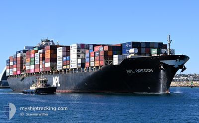
APL OREGON
Container Ship
Current Trip
| Trip Time | 7 days |
|---|---|
| Trip Distance | 2535.06 nm |
| AVG Speed | 13.1 Knots |
| MAX Speed | 19.5 Knots |
| Draught | 13.3 m |
| AVG Wind | 8.8 knots |
| MAX Wind | 26.2 knots |
| MIN Temp | 23.5°C / 74.3°F |
| MAX Temp | 30.7°C / 87.26°F |
| Position Received | 13 h, 55 m ago |
Current Position
| Longitude | 101.27635° |
|---|---|
| Latitude | 2.79135° |
| Status | At anchor |
| Speed | |
| Course | 104° |
| Area | Malacca Strait |
| Station | T-AIS |
| Position Received | 13 h, 55 m ago |
Info
Information
The current position of APL OREGON is in Malacca Strait with coordinates 2.79135° / 101.27635° as reported on 2024-04-23 18:31 by AIS to our vessel tracker app. The vessel's current speed is 0 Knots and is currently inside the port of PORT KLANG.
The vessel APL OREGON (IMO: 9532783, MMSI: 248711000) is a Container Ship that was built in 2010 ( 14 years old ). It's sailing under the flag of [MT] Malta.
In this page you can find informations about the vessels current position, last detected port calls, and current voyage information. If the vessels is not in coverage by AIS you will find the latest position.
The current position of APL OREGON is detected by our AIS receivers and we are not responsible for the reliability of the data. The last position was recorded while the vessel was in Coverage by the Ais receivers of our vessel tracking app.
The current draught of APL OREGON as reported by AIS is 13.3 meters
Weather
| Temperature | 30.1°C / 86.18°F |
|---|---|
| Wind Speed | 11 knots |
| Direction | 187° S |
| Pressure | 1004.8 hPa |
| Humidity | 74.4 % |
| Cloud Coverage | 100 % |
Featured Company
Last Port Calls
| Port | Arrival | Departure | Time In Port |
|---|---|---|---|
| 2024-04-24 01:28 | |||
| 2024-04-13 06:55 | 2024-04-16 03:46 | 2 d | |
| 2024-04-07 09:21 | 2024-04-08 18:14 | 1 d | |
| 2024-04-01 19:41 | 2024-04-04 11:34 | 2 d | |
| 2024-03-26 18:53 | 2024-03-28 22:13 | 2 d | |
| 2024-03-16 13:06 | 2024-03-17 06:13 | 17 h | |
| 2024-03-14 03:26 | 2024-03-16 02:07 | 1 d | |
| 2024-03-09 22:47 | 2024-03-10 22:33 | 23 h | |
| 2024-03-08 03:39 | 2024-03-09 05:19 | 1 d | |
| 2024-02-27 04:56 | 2024-02-28 19:37 | 1 d |
Most Visited Ports (Last year)
| Port | Arrivals | |
|---|---|---|
| 14 | ||
| 8 | ||
| 8 | ||
| 7 | ||
| 7 | ||
| 7 |
Last Trips
| Origin | Departure | Destination | Arrival | Distance | |
|---|---|---|---|---|---|
| 2024-04-16 11:46 | 2024-04-24 09:28 | 2535.06 nm | |||
| 2024-04-09 03:44 | 2024-04-13 14:55 | 1382.22 nm | |||
| 2024-04-04 22:34 | 2024-04-07 18:51 | 977.67 nm | |||
| 2024-03-29 09:13 | 2024-04-02 06:41 | 687.54 nm | |||
| 2024-03-17 14:13 | 2024-03-27 05:53 | 3935.57 nm | |||
| 2024-03-16 10:07 | 2024-03-16 21:06 | 7.03 nm | |||
| 2024-03-11 06:33 | 2024-03-14 11:26 | 63.63 nm | |||
| 2024-03-09 13:19 | 2024-03-10 06:47 | 189.58 nm | |||
| 2024-02-29 03:37 | 2024-03-08 11:39 | 2351.84 nm | |||
| 2024-02-23 07:17 | 2024-02-27 12:56 | 1384.65 nm |
Events
| Time | Event | Details | Position / Dest | Info |
|---|---|---|---|---|
| 2024-04-24 01:28 | PORT ARRIVAL |
|
2.91058 / 101.27505
[MY] PORT KLANG
|
Speed: 3.7 kn Course: 42° |
| 2024-04-24 00:20 | START Moving | 12.95 nm, South of PORT KLANG |
2.79317 / 101.27888
MYPKG
|
Speed: 5.3 kn Course: 322° |
| 2024-04-23 18:34 | Status Changed | Default At anchor |
2.79134 / 101.27633
MYPKG
|
Speed: Course: 104° |
| 2024-04-23 18:31 | Status Changed | At anchor Default |
2.79135 / 101.27635
MYPKG
|
Speed: Course: 105° |
| 2024-04-23 18:31 | OUT of Coverage |
2.79135 / 101.27635
Malacca Strait
MYPKG
|
Speed: Course: 214° |
|
| 2024-04-23 18:28 | IN Coverage |
2.79135 / 101.27635
Malacca Strait
MYPKG
|
Speed: Course: 214° |
|
| 2024-04-23 14:35 | STOP Moving | 13.11 nm, South of PORT KLANG |
2.79106 / 101.27640
MYPKG
|
Speed: 0.3 kn Course: 125° |
| 2024-04-23 10:40 | Status Changed | Default Under way using engine |
2.43567 / 101.68977
MYPKG
|
Speed: 10.4 kn Course: 308.5° |
| 2024-04-23 10:35 | OUT of Coverage |
2.42647 / 101.70095
Malacca Strait
MYPKG
|
Speed: 10.4 kn Course: 308.5° |
|
| 2024-04-23 10:32 | Status Changed | Under way using engine Default |
2.41975 / 101.70914
MYPKG
|
Speed: 10.4 kn Course: 308° |