
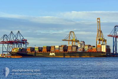
APL GWANGYANG
Container Ship
Current Trip
| Time Travelled | 4 days |
|---|---|
| Remaining Time | --- |
| Distance Travelled | 1805.20 nm |
| Remaining Distance | --- |
| AVG Speed | 17 Knots |
| MAX Speed | 19.2 Knots |
| AVG Wind | 12.2 knots |
| MAX Wind | 19 knots |
| MIN Temp | 15.2°C / 59.36°F |
| MAX Temp | 24.5°C / 76.1°F |
| Draught | 15.7 m |
| Position Received | 4 d ago |
Current Position
| Longitude | -5.66104° |
|---|---|
| Latitude | 35.96216° |
| Status | Under way using engine |
| Speed | 15.9 Knots |
| Course | 265.4° |
| Area | Strait of Gibraltar |
| Station | T-AIS |
| Position Received | 4 d ago |
Info
Information
The current position of APL GWANGYANG is in Strait of Gibraltar with coordinates 35.96216° / -5.66104° as reported on 2024-04-20 19:04 by AIS to our vessel tracker app. The vessel's current speed is 15.9 Knots and is heading at the port of JEBEL ALI. The estimated time of arrival as calculated by MyShipTracking vessel tracking app is 2024-05-14 05:00 LT
The vessel APL GWANGYANG (IMO: 9461879, MMSI: 566319000) is a Container Ship that was built in 2011 ( 13 years old ). It's sailing under the flag of [SG] Singapore.
In this page you can find informations about the vessels current position, last detected port calls, and current voyage information. If the vessels is not in coverage by AIS you will find the latest position.
The current position of APL GWANGYANG is detected by our AIS receivers and we are not responsible for the reliability of the data. The last position was recorded while the vessel was in Coverage by the Ais receivers of our vessel tracking app.
The current draught of APL GWANGYANG as reported by AIS is 15.7 meters
Weather
| Temperature | 24.4°C / 75.92°F |
|---|---|
| Wind Speed | 13 knots |
| Direction | 320° NW |
| Pressure | 1010.9 hPa |
| Humidity | 83.7 % |
| Cloud Coverage | 100 % |
Featured Company
Last Port Calls
| Port | Arrival | Departure | Time In Port |
|---|---|---|---|
| 2024-04-19 15:33 | 2024-04-20 17:44 | 1 d | |
| 2024-04-14 03:06 | 2024-04-15 08:02 | 1 d | |
| 2024-04-11 00:57 | 2024-04-12 13:58 | 1 d | |
| 2024-04-08 17:04 | 2024-04-10 00:50 | 1 d | |
| 2024-04-06 12:04 | 2024-04-07 18:17 | 1 d | |
| 2024-03-31 13:33 | 2024-04-01 14:30 | 1 d | |
| 2024-03-01 22:45 | 2024-03-03 01:35 | 1 d | |
| 2024-02-28 03:00 | 2024-02-29 09:38 | 1 d | |
| 2024-02-19 14:17 | 2024-02-21 07:39 | 1 d | |
| 2024-02-17 23:04 | 2024-02-19 09:13 | 1 d |
Last Trips
| Origin | Departure | Destination | Arrival | Distance | |
|---|---|---|---|---|---|
| 2024-04-15 10:02 | 2024-04-19 17:33 | 1275.67 nm | |||
| 2024-04-12 15:58 | 2024-04-14 05:06 | 270.50 nm | |||
| 2024-04-10 02:50 | 2024-04-11 02:57 | 120.85 nm | |||
| 2024-04-07 19:17 | 2024-04-08 19:04 | 259.20 nm | |||
| 2024-04-01 14:30 | 2024-04-06 13:04 | 1220.40 nm | |||
| 2024-03-03 07:05 | 2024-03-31 13:33 | 9983.03 nm | |||
| 2024-02-29 15:08 | 2024-03-02 04:15 | 417.30 nm | |||
| 2024-02-21 11:39 | 2024-02-28 08:30 | 1611.14 nm | |||
| 2024-02-19 13:13 | 2024-02-19 18:17 | 46.12 nm | |||
| 2024-02-08 01:17 | 2024-02-18 03:04 | 3555.80 nm |
Events
| Time | Event | Details | Position / Dest | Info |
|---|---|---|---|---|
| 2024-04-20 19:10 | Status Changed | Default Under way using engine |
35.96090 / -5.69841
ESALG>AEJEA
|
Speed: 15.9 kn Course: 265.4° |
| 2024-04-20 19:04 | OUT of Coverage |
35.96216 / -5.66104
Strait of Gibraltar
ESALG>AEJEA
|
Speed: 15.9 kn Course: 265.4° |
|
| 2024-04-20 17:44 | PORT DEPARTURE |
|
36.11134 / -5.41358
ESALG>AEJEA
|
Speed: 6.1 kn Course: 130° |
| 2024-04-20 17:31 | START Moving |
36.12834 / -5.42105
[ES] ALGECIRAS
|
Speed: 3.1 kn Course: 175° |
|
| 2024-04-20 17:17 | Status Changed | Under way using engine Moored |
36.13153 / -5.42256
[ES] ALGECIRAS
|
Speed: 0.1 kn Course: 177° |
| 2024-04-20 17:15 | Status Changed | Moored Default |
36.13148 / -5.42257
[ES] ALGECIRAS
|
Speed: Course: 177° |
| 2024-04-20 17:10 | Status Changed | Default Moored |
36.13157 / -5.42250
[ES] ALGECIRAS
|
Speed: Course: 177° |
| 2024-04-20 07:40 | Status Changed | Moored Default |
36.13135 / -5.42232
[ES] ALGECIRAS
|
Speed: Course: 178° |
| 2024-04-20 07:36 | Status Changed | Default Moored |
36.13146 / -5.42247
[ES] ALGECIRAS
|
Speed: Course: 178° |
| 2024-04-20 06:28 | Status Changed | Moored Default |
36.13171 / -5.42246
[ES] ALGECIRAS
|
Speed: Course: 178° |