
APAGEON
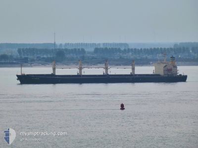
Bulk Carrier
Current Trip
INDIA
| Time Travelled | 16 days |
|---|---|
| Remaining Time | --- |
| Distance Travelled | 4787.68 nm |
| Remaining Distance | --- |
| AVG Speed | 11.8 Knots |
| MAX Speed | 16.7 Knots |
| AVG Wind | 15 knots |
| MAX Wind | 34 knots |
| MIN Temp | 1.1°C / 33.98°F |
| MAX Temp | 29.4°C / 84.92°F |
| Draught | 12.1 m |
| Position Received | 3 d ago |
Current Position
| Longitude | -18.10576° |
|---|---|
| Latitude | 20.35014° |
| Status | Under way using engine |
| Speed | 12.3 Knots |
| Course | 185.3° |
| Area | North Atlantic Ocean |
| Station | T-AIS |
| Position Received | 3 d ago |
Info
Information
The current position of APAGEON is in North Atlantic Ocean with coordinates 20.35014° / -18.10576° as reported on 2024-04-21 20:42 by AIS to our vessel tracker app. The vessel's current speed is 12.3 Knots
The vessel APAGEON (IMO: 9278870, MMSI: 256334000) is a Bulk Carrier that was built in 2005 ( 19 years old ). It's sailing under the flag of [MT] Malta.
In this page you can find informations about the vessels current position, last detected port calls, and current voyage information. If the vessels is not in coverage by AIS you will find the latest position.
The current position of APAGEON is detected by our AIS receivers and we are not responsible for the reliability of the data. The last position was recorded while the vessel was in Coverage by the Ais receivers of our vessel tracking app.
The current draught of APAGEON as reported by AIS is 12.1 meters
Weather
| Temperature | 29.2°C / 84.56°F |
|---|---|
| Wind Speed | 5 knots |
| Direction | 227° SW |
| Pressure | 1010 hPa |
| Humidity | 71.5 % |
| Cloud Coverage | 21 % |
Featured Company
Last Port Calls
| Port | Arrival | Departure | Time In Port |
|---|---|---|---|
| 2024-04-01 02:06 | 2024-04-09 02:26 | 8 d | |
| 2024-03-20 03:11 | 2024-03-23 13:46 | 3 d | |
| 2024-02-14 15:50 | 2024-02-28 01:40 | 13 d |
Last Trips
| Origin | Departure | Destination | Arrival | Distance | |
|---|---|---|---|---|---|
| 2024-03-23 14:46 | 2024-04-01 05:06 | 2116.96 nm | |||
| 2024-02-27 22:40 | 2024-03-20 04:11 | 5862.20 nm | |||
| 2024-01-19 03:30 | 2024-02-14 12:50 | 7317.24 nm |
Events
| Time | Event | Details | Position / Dest | Info |
|---|---|---|---|---|
| 2024-04-21 20:48 | Status Changed | Default Under way using engine |
20.32833 / -18.10667
INDIA
|
Speed: 12.3 kn Course: 185.3° |
| 2024-04-21 20:42 | OUT of Coverage |
20.35014 / -18.10576
North Atlantic Ocean
INDIA
|
Speed: 12.3 kn Course: 185.3° |
|
| 2024-04-21 20:39 | Status Changed | Under way using engine Default |
20.36033 / -18.10483
INDIA
|
Speed: 12 kn Course: 185° |
| 2024-04-21 20:31 | IN Coverage |
20.35692 / -18.10513
North Atlantic Ocean
INDIA
|
Speed: 12.2 kn Course: 184.8° |
|
| 2024-04-21 05:04 | Status Changed | Default Under way using engine |
23.51357 / -17.22318
INDIA
|
Speed: 12.5 kn Course: 205.6° |
| 2024-04-21 04:59 | Status Changed | Under way using engine Default |
23.52835 / -17.21556
INDIA
|
Speed: 12.5 kn Course: 206° |
| 2024-04-21 04:59 | OUT of Coverage |
23.52835 / -17.21556
North Atlantic Ocean
INDIA
|
Speed: 12.5 kn Course: 205.6° |
|
| 2024-04-21 04:57 | IN Coverage |
23.52835 / -17.21556
North Atlantic Ocean
INDIA
|
Speed: 12.5 kn Course: 205.6° |
|
| 2024-04-21 03:24 | Status Changed | Default Under way using engine |
23.83833 / -17.06833
INDIA
|
Speed: 13.1 kn Course: 203.1° |
| 2024-04-21 03:22 | OUT of Coverage |
23.84719 / -17.06525
North Atlantic Ocean
INDIA
|
Speed: 13.1 kn Course: 203.1° |