
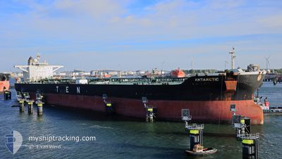
ANTARCTIC
Crude Oil Tanker
Current Trip
| Time Travelled | 1 day |
|---|---|
| Remaining Time | 22 h, 46 mins |
| Distance Travelled | 349.67 nm |
| Remaining Distance | 343.50 nm |
| AVG Speed | 12.2 Knots |
| MAX Speed | 13.2 Knots |
| AVG Wind | 11.5 knots |
| MAX Wind | 16 knots |
| MIN Temp | 21.4°C / 70.52°F |
| MAX Temp | 24.5°C / 76.1°F |
| Draught | 9.5 m |
| Position Received | 4 d ago |
Current Position
| Longitude | -96.79640° |
|---|---|
| Latitude | 27.84063° |
| Status | At anchor |
| Speed | |
| Course | 106° |
| Area | Gulf of Mexico |
| Station | T-AIS |
| Position Received | 4 d ago |
Info
Information
The current position of ANTARCTIC is in Gulf of Mexico with coordinates 27.84063° / -96.79640° as reported on 2024-04-20 02:19 by AIS to our vessel tracker app. The vessel's current speed is 0 Knots and is heading at the port of CORPUS CHRISTI. The estimated time of arrival as calculated by MyShipTracking vessel tracking app is 2024-04-25 18:58 LT
The vessel ANTARCTIC (IMO: 9315185, MMSI: 636015560) is a Crude Oil Tanker that was built in 2007 ( 17 years old ). It's sailing under the flag of [LR] Liberia.
In this page you can find informations about the vessels current position, last detected port calls, and current voyage information. If the vessels is not in coverage by AIS you will find the latest position.
The current position of ANTARCTIC is detected by our AIS receivers and we are not responsible for the reliability of the data. The last position was recorded while the vessel was in Coverage by the Ais receivers of our vessel tracking app.
The current draught of ANTARCTIC as reported by AIS is 9.5 meters
Weather
| Temperature | 24.4°C / 75.92°F |
|---|---|
| Wind Speed | 9 knots |
| Direction | 101° E |
| Pressure | 1018.5 hPa |
| Humidity | 82 % |
| Cloud Coverage | --- |
Featured Company
Last Port Calls
| Port | Arrival | Departure | Time In Port |
|---|---|---|---|
| 2024-04-21 16:26 | 2024-04-23 13:02 | 1 d | |
| 2024-04-08 17:12 | 2024-04-11 00:20 | 2 d | |
| 2024-03-25 15:43 | 2024-03-27 02:19 | 1 d | |
| 2024-03-10 10:59 | 2024-03-12 08:48 | 1 d | |
| 2024-02-27 01:53 | 2024-02-28 00:27 | 22 h | |
| 2024-02-20 04:10 | 2024-02-20 20:41 | 16 h | |
| 2024-02-14 11:01 | 2024-02-15 02:33 | 15 h |
Most Visited Ports (Last year)
| Port | Arrivals | |
|---|---|---|
| 3 | ||
| 2 | ||
| 2 | ||
| 2 | ||
| 2 | ||
| 1 |
Last Trips
| Origin | Departure | Destination | Arrival | Distance | |
|---|---|---|---|---|---|
| 2024-04-10 19:20 | 2024-04-21 11:26 | 220.14 nm | |||
| 2024-03-26 23:49 | 2024-04-08 12:12 | 3010.48 nm | |||
| 2024-03-12 08:48 | 2024-03-25 13:13 | 2518.43 nm | |||
| 2024-02-27 20:57 | 2024-03-10 10:59 | 2300.01 nm | |||
| 2024-02-20 15:41 | 2024-02-26 22:23 | 1294.16 nm | |||
| 2024-02-14 21:33 | 2024-02-19 23:10 | 166.58 nm | |||
| 2024-01-08 22:58 | 2024-02-14 06:01 | 7343.05 nm |
Events
| Time | Event | Details | Position / Dest | Info |
|---|---|---|---|---|
| 2024-04-23 13:02 | PORT DEPARTURE |
|
27.82200 / -97.17735
USHOU>>>USCRP
|
Speed: 6.5 kn Course: 80° |
| 2024-04-23 12:50 | START Moving |
27.81808 / -97.19936
[US] INGLESIDE
|
Speed: 4.2 kn Course: 79° |
|
| 2024-04-21 16:26 | STOP Moving |
27.81987 / -97.20783
[US] INGLESIDE
|
Speed: Course: 203° |
|
| 2024-04-21 16:26 | PORT ARRIVAL |
|
27.81987 / -97.20783
[US] INGLESIDE
|
Speed: 3.8 kn Course: 278° |
| 2024-04-21 13:06 | START Moving | 14.68 nm, East of PORT ARANSAS |
27.83240 / -96.79145
USHOU>>>USCRP
|
Speed: 4.6 kn Course: 159° |
| 2024-04-20 02:25 | Status Changed | Default At anchor |
27.84068 / -96.79640
USHOU>>>USCRP
|
Speed: Course: 106° |
| 2024-04-20 02:19 | Status Changed | At anchor Default |
27.84063 / -96.79640
USHOU>>>USCRP
|
Speed: Course: 105° |
| 2024-04-20 02:19 | OUT of Coverage |
27.84063 / -96.79640
Gulf of Mexico
|
Speed: Course: 56° |
|
| 2024-04-20 02:10 | IN Coverage |
27.84063 / -96.79640
Gulf of Mexico
|
Speed: Course: 56° |
|
| 2024-04-19 14:10 | OUT of Coverage |
27.84118 / -96.79603
Gulf of Mexico
USHOU>>>USCRP
|
Speed: Course: 344° |