
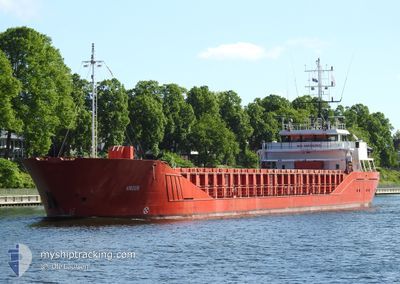
ANOUK
General Cargo
Current Trip
| Time Travelled | 2 days |
|---|---|
| Remaining Time | 2 h, 53 mins |
| Distance Travelled | 417.19 nm |
| Remaining Distance | 32.45 nm |
| AVG Speed | 8.3 Knots |
| MAX Speed | 11.8 Knots |
| AVG Wind | 12.9 knots |
| MAX Wind | 32 knots |
| MIN Temp | 6.1°C / 42.98°F |
| MAX Temp | 8°C / 46.4°F |
| Draught | 4.1 m |
| Position Received | 15 m ago |
Current Position
| Longitude | --- |
|---|---|
| Latitude | --- |
| Status | Under way using engine |
| Speed | 11.5 Knots |
| Course | 325.1° |
| Area | Kattegat |
| Station | T-AIS |
| Position Received | 15 m ago |
Info
Information
The current position of ANOUK is in Kattegat with coordinates 55.67005° / 10.64998° as reported on 2025-12-07 18:22 by AIS to our vessel tracker app. The vessel's current speed is 11.5 Knots and is heading at the port of AARHUS. The estimated time of arrival as calculated by MyShipTracking vessel tracking app is 2025-12-07 22:31 LT
The vessel ANOUK (IMO: 9196266, MMSI: 218856000) is a General Cargo that was built in 2000 ( 25 years old ). It's sailing under the flag of [DE] Germany.
In this page you can find informations about the vessels current position, last detected port calls, and current voyage information. If the vessels is not in coverage by AIS you will find the latest position.
The current position of ANOUK is detected by our AIS receivers and we are not responsible for the reliability of the data. The last position was recorded while the vessel was in Coverage by the Ais receivers of our vessel tracking app.
The current draught of ANOUK as reported by AIS is 4.1 meters
Weather
| Temperature | 7.3°C / 45.14°F |
|---|---|
| Wind Speed | 12 knots |
| Direction | 182° S |
| Pressure | 1005.7 hPa |
| Humidity | 97 % |
| Cloud Coverage | 100 % |
Featured Company
Last Port Calls
| Port | Arrival | Departure | Time In Port |
|---|---|---|---|
| 2025-12-05 00:49 | 2025-12-05 18:45 | 17 h | |
| 2025-12-04 19:42 | 2025-12-04 23:37 | 3 h | |
| 2025-12-03 19:55 | 2025-12-04 19:08 | 23 h | |
| 2025-11-30 07:34 | 2025-12-01 15:59 | 1 d | |
| 2025-11-28 17:55 | 2025-11-29 19:47 | 1 d | |
| 2025-11-26 09:44 | 2025-11-26 21:27 | 11 h | |
| 2025-11-21 18:39 | 2025-11-24 18:16 | 2 d | |
| 2025-11-21 03:18 | 2025-11-21 03:21 | 3 m | |
| 2025-11-18 17:41 | 2025-11-20 06:13 | 1 d | |
| 2025-11-18 08:49 | 2025-11-18 16:37 | 7 h |
Last Trips
| Origin | Departure | Destination | Arrival | Distance | |
|---|---|---|---|---|---|
| 2025-12-04 23:37 | 2025-12-05 00:49 | 12.83 nm | |||
| 2025-12-04 19:08 | 2025-12-04 19:42 | 1.47 nm | |||
| 2025-12-01 15:59 | 2025-12-03 19:55 | 335.44 nm | |||
| 2025-11-29 19:47 | 2025-11-30 07:34 | 112.37 nm | |||
| 2025-11-26 21:27 | 2025-11-28 17:55 | 345.15 nm | |||
| 2025-11-24 18:16 | 2025-11-26 09:44 | 266.32 nm | |||
| 2025-11-21 03:21 | 2025-11-21 18:39 | 133.45 nm | |||
| 2025-11-20 06:13 | 2025-11-21 03:18 | 143.31 nm | |||
| 2025-11-18 16:37 | 2025-11-18 17:41 | 7.70 nm | |||
| 2025-11-17 22:17 | 2025-11-18 08:49 | 92.13 nm |
Events
| Time | Event | Details | Position / Dest | Info |
|---|---|---|---|---|
| 2025-12-07 18:29 | Status Changed | Default Under way using engine |
55.68627 / 10.62682
DKAAR
|
Speed: 11.5 kn Course: 325.1° |
| 2025-12-07 18:22 | Status Changed | Under way using engine Default |
55.67005 / 10.64998
DKAAR
|
Speed: 11.6 kn Course: 326° |
| 2025-12-07 18:05 | IN Coverage |
55.67005 / 10.64998
Kattegat
|
Speed: 11.5 kn Course: 325.1° |
|
| 2025-12-07 16:49 | Status Changed | Default Under way using engine |
55.45041 / 10.94701
DKAAR
|
Speed: 10.1 kn Course: 324.1° |
| 2025-12-07 16:43 | OUT of Coverage |
55.43638 / 10.96406
Kattegat
|
Speed: 10.1 kn Course: 324.1° |
|
| 2025-12-07 12:31 | Change Sea Area | Danish part of the Kattegat Danish part of the Baltic Sea |
54.74541 / 10.82865
Kattegat
|
Speed: 11.2 kn Course: 20.5° |
| 2025-12-07 12:06 | Change Sea Area | Danish part of the Baltic Sea German part of the Baltic Sea |
54.67622 / 10.78318
Baltic Sea
|
Speed: 9.9 kn Course: 45.9° |
| 2025-12-07 12:05 | Status Changed | Under way using engine Default |
54.67559 / 10.78201
DKAAR
|
Speed: 10.1 kn Course: 45° |
| 2025-12-07 11:53 | IN Coverage |
54.67622 / 10.78318
Baltic Sea
|
Speed: 9.9 kn Course: 45.9° |
|
| 2025-12-07 10:21 | OUT of Coverage |
54.50803 / 10.36343
Baltic Sea
|
Speed: 10.1 kn Course: 58.6° |