
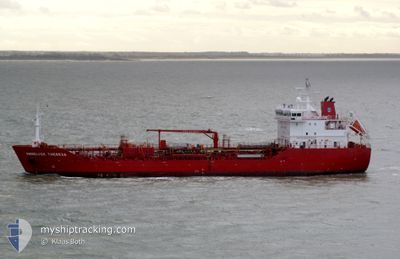
ANNELISE THERESA
Oil/Chemical Tanker
Current Trip
| Trip Time | 2 days |
|---|---|
| Trip Distance | 574.52 nm |
| AVG Speed | 11.4 Knots |
| MAX Speed | 13.1 Knots |
| Draught | 7.7 m |
| AVG Wind | 15.8 knots |
| MAX Wind | 35.2 knots |
| MIN Temp | 12.6°C / 54.68°F |
| MAX Temp | 18.4°C / 65.12°F |
| Position Received | 1 d ago |
Current Position
| Longitude | 15.48905° |
|---|---|
| Latitude | 37.71935° |
| Status | Under way using engine |
| Speed | 11.7 Knots |
| Course | 189.6° |
| Area | Ionian Sea |
| Station | T-AIS |
| Position Received | 1 d ago |
Info
Information
The current position of ANNELISE THERESA is in Ionian Sea with coordinates 37.71935° / 15.48905° as reported on 2024-04-17 12:08 by AIS to our vessel tracker app. The vessel's current speed is 11.7 Knots and is currently inside the port of AUGUSTA.
The vessel ANNELISE THERESA (IMO: 9478286, MMSI: 219023000) is a Oil/Chemical Tanker that was built in 2009 ( 15 years old ). It's sailing under the flag of [DK] Denmark.
In this page you can find informations about the vessels current position, last detected port calls, and current voyage information. If the vessels is not in coverage by AIS you will find the latest position.
The current position of ANNELISE THERESA is detected by our AIS receivers and we are not responsible for the reliability of the data. The last position was recorded while the vessel was in Coverage by the Ais receivers of our vessel tracking app.
The current draught of ANNELISE THERESA as reported by AIS is 7.7 meters
Weather
| Temperature | 16.2°C / 61.16°F |
|---|---|
| Wind Speed | 11 knots |
| Direction | 317° NW |
| Pressure | 1010.4 hPa |
| Humidity | 51 % |
| Cloud Coverage | --- |
Featured Company
Last Port Calls
| Port | Arrival | Departure | Time In Port |
|---|---|---|---|
| 2024-04-17 15:49 | |||
| 2024-04-13 04:49 | 2024-04-15 14:03 | 2 d | |
| 2024-04-07 14:08 | 2024-04-08 17:05 | 1 d | |
| 2024-04-04 14:45 | 2024-04-06 06:46 | 1 d | |
| 2024-04-02 21:24 | 2024-04-03 05:14 | 7 h | |
| 2024-03-20 13:46 | 2024-03-25 07:03 | 4 d | |
| 2024-03-10 06:42 | 2024-03-10 19:00 | 12 h | |
| 2024-03-07 11:58 | |||
| 2024-02-22 04:55 | 2024-02-22 18:15 | 13 h | |
| 2024-02-16 02:18 | 2024-02-16 03:13 | 54 m |
Most Visited Ports (Last year)
| Port | Arrivals | |
|---|---|---|
| 6 | ||
| 6 | ||
| 5 | ||
| 5 | ||
| 3 | ||
| 3 |
Last Trips
| Origin | Departure | Destination | Arrival | Distance | |
|---|---|---|---|---|---|
| 2024-04-15 16:03 | 2024-04-17 17:49 | 574.52 nm | |||
| 2024-04-08 17:05 | 2024-04-13 06:49 | 1087.37 nm | |||
| 2024-04-06 06:46 | 2024-04-07 14:08 | 319.95 nm | |||
| 2024-04-03 06:14 | 2024-04-04 14:45 | 349.85 nm | |||
| 2024-03-25 07:03 | 2024-04-02 22:24 | 2147.13 nm | |||
| 2024-03-10 20:00 | 2024-03-20 13:46 | 1276.56 nm | |||
| 2024-03-07 12:58 | 2024-03-10 07:42 | 645.25 nm | |||
| 2024-02-16 04:13 | 2024-02-22 04:55 | 1590.40 nm | |||
| 2024-02-12 22:37 | 2024-02-16 03:18 | 2.91 nm | |||
| 2024-01-26 07:58 | 2024-02-12 21:27 | 2316.05 nm |
Events
| Time | Event | Details | Position / Dest | Info |
|---|---|---|---|---|
| 2024-04-17 16:03 | STOP Moving |
37.18353 / 15.21155
[IT] AUGUSTA
|
Speed: 0.2 kn Course: 143° |
|
| 2024-04-17 15:49 | PORT ARRIVAL |
|
37.19612 / 15.22987
[IT] AUGUSTA
|
Speed: 9.8 kn Course: 272° |
| 2024-04-17 12:11 | Status Changed | Default Under way using engine |
37.70973 / 15.48705
IT AUG
|
Speed: 11.7 kn Course: 189.6° |
| 2024-04-17 12:08 | OUT of Coverage |
37.71935 / 15.48905
Ionian Sea
IT AUG
|
Speed: 11.7 kn Course: 189.6° |
|
| 2024-04-17 11:13 | Status Changed | Under way using engine Default |
37.89739 / 15.52518
IT AUG
|
Speed: 11.6 kn Course: 187° |
| 2024-04-17 10:52 | Status Changed | Default Under way using engine |
37.96500 / 15.53333
IT AUG
|
Speed: 11.7 kn Course: 187.9° |
| 2024-04-17 09:19 | Change Sea Area | Italian part of the Ionian Sea Italian part of the Tyrrhenian Sea |
38.25630 / 15.64869
Ionian Sea
IT AUG
|
Speed: 11.6 kn Course: 250.8° |
| 2024-04-17 06:01 | ETA Changed | 2024/04/17 16:00 2024/04/17 15:00 |
38.86742 / 15.41398
IT AUG
|
Speed: 11.5 kn Course: 155.8° |
| 2024-04-17 05:07 | Status Changed | Under way using engine Default |
38.99480 / 15.26146
IT AUG
|
Speed: 11.9 kn Course: 131° |
| 2024-04-17 05:07 | IN Coverage |
38.99480 / 15.26146
Tyrrhenian Sea
IT AUG
|
Speed: 12.2 kn Course: 128.2° |