
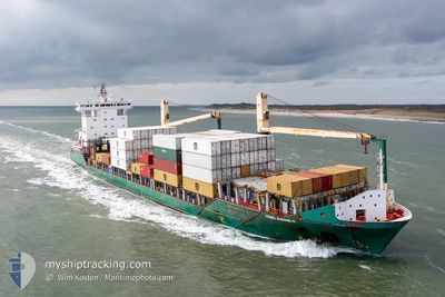
MSC ANNE F
Container Ship
Current Trip
| Time Travelled | 10 h, 2 mins |
|---|---|
| Remaining Time | 14 h, 42 mins |
| Distance Travelled | 118.60 nm |
| Remaining Distance | 172.99 nm |
| AVG Speed | 12 Knots |
| MAX Speed | 13.5 Knots |
| AVG Wind | 16.7 knots |
| MAX Wind | 25.5 knots |
| MIN Temp | 6.3°C / 43.34°F |
| MAX Temp | 8°C / 46.4°F |
| Draught | 7.7 m |
| Position Received | Now |
Current Position
| Longitude | 7.38349° |
|---|---|
| Latitude | 55.33162° |
| Status | Under way using engine |
| Speed | 10.9 Knots |
| Course | 357.5° |
| Area | North Sea |
| Station | T-AIS |
| Position Received | Now |
Info
Information
The current position of MSC ANNE F is in North Sea with coordinates 55.33162° / 7.38349° as reported on 2024-04-23 19:49 by AIS to our vessel tracker app. The vessel's current speed is 10.9 Knots and is heading at the port of KRISTIANSAND. The estimated time of arrival as calculated by MyShipTracking vessel tracking app is 2024-04-24 10:32 LT
The vessel MSC ANNE F (IMO: 9347803, MMSI: 255806190) is a Container Ship that was built in 2006 ( 18 years old ). It's sailing under the flag of [PT] Portugal.
In this page you can find informations about the vessels current position, last detected port calls, and current voyage information. If the vessels is not in coverage by AIS you will find the latest position.
The current position of MSC ANNE F is detected by our AIS receivers and we are not responsible for the reliability of the data. The last position was recorded while the vessel was in Coverage by the Ais receivers of our vessel tracking app.
The current draught of MSC ANNE F as reported by AIS is 7.7 meters
Weather
| Temperature | 7°C / 44.6°F |
|---|---|
| Wind Speed | 20 knots |
| Direction | 331° NNW |
| Pressure | 1008.8 hPa |
| Humidity | 70.3 % |
| Cloud Coverage | 100 % |
Featured Company
Last Port Calls
| Port | Arrival | Departure | Time In Port |
|---|---|---|---|
| 2024-04-22 20:15 | 2024-04-23 09:48 | 13 h | |
| 2024-04-21 10:27 | 2024-04-21 22:15 | 11 h | |
| 2024-04-18 06:54 | 2024-04-18 17:24 | 10 h | |
| 2024-04-16 09:33 | 2024-04-17 01:09 | 15 h | |
| 2024-04-12 03:56 | 2024-04-12 12:15 | 8 h | |
| 2024-04-11 03:09 | 2024-04-11 19:12 | 16 h | |
| 2024-04-09 18:26 | 2024-04-10 16:12 | 21 h | |
| 2024-04-08 01:37 | 2024-04-08 19:10 | 17 h | |
| 2024-04-03 22:54 | 2024-04-04 18:40 | 19 h | |
| 2024-04-03 02:01 | 2024-04-03 14:26 | 12 h |
Most Visited Ports (Last year)
| Port | Arrivals | |
|---|---|---|
| 19 | ||
| 10 | ||
| 8 | ||
| 8 | ||
| 7 | ||
| 6 |
Last Trips
| Origin | Departure | Destination | Arrival | Distance | |
|---|---|---|---|---|---|
| 2024-04-22 00:15 | 2024-04-22 22:15 | 304.87 nm | |||
| 2024-04-18 19:24 | 2024-04-21 12:27 | 660.92 nm | |||
| 2024-04-17 03:09 | 2024-04-18 08:54 | 376.52 nm | |||
| 2024-04-12 14:15 | 2024-04-16 11:33 | 819.11 nm | |||
| 2024-04-11 21:12 | 2024-04-12 05:56 | 114.87 nm | |||
| 2024-04-10 18:12 | 2024-04-11 05:09 | 130.36 nm | |||
| 2024-04-08 21:10 | 2024-04-09 20:26 | 296.00 nm | |||
| 2024-04-04 20:40 | 2024-04-08 03:37 | 791.78 nm | |||
| 2024-04-03 16:26 | 2024-04-04 00:54 | 109.08 nm | |||
| 2024-04-02 17:39 | 2024-04-03 04:01 | 130.64 nm |
Events
| Time | Event | Details | Position / Dest | Info |
|---|---|---|---|---|
| 2024-04-23 19:10 | Change Sea Area | Danish part of the North Sea German part of the North Sea |
55.20605 / 7.39680
North Sea
NO KRS
|
Speed: 11.4 kn Course: 356.5° |
| 2024-04-23 17:29 | IN Coverage |
54.87628 / 7.42525
North Sea
NO KRS
|
Speed: 12 kn Course: 357.6° |
|
| 2024-04-23 16:11 | OUT of Coverage |
54.61193 / 7.45775
North Sea
NO KRS
|
Speed: 12.5 kn Course: 355.5° |
|
| 2024-04-23 14:55 | Status Changed | Under way using engine Default |
54.35664 / 7.49807
NO KRS
|
Speed: 12.2 kn Course: 356° |
| 2024-04-23 14:55 | IN Coverage |
54.35664 / 7.49807
North Sea
NO KRS
|
Speed: 12 kn Course: 357° |
|
| 2024-04-23 12:57 | Status Changed | Default Under way using engine |
53.97823 / 7.66657
NO KRS
|
Speed: 12.1 kn Course: 331.1° |
| 2024-04-23 12:56 | OUT of Coverage |
53.97430 / 7.67043
North Sea
NO KRS
|
Speed: 12.1 kn Course: 331.1° |
|
| 2024-04-23 12:20 | Status Changed | Under way using engine Default |
53.88422 / 7.79684
NO KRS
|
Speed: 12.2 kn Course: 285° |
| 2024-04-23 12:08 | Status Changed | Default Under way using engine |
53.87256 / 7.86533
NO KRS
|
Speed: 9.9 kn Course: 264.9° |
| 2024-04-23 11:58 | Status Changed | Under way using engine Default |
53.86697 / 7.91638
NO KRS
|
Speed: 13.5 kn Course: 284° |