
ANNA
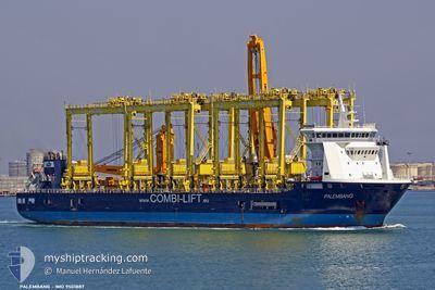
General Cargo
Current Trip
| Time Travelled | 8 days |
|---|---|
| Remaining Time | --- |
| Distance Travelled | 2399.53 nm |
| Remaining Distance | 1.20 nm |
| AVG Speed | 13.2 Knots |
| MAX Speed | 16 Knots |
| AVG Wind | 9.4 knots |
| MAX Wind | 28 knots |
| MIN Temp | 5.2°C / 41.36°F |
| MAX Temp | 19.5°C / 67.1°F |
| Draught | 7.1 m |
| Position Received | 3 m ago |
Current Position
| Longitude | --- |
|---|---|
| Latitude | --- |
| Status | At anchor |
| Speed | 0.1 Knots |
| Course | 105° |
| Area | North Atlantic Ocean |
| Station | T-AIS |
| Position Received | 3 m ago |
Info
Information
The current position of ANNA is in North Atlantic Ocean with coordinates 28.10155° / -15.39854° as reported on 2025-12-07 08:27 by AIS to our vessel tracker app. The vessel's current speed is 0.1 Knots and is heading at the port of LAS PALMAS. The estimated time of arrival as calculated by MyShipTracking vessel tracking app is 2025-12-06 12:00 LT
The vessel ANNA (IMO: 9501887, MMSI: 305544000) is a General Cargo that was built in 2010 ( 15 years old ). It's sailing under the flag of [AG] Antigua Barbuda.
In this page you can find informations about the vessels current position, last detected port calls, and current voyage information. If the vessels is not in coverage by AIS you will find the latest position.
The current position of ANNA is detected by our AIS receivers and we are not responsible for the reliability of the data. The last position was recorded while the vessel was in Coverage by the Ais receivers of our vessel tracking app.
The current draught of ANNA as reported by AIS is 7.1 meters
Weather
| Temperature | 15.4°C / 59.72°F |
|---|---|
| Wind Speed | 5 knots |
| Direction | 153° SSE |
| Pressure | 1021.5 hPa |
| Humidity | 51.8 % |
| Cloud Coverage | 51 % |
Featured Company
Last Port Calls
| Port | Arrival | Departure | Time In Port |
|---|---|---|---|
| 2025-11-24 07:06 | 2025-11-28 20:52 | 4 d | |
| 2025-11-12 08:04 | 2025-11-14 19:58 | 2 d | |
| 2025-11-04 04:30 | 2025-11-08 06:04 | 4 d | |
| 2025-10-27 09:46 | 2025-10-31 21:20 | 4 d | |
| 2025-10-23 16:02 | 2025-10-25 08:39 | 1 d | |
| 2025-10-19 11:08 | 2025-10-22 21:00 | 3 d | |
| 2025-10-06 15:30 |
Last Trips
| Origin | Departure | Destination | Arrival | Distance | |
|---|---|---|---|---|---|
| 2025-11-14 19:58 | 2025-11-24 07:06 | 45.09 nm | |||
| 2025-10-31 21:20 | 2025-11-12 08:04 | 2231.45 nm | |||
| 2025-10-31 21:20 | 2025-11-04 04:30 | 872.66 nm | |||
| 2025-10-25 08:39 | 2025-10-27 09:46 | 58.40 nm | |||
| 2025-10-22 21:00 | 2025-10-23 16:02 | 196.86 nm | |||
| 2025-10-06 15:30 | 2025-10-19 11:08 | 4207.47 nm |
Events
| Time | Event | Details | Position / Dest | Info |
|---|---|---|---|---|
| 2025-12-07 03:30 | Status Changed | At anchor Default |
28.10125 / -15.39854
ESLPA
|
Speed: 0.4 kn Course: 111° |
| 2025-12-07 03:24 | Status Changed | Default At anchor |
28.10132 / -15.39852
ESLPA
|
Speed: 0.1 kn Course: 116° |
| 2025-12-06 21:24 | Status Changed | At anchor Default |
28.10073 / -15.39863
ESLPA
|
Speed: 0.1 kn Course: 70° |
| 2025-12-06 21:21 | Status Changed | Default At anchor |
28.10078 / -15.39863
ESLPA
|
Speed: 0.1 kn Course: 70° |
| 2025-12-06 20:27 | Status Changed | At anchor Default |
28.10092 / -15.39864
ESLPA
|
Speed: Course: 89° |
| 2025-12-06 20:21 | Status Changed | Default At anchor |
28.10087 / -15.39863
ESLPA
|
Speed: Course: 83° |
| 2025-12-06 16:12 | Status Changed | At anchor Default |
28.10085 / -15.39870
ESLPA
|
Speed: 0.2 kn Course: 45° |
| 2025-12-06 16:06 | Status Changed | Default At anchor |
28.10085 / -15.39871
ESLPA
|
Speed: 0.2 kn Course: 45° |
| 2025-12-06 12:00 | Status Changed | At anchor Default |
28.10085 / -15.39876
ESLPA
|
Speed: 0.2 kn Course: 56° |
| 2025-12-06 11:57 | Status Changed | Default At anchor |
28.10085 / -15.39883
ESLPA
|
Speed: 0.2 kn Course: 55° |