
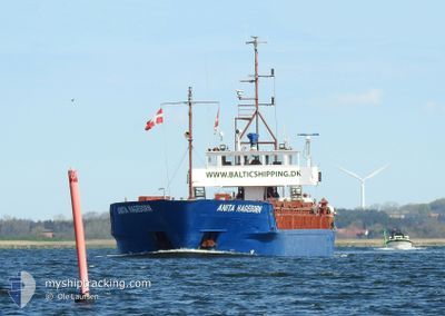
ANITA HAGEDORN
General Cargo
Current Trip
| Time Travelled | 2 days |
|---|---|
| Remaining Time | 1 day |
| Distance Travelled | 304.48 nm |
| Remaining Distance | 319.90 nm |
| AVG Speed | 8.3 Knots |
| MAX Speed | 10.5 Knots |
| AVG Wind | 6.9 knots |
| MAX Wind | 18.9 knots |
| MIN Temp | 3.1°C / 37.58°F |
| MAX Temp | 9.7°C / 49.46°F |
| Draught | 2.8 m |
| Position Received | Now |
Current Position
| Longitude | 12.04688° |
|---|---|
| Latitude | 56.32513° |
| Status | Under way using engine |
| Speed | 8.6 Knots |
| Course | 133.9° |
| Area | Kattegat |
| Station | T-AIS |
| Position Received | Now |
Info
Information
The current position of ANITA HAGEDORN is in Kattegat with coordinates 56.32513° / 12.04688° as reported on 2024-04-20 00:59 by AIS to our vessel tracker app. The vessel's current speed is 8.6 Knots and is heading at the port of GDYNIA. The estimated time of arrival as calculated by MyShipTracking vessel tracking app is 2024-04-21 15:08 LT
The vessel ANITA HAGEDORN (IMO: 8505927, MMSI: 211686000) is a General Cargo that was built in 1985 ( 39 years old ). It's sailing under the flag of [DE] Germany.
In this page you can find informations about the vessels current position, last detected port calls, and current voyage information. If the vessels is not in coverage by AIS you will find the latest position.
The current position of ANITA HAGEDORN is detected by our AIS receivers and we are not responsible for the reliability of the data. The last position was recorded while the vessel was in Coverage by the Ais receivers of our vessel tracking app.
The current draught of ANITA HAGEDORN as reported by AIS is 2.8 meters
Weather
| Temperature | 3.4°C / 38.12°F |
|---|---|
| Wind Speed | 11 knots |
| Direction | 52° NE |
| Pressure | 1011.2 hPa |
| Humidity | 68.4 % |
| Cloud Coverage | 73 % |
Featured Company
Last Port Calls
| Port | Arrival | Departure | Time In Port |
|---|---|---|---|
| 2024-04-15 21:27 | 2024-04-17 10:08 | 1 d | |
| 2024-04-14 19:23 | 2024-04-15 09:30 | 14 h | |
| 2024-04-11 19:18 | 2024-04-12 09:25 | 14 h | |
| 2024-04-07 08:28 | 2024-04-09 15:06 | 2 d | |
| 2024-04-05 19:20 | 2024-04-06 17:25 | 22 h | |
| 2024-04-03 14:29 | 2024-04-04 11:51 | 21 h | |
| 2024-04-02 21:52 | 2024-04-03 10:10 | 12 h | |
| 2024-03-28 06:26 | 2024-04-02 10:50 | 5 d | |
| 2024-03-26 17:47 | 2024-03-27 15:15 | 21 h | |
| 2024-03-24 15:11 | 2024-03-25 04:29 | 13 h |
Most Visited Ports (Last year)
| Port | Arrivals | |
|---|---|---|
| 10 | ||
| 9 | ||
| 5 | ||
| 5 | ||
| 4 | ||
| 4 |
Last Trips
| Origin | Departure | Destination | Arrival | Distance | |
|---|---|---|---|---|---|
| 2024-04-15 11:30 | 2024-04-15 23:27 | 97.65 nm | |||
| 2024-04-12 11:25 | 2024-04-14 21:23 | 379.49 nm | |||
| 2024-04-09 17:06 | 2024-04-11 21:18 | 403.94 nm | |||
| 2024-04-06 19:25 | 2024-04-07 10:28 | 119.15 nm | |||
| 2024-04-04 13:51 | 2024-04-05 21:20 | 240.29 nm | |||
| 2024-04-03 12:10 | 2024-04-03 16:29 | 37.09 nm | |||
| 2024-04-02 12:50 | 2024-04-02 23:52 | 95.57 nm | |||
| 2024-03-27 16:15 | 2024-03-28 07:26 | 116.42 nm | |||
| 2024-03-25 05:29 | 2024-03-26 18:47 | 311.68 nm | |||
| 2024-03-21 16:37 | 2024-03-24 16:11 | 281.11 nm |
Events
| Time | Event | Details | Position / Dest | Info |
|---|---|---|---|---|
| 2024-04-19 14:55 | START Moving | 3.02 nm, East of AALBORG |
57.05604 / 10.05204
GDYNIA
|
Speed: 4.5 kn Course: 110° |
| 2024-04-19 14:55 | ETA Changed | 2024/04/21 17:00 2024/04/18 13:00 |
57.05626 / 10.05067
GDYNIA
|
Speed: 3.6 kn Course: 108° |
| 2024-04-19 14:49 | Status Changed | Under way using engine Moored |
57.05545 / 10.04869
GDYNIA
|
Speed: 0.1 kn Course: 308° |
| 2024-04-19 14:38 | Draught Changed | 2.8 3.8 |
57.05543 / 10.04868
GDYNIA
|
Speed: Course: 308° |
| 2024-04-19 04:11 | Destination Changed | GDYNIA AALBORG |
57.05542 / 10.04864
GDYNIA
|
Speed: Course: 308° |
| 2024-04-18 12:27 | Status Changed | Moored Under way using engine |
57.05542 / 10.04864
AALBORG
|
Speed: Course: 309° |
| 2024-04-18 12:21 | STOP Moving | 2.92 nm, East of AALBORG |
57.05542 / 10.04877
AALBORG
|
Speed: 0.3 kn Course: 308° |
| 2024-04-18 10:38 | ETA Changed | 2024/04/18 13:00 2024/04/18 15:00 |
56.97105 / 10.34304
AALBORG
|
Speed: 6.7 kn Course: 300.5° |
| 2024-04-17 17:47 | Change Sea Area | Danish part of the Kattegat Danish part of the Baltic Sea |
54.74920 / 10.90061
Kattegat
AALBORG
|
Speed: 9.6 kn Course: 333.2° |
| 2024-04-17 15:56 | Change Sea Area | Danish part of the Baltic Sea German part of the Baltic Sea |
54.58112 / 11.28179
Baltic Sea
AALBORG
|
Speed: 9.1 kn Course: 307.6° |