
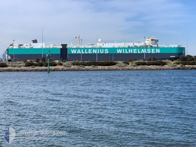
ANIARA
Vehicles Carrier
Current Trip
UK BRS
| Time Travelled | 14 days |
|---|---|
| Remaining Time | --- |
| Distance Travelled | 5695.14 nm |
| Remaining Distance | --- |
| AVG Speed | 15.5 Knots |
| MAX Speed | 18 Knots |
| AVG Wind | 11 knots |
| MAX Wind | 21 knots |
| MIN Temp | 9.7°C / 49.46°F |
| MAX Temp | 30.1°C / 86.18°F |
| Draught | 10.3 m |
| Position Received | 7 d ago |
Current Position
| Longitude | 103.53480° |
|---|---|
| Latitude | 1.21216° |
| Status | Under way using engine |
| Speed | 16 Knots |
| Course | 284.4° |
| Area | Singapore Strait |
| Station | T-AIS |
| Position Received | 7 d ago |
Info
Information
The current position of ANIARA is in Singapore Strait with coordinates 1.21216° / 103.53480° as reported on 2024-04-16 10:27 by AIS to our vessel tracker app. The vessel's current speed is 16 Knots
The vessel ANIARA (IMO: 9377494, MMSI: 266282000) is a Vehicles Carrier that was built in 2008 ( 16 years old ). It's sailing under the flag of [SE] Sweden.
In this page you can find informations about the vessels current position, last detected port calls, and current voyage information. If the vessels is not in coverage by AIS you will find the latest position.
The current position of ANIARA is detected by our AIS receivers and we are not responsible for the reliability of the data. The last position was recorded while the vessel was in Coverage by the Ais receivers of our vessel tracking app.
The current draught of ANIARA as reported by AIS is 10.3 meters
Weather
| Temperature | 27.2°C / 80.96°F |
|---|---|
| Wind Speed | 15 knots |
| Direction | 88° E |
| Pressure | 1013.7 hPa |
| Humidity | 81.3 % |
| Cloud Coverage | 68 % |
Featured Company
Last Port Calls
| Port | Arrival | Departure | Time In Port |
|---|---|---|---|
| 2024-04-08 19:43 | 2024-04-09 06:41 | 10 h | |
| 2024-04-06 03:32 | 2024-04-07 03:20 | 23 h | |
| 2024-03-31 21:56 | 2024-04-01 07:25 | 9 h | |
| 2024-03-30 22:51 | 2024-03-31 07:12 | 8 h | |
| 2024-03-07 08:21 | 2024-03-08 07:54 | 23 h | |
| 2024-02-28 15:28 | 2024-03-01 22:14 | 2 d | |
| 2024-02-14 07:57 | 2024-02-15 18:31 | 1 d | |
| 2024-02-12 23:34 | 2024-02-14 07:47 | 1 d |
Most Visited Ports (Last year)
| Port | Arrivals | |
|---|---|---|
| 4 | ||
| 3 | ||
| 3 | ||
| 3 | ||
| 3 | ||
| 2 |
Last Trips
| Origin | Departure | Destination | Arrival | Distance | |
|---|---|---|---|---|---|
| 2024-04-07 11:20 | 2024-04-09 04:43 | 492.23 nm | |||
| 2024-04-01 16:25 | 2024-04-06 11:32 | 1001.57 nm | |||
| 2024-03-31 16:12 | 2024-04-01 06:56 | 212.67 nm | |||
| 2024-03-08 17:54 | 2024-03-31 07:51 | 4031.34 nm | |||
| 2024-03-02 09:14 | 2024-03-07 18:21 | 1136.18 nm | |||
| 2024-02-16 02:31 | 2024-02-29 02:28 | 2127.04 nm | |||
| 2024-02-14 15:47 | 2024-02-14 15:57 | 0.24 nm | |||
| 2024-01-02 23:39 | 2024-02-13 07:34 | 13227.21 nm |
Events
| Time | Event | Details | Position / Dest | Info |
|---|---|---|---|---|
| 2024-04-16 10:31 | Status Changed | Default Under way using engine |
1.21747 / 103.51629
UK BRS
|
Speed: 16 kn Course: 284.4° |
| 2024-04-16 10:27 | OUT of Coverage |
1.21216 / 103.53480
Singapore Strait
UK BRS
|
Speed: 16 kn Course: 284.4° |
|
| 2024-04-16 10:17 | Change Sea Area | Malaysian part of the Singapore Strait Indonesian part of the Singapore Strait |
1.19873 / 103.57556
Singapore Strait
UK BRS
|
Speed: 14.4 kn Course: 291.4° |
| 2024-04-16 09:32 | Change Sea Area | Indonesian part of the Singapore Strait Singaporean part of the Singapore Strait |
1.14048 / 103.72365
Singapore Strait
UK BRS
|
Speed: 10.7 kn Course: 287.4° |
| 2024-04-16 08:02 | Draught Changed | 10.3 10.4 |
1.25800 / 103.97806
UK BRS
|
Speed: 6.6 kn Course: 230.8° |
| 2024-04-16 08:02 | Destination Changed | UK BRS UK BRSR |
1.25800 / 103.97806
UK BRS
|
Speed: 6.6 kn Course: 230.8° |
| 2024-04-16 08:02 | ETA Changed | 2024/05/15 08:00 2024/05/15 05:00 |
1.25800 / 103.97806
UK BRS
|
Speed: 6.6 kn Course: 230.8° |
| 2024-04-16 07:40 | START Moving | 1.95 nm, South of TANAH MERAH |
1.27979 / 104.01432
UK BRSR
|
Speed: 3.8 kn Course: 229° |
| 2024-04-16 07:26 | Status Changed | Under way using engine At anchor |
1.28364 / 104.01494
UK BRSR
|
Speed: 0.7 kn Course: 318° |
| 2024-04-16 07:25 | Destination Changed | UK BRSR SIN PEBGBC BUNKER |
1.28396 / 104.01469
UK BRSR
|
Speed: 0.7 kn Course: 318° |