
FRONT FORTH
Tanker
Current Trip
RONDO FOR ORDERS
| Time Travelled | 12 days |
|---|---|
| Remaining Time | --- |
| Distance Travelled | 2874.40 nm |
| Remaining Distance | --- |
| AVG Speed | 11.1 Knots |
| MAX Speed | 15.8 Knots |
| AVG Wind | 10.3 knots |
| MAX Wind | 25.8 knots |
| MIN Temp | 9°C / 48.2°F |
| MAX Temp | 29.9°C / 85.82°F |
| Draught | 11 m |
| Position Received | 1 d ago |
Current Position
| Longitude | 103.39696° |
|---|---|
| Latitude | 1.24833° |
| Status | Under way using engine |
| Speed | 11.4 Knots |
| Course | 304.6° |
| Area | Malacca Strait |
| Station | T-AIS |
| Position Received | 1 d ago |
Info
Information
The current position of FRONT FORTH is in Malacca Strait with coordinates 1.24833° / 103.39696° as reported on 2024-04-17 12:01 by AIS to our vessel tracker app. The vessel's current speed is 11.4 Knots
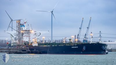
The vessel FRONT FORTH (IMO: 9739501, MMSI: 636017088) is a Tanker It's sailing under the flag of [LR] Liberia.
In this page you can find informations about the vessels current position, last detected port calls, and current voyage information. If the vessels is not in coverage by AIS you will find the latest position.
The current position of FRONT FORTH is detected by our AIS receivers and we are not responsible for the reliability of the data. The last position was recorded while the vessel was in Coverage by the Ais receivers of our vessel tracking app.
The current draught of FRONT FORTH as reported by AIS is 11 meters
Weather
| Temperature | 27.3°C / 81.14°F |
|---|---|
| Wind Speed | 11 knots |
| Direction | 341° NNW |
| Pressure | 1010.6 hPa |
| Humidity | 85.6 % |
| Cloud Coverage | 100 % |
Featured Company
Most Visited Ports (Last year)
| Port | Arrivals | |
|---|---|---|
| 2 | ||
| 1 | ||
| 1 | ||
| 1 | ||
| 1 | ||
| 1 |
Events
| Time | Event | Details | Position / Dest | Info |
|---|---|---|---|---|
| 2024-04-17 12:04 | Status Changed | Default Under way using engine |
1.25586 / 103.39032
RONDO FOR ORDERS
|
Speed: 11.4 kn Course: 304.6° |
| 2024-04-17 12:01 | Status Changed | Under way using engine Default |
1.24833 / 103.39696
RONDO FOR ORDERS
|
Speed: 11.7 kn Course: 293° |
| 2024-04-17 12:01 | OUT of Coverage |
1.24833 / 103.39696
Malacca Strait
RONDO FOR ORDERS
|
Speed: 11.4 kn Course: 304.6° |
|
| 2024-04-17 11:44 | Status Changed | Default Under way using engine |
1.22790 / 103.44629
RONDO FOR ORDERS
|
Speed: 11.7 kn Course: 287.8° |
| 2024-04-17 11:40 | Change Sea Area | Malaysian part of the Malacca Strait Malaysian part of the Singapore Strait |
1.22320 / 103.46053
Malacca Strait
RONDO FOR ORDERS
|
Speed: 11.7 kn Course: 287.8° |
| 2024-04-17 10:59 | ETA Changed | 2024/04/19 16:00 2024/04/19 14:00 |
1.19545 / 103.58683
RONDO FOR ORDERS
|
Speed: 11.5 kn Course: 280.5° |
| 2024-04-17 10:58 | Change Sea Area | Malaysian part of the Singapore Strait Indonesian part of the Singapore Strait |
1.19506 / 103.58882
Singapore Strait
RONDO FOR ORDERS
|
Speed: 11.5 kn Course: 280.2° |
| 2024-04-17 10:23 | Change Sea Area | Indonesian part of the Singapore Strait Singaporean part of the Singapore Strait |
1.16213 / 103.69539
Singapore Strait
RONDO FOR ORDERS
|
Speed: 11.4 kn Course: 300.9° |
| 2024-04-17 08:35 | Change Sea Area | Singaporean part of the Singapore Strait Indonesian part of the Singapore Strait |
1.26208 / 104.01507
Singapore Strait
RONDO FOR ORDERS
|
Speed: 12 kn Course: 252.5° |
| 2024-04-17 08:29 | Change Sea Area | Indonesian part of the Singapore Strait Singaporean part of the Singapore Strait |
1.26785 / 104.03329
Singapore Strait
RONDO FOR ORDERS
|
Speed: 10.8 kn Course: 249.1° |