
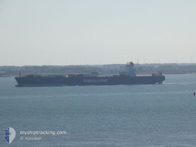
AMSTERDAM EXPRESS
Container Ship
Current Trip
| Trip Time | 1 day |
|---|---|
| Trip Distance | 710.80 nm |
| AVG Speed | 17.1 Knots |
| MAX Speed | 19.1 Knots |
| Draught | 11.3 m |
| AVG Wind | 10.1 knots |
| MAX Wind | 14.5 knots |
| MIN Temp | 19.4°C / 66.92°F |
| MAX Temp | 28.9°C / 84.02°F |
| Position Received | 7 d ago |
Current Position
| Longitude | -71.98461° |
|---|---|
| Latitude | -33.07073° |
| Status | Under way using engine |
| Speed | 17.7 Knots |
| Course | 349.3° |
| Area | South Pacific Ocean |
| Station | T-AIS |
| Position Received | 7 d ago |
Info
Information
The current position of AMSTERDAM EXPRESS is in South Pacific Ocean with coordinates -33.07073° / -71.98461° as reported on 2024-04-17 22:59 by AIS to our vessel tracker app. The vessel's current speed is 17.7 Knots and is currently inside the port of GUAYAQUIL.
The vessel AMSTERDAM EXPRESS (IMO: 9193317, MMSI: 636093132) is a Container Ship that was built in 2000 ( 24 years old ). It's sailing under the flag of [LR] Liberia.
In this page you can find informations about the vessels current position, last detected port calls, and current voyage information. If the vessels is not in coverage by AIS you will find the latest position.
The current position of AMSTERDAM EXPRESS is detected by our AIS receivers and we are not responsible for the reliability of the data. The last position was recorded while the vessel was in Coverage by the Ais receivers of our vessel tracking app.
The current draught of AMSTERDAM EXPRESS as reported by AIS is 11.3 meters
Weather
| Temperature | 28.8°C / 83.84°F |
|---|---|
| Wind Speed | 8 knots |
| Direction | 257° WSW |
| Pressure | 1006.8 hPa |
| Humidity | 72.8 % |
| Cloud Coverage | 100 % |
Featured Company
Last Port Calls
| Port | Arrival | Departure | Time In Port |
|---|---|---|---|
| 2024-04-23 22:14 | |||
| 2024-04-21 11:09 | 2024-04-22 04:53 | 17 h | |
| 2024-04-16 21:51 | 2024-04-17 20:37 | 22 h | |
| 2024-04-02 23:17 | 2024-04-03 16:26 | 17 h | |
| 2024-04-01 09:38 | 2024-04-02 08:46 | 23 h | |
| 2024-03-30 14:01 | 2024-03-30 14:06 | 5 m | |
| 2024-03-29 00:50 | 2024-03-29 15:02 | 14 h | |
| 2024-03-18 03:31 | |||
| 2024-03-15 09:51 | |||
| 2024-03-13 10:24 |
Most Visited Ports (Last year)
| Port | Arrivals | |
|---|---|---|
| 8 | ||
| 2 | ||
| 2 | ||
| 2 | ||
| 1 | ||
| 1 |
Last Trips
| Origin | Departure | Destination | Arrival | Distance | |
|---|---|---|---|---|---|
| 2024-04-21 23:53 | 2024-04-23 17:14 | 710.80 nm | |||
| 2024-04-17 16:37 | 2024-04-21 06:09 | 1357.96 nm | |||
| 2024-04-03 13:26 | 2024-04-16 17:51 | 3603.17 nm | |||
| 2024-04-02 05:46 | 2024-04-02 20:17 | 38.89 nm | |||
| 2024-03-30 11:06 | 2024-04-01 06:38 | 252.42 nm | |||
| 2024-03-29 12:02 | 2024-03-30 11:01 | 368.19 nm | |||
| 2024-03-18 00:31 | 2024-03-28 21:50 | 3200.76 nm | |||
| 2024-03-13 07:24 | 2024-03-15 06:51 | 599.50 nm | |||
| 2024-02-10 01:29 | 2024-02-12 08:38 | 221.39 nm |
Events
| Time | Event | Details | Position / Dest | Info |
|---|---|---|---|---|
| 2024-04-23 22:14 | PORT ARRIVAL |
|
-2.24877 / -79.92834
[EC] GUAYAQUIL
|
Speed: 14.1 kn Course: 18° |
| 2024-04-22 04:53 | START Moving | 0.72 nm, North West of CALLAO |
-12.04636 / -77.16296
BRRIG
|
Speed: 6.6 kn Course: 275° |
| 2024-04-22 04:53 | PORT DEPARTURE |
|
-12.04636 / -77.16296
BRRIG
|
Speed: 2.9 kn Course: 273° |
| 2024-04-21 11:30 | STOP Moving |
-12.05321 / -77.14891
[PE] CALLAO
|
Speed: 0.3 kn Course: 138° |
|
| 2024-04-21 11:09 | PORT ARRIVAL |
|
-12.04810 / -77.15389
[PE] CALLAO
|
Speed: 5.7 kn Course: 99° |
| 2024-04-21 08:33 | START Moving | 11.6 nm, West of CALLAO |
-12.07953 / -77.35128
BRRIG
|
Speed: 3.1 kn Course: 311° |
| 2024-04-21 06:41 | STOP Moving | 10.93 nm, West of CALLAO |
-12.09291 / -77.33749
BRRIG
|
Speed: 0.3 kn Course: 207° |
| 2024-04-17 23:09 | Status Changed | Default Under way using engine |
-33.01984 / -71.99646
BRRIG
|
Speed: 17.7 kn Course: 349.3° |
| 2024-04-17 22:59 | Detected in Sea | Chilean (disputed - Chilean point of view) part of the South Pacific Ocean |
-33.07073 / -71.98461
South Pacific Ocean
|
Speed: 17.7 kn Course: 349.3° |
| 2024-04-17 22:59 | OUT of Coverage |
-33.07073 / -71.98461
South Pacific Ocean
|
Speed: 17.7 kn Course: 349.3° |