
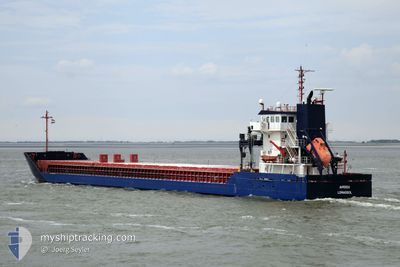
AMISIA
General Cargo
Current Trip
| Time Travelled | 2 days |
|---|---|
| Remaining Time | 1 h, 43 mins |
| Distance Travelled | 649.13 nm |
| Remaining Distance | 28.03 nm |
| AVG Speed | 12.2 Knots |
| MAX Speed | 13.5 Knots |
| AVG Wind | 9.8 knots |
| MAX Wind | 20.7 knots |
| MIN Temp | -1.9°C / 28.58°F |
| MAX Temp | 4.5°C / 40.1°F |
| Draught | 4 m |
| Position Received | 13 h, 2 m ago |
Current Position
| Longitude | 21.28766° |
|---|---|
| Latitude | 59.25762° |
| Status | Under way using engine |
| Speed | 12.7 Knots |
| Course | 174.4° |
| Area | Baltic Sea |
| Station | T-AIS |
| Position Received | 13 h, 2 m ago |
Info
Information
The current position of AMISIA is in Baltic Sea with coordinates 59.25762° / 21.28766° as reported on 2024-04-25 05:55 by AIS to our vessel tracker app. The vessel's current speed is 12.7 Knots and is heading at the port of RIGA. The estimated time of arrival as calculated by MyShipTracking vessel tracking app is 2024-04-25 20:40 LT
The vessel AMISIA (IMO: 9361378, MMSI: 209530000) is a General Cargo that was built in 2008 ( 16 years old ). It's sailing under the flag of [CY] Cyprus.
In this page you can find informations about the vessels current position, last detected port calls, and current voyage information. If the vessels is not in coverage by AIS you will find the latest position.
The current position of AMISIA is detected by our AIS receivers and we are not responsible for the reliability of the data. The last position was recorded while the vessel was in Coverage by the Ais receivers of our vessel tracking app.
The current draught of AMISIA as reported by AIS is 4 meters
Weather
| Temperature | 4.7°C / 40.46°F |
|---|---|
| Wind Speed | 11 knots |
| Direction | 247° WSW |
| Pressure | 1006 hPa |
| Humidity | 90.6 % |
| Cloud Coverage | 100 % |
Featured Company
Last Port Calls
| Port | Arrival | Departure | Time In Port |
|---|---|---|---|
| 2024-04-21 23:12 | 2024-04-23 14:00 | 1 d | |
| 2024-04-17 11:40 | 2024-04-17 14:40 | 2 h | |
| 2024-04-15 16:15 | 2024-04-15 16:31 | 16 m | |
| 2024-04-14 08:43 | 2024-04-14 18:40 | 9 h | |
| 2024-04-12 03:51 | 2024-04-12 21:25 | 17 h | |
| 2024-04-09 14:26 | 2024-04-10 06:24 | 15 h | |
| 2024-03-30 18:03 | 2024-04-05 11:08 | 5 d | |
| 2024-03-20 11:12 | 2024-03-20 11:44 | 32 m | |
| 2024-03-17 13:27 | 2024-03-19 17:56 | 2 d | |
| 2024-02-29 11:47 | 2024-03-06 00:43 | 5 d |
Most Visited Ports (Last year)
| Port | Arrivals | |
|---|---|---|
| 4 | ||
| 3 | ||
| 3 | ||
| 2 | ||
| 2 | ||
| 2 |
Last Trips
| Origin | Departure | Destination | Arrival | Distance | |
|---|---|---|---|---|---|
| 2024-04-17 16:40 | 2024-04-22 01:12 | 995.85 nm | |||
| 2024-04-15 18:31 | 2024-04-17 13:40 | 10.58 nm | |||
| 2024-04-14 20:40 | 2024-04-15 18:15 | 215.67 nm | |||
| 2024-04-12 23:25 | 2024-04-14 10:43 | 331.47 nm | |||
| 2024-04-10 08:24 | 2024-04-12 05:51 | 299.84 nm | |||
| 2024-04-05 12:08 | 2024-04-09 16:26 | 1046.10 nm | |||
| 2024-03-20 12:44 | 2024-03-30 18:03 | 1084.91 nm | |||
| 2024-03-19 17:56 | 2024-03-20 12:12 | 214.52 nm | |||
| 2024-03-06 00:43 | 2024-03-17 13:27 | 1671.16 nm | |||
| 2024-02-25 16:15 | 2024-02-29 11:47 | 594.48 nm |
Events
| Time | Event | Details | Position / Dest | Info |
|---|---|---|---|---|
| 2024-04-25 06:01 | Status Changed | Default Under way using engine |
59.23667 / 21.29333
LVRIX
|
Speed: 12.7 kn Course: 174.4° |
| 2024-04-25 05:55 | OUT of Coverage |
59.25762 / 21.28766
Baltic Sea
LVRIX
|
Speed: 12.7 kn Course: 174.4° |
|
| 2024-04-25 05:54 | Status Changed | Under way using engine Default |
59.26112 / 21.28692
LVRIX
|
Speed: 13 kn Course: 173° |
| 2024-04-25 05:52 | Status Changed | Default Under way using engine |
59.26833 / 21.28500
LVRIX
|
Speed: 12.7 kn Course: 173° |
| 2024-04-25 03:41 | Status Changed | Under way using engine Default |
59.62559 / 20.92759
LVRIX
|
Speed: 12 kn Course: 107° |
| 2024-04-25 03:34 | Status Changed | Default Under way using engine |
59.63334 / 20.87667
LVRIX
|
Speed: 12.5 kn Course: 106° |
| 2024-04-25 03:18 | Status Changed | Under way using engine Default |
59.64774 / 20.77695
LVRIX
|
Speed: 12.6 kn Course: 105° |
| 2024-04-25 03:15 | Status Changed | Default Under way using engine |
59.65074 / 20.75571
LVRIX
|
Speed: 12.6 kn Course: 105.6° |
| 2024-04-25 02:55 | Status Changed | Under way using engine Default |
59.66788 / 20.62119
LVRIX
|
Speed: 12.7 kn Course: 104° |
| 2024-04-25 02:52 | Status Changed | Default Under way using engine |
59.67028 / 20.60181
LVRIX
|
Speed: 12.7 kn Course: 104.2° |