
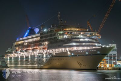
AMERA
Passengers Ship
Current Trip
PAAMD
| Time Travelled | 2 days |
|---|---|
| Remaining Time | --- |
| Distance Travelled | 971.69 nm |
| Remaining Distance | --- |
| AVG Speed | 17.6 Knots |
| MAX Speed | 20.3 Knots |
| AVG Wind | 8.3 knots |
| MAX Wind | 13.6 knots |
| MIN Temp | 24.6°C / 76.28°F |
| MAX Temp | 28.3°C / 82.94°F |
| Draught | 7.2 m |
| Position Received | 50 m ago |
Current Position
| Longitude | -84.23165° |
|---|---|
| Latitude | 22.76497° |
| Status | Under way using engine |
| Speed | 16 Knots |
| Course | 52° |
| Area | Gulf of Mexico |
| Station | T-AIS |
| Position Received | 50 m ago |
Info
Information
The current position of AMERA is in Gulf of Mexico with coordinates 22.76497° / -84.23165° as reported on 2024-04-24 13:37 by AIS to our vessel tracker app. The vessel's current speed is 16 Knots
The vessel AMERA (IMO: 8700280, MMSI: 311000840) is a Passengers Ship that was built in 1988 ( 36 years old ). It's sailing under the flag of [BS] Bahamas.
In this page you can find informations about the vessels current position, last detected port calls, and current voyage information. If the vessels is not in coverage by AIS you will find the latest position.
The current position of AMERA is detected by our AIS receivers and we are not responsible for the reliability of the data. The last position was recorded while the vessel was in Coverage by the Ais receivers of our vessel tracking app.
The current draught of AMERA as reported by AIS is 7.2 meters
Weather
| Temperature | 25°C / 77°F |
|---|---|
| Wind Speed | 10 knots |
| Direction | 108° ESE |
| Pressure | 1018.5 hPa |
| Humidity | 77 % |
| Cloud Coverage | --- |
Featured Company
Last Port Calls
| Port | Arrival | Departure | Time In Port |
|---|---|---|---|
| 2024-04-21 12:21 | 2024-04-22 00:16 | 11 h | |
| 2024-04-17 17:41 | 2024-04-18 00:21 | 6 h | |
| 2024-04-12 10:59 | 2024-04-14 18:47 | 2 d | |
| 2024-04-08 11:12 | 2024-04-08 23:09 | 11 h | |
| 2024-04-06 09:21 | 2024-04-06 20:46 | 11 h | |
| 2024-03-30 22:31 | 2024-03-31 23:39 | 1 d | |
| 2024-03-29 14:42 | 2024-03-30 00:33 | 9 h | |
| 2024-03-23 18:50 | 2024-03-24 23:17 | 1 d | |
| 2024-03-18 10:02 | 2024-03-21 17:31 | 3 d | |
| 2024-03-11 22:36 | 2024-03-13 22:08 | 1 d |
Most Visited Ports (Last year)
| Port | Arrivals | |
|---|---|---|
| 10 | ||
| 4 | ||
| 3 | ||
| 3 | ||
| 3 | ||
| 2 |
Last Trips
| Origin | Departure | Destination | Arrival | Distance | |
|---|---|---|---|---|---|
| 2024-04-17 19:21 | 2024-04-21 06:21 | 847.00 nm | |||
| 2024-04-14 13:47 | 2024-04-17 12:41 | 932.77 nm | |||
| 2024-04-08 19:09 | 2024-04-12 05:59 | 1336.60 nm | |||
| 2024-04-06 17:46 | 2024-04-08 07:12 | 598.82 nm | |||
| 2024-03-31 20:39 | 2024-04-06 06:21 | 1655.01 nm | |||
| 2024-03-29 21:33 | 2024-03-30 19:31 | 283.52 nm | |||
| 2024-03-24 20:17 | 2024-03-29 11:42 | 1223.53 nm | |||
| 2024-03-21 14:31 | 2024-03-23 15:50 | 825.23 nm | |||
| 2024-03-13 19:08 | 2024-03-18 07:02 | 1191.28 nm | |||
| 2024-03-08 18:40 | 2024-03-11 19:36 | 815.73 nm |
Events
| Time | Event | Details | Position / Dest | Info |
|---|---|---|---|---|
| 2024-04-24 13:40 | Status Changed | Default Under way using engine |
22.77333 / -84.21833
PAAMD
|
Speed: 16 kn Course: 52° |
| 2024-04-24 13:36 | Status Changed | Under way using engine Default |
22.76226 / -84.23558
PAAMD
|
Speed: 16 kn Course: 53° |
| 2024-04-24 13:31 | Status Changed | Default Under way using engine |
22.74833 / -84.25333
PAAMD
|
Speed: 16 kn Course: 53° |
| 2024-04-24 09:35 | Change Sea Area | Cuban part of the Gulf of Mexico Cuban part of the Caribbean Sea |
21.94247 / -85.07640
Gulf of Mexico
|
Speed: 18 kn Course: 359° |
| 2024-04-24 09:35 | Status Changed | Under way using engine Default |
21.94247 / -85.07640
PAAMD
|
Speed: 18 kn Course: 1° |
| 2024-04-24 09:35 | IN Coverage |
21.94247 / -85.07640
Gulf of Mexico
|
Speed: 18 kn Course: 359° |
|
| 2024-04-24 08:37 | Status Changed | Default Under way using engine |
21.67667 / -84.99834
PAAMD
|
Speed: 18.3 kn Course: 301.9° |
| 2024-04-24 08:32 | Change Sea Area | Cuban part of the Caribbean Sea Panamanian part of the Caribbean Sea |
21.66278 / -84.97230
Caribbean Sea
|
Speed: 18.3 kn Course: 301.9° |
| 2024-04-24 08:32 | Status Changed | Under way using engine Default |
21.66278 / -84.97230
PAAMD
|
Speed: 18.4 kn Course: 302° |
| 2024-04-24 08:32 | OUT of Coverage |
21.66278 / -84.97230
Caribbean Sea
|
Speed: 18.3 kn Course: 301.9° |