
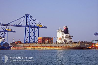
AMALTHEA
Container Ship
Current Trip
| Time Travelled | 5 days |
|---|---|
| Remaining Time | --- |
| Distance Travelled | 2026.27 nm |
| Remaining Distance | --- |
| AVG Speed | 16.4 Knots |
| MAX Speed | 18.8 Knots |
| AVG Wind | 12 knots |
| MAX Wind | 20 knots |
| MIN Temp | 14.3°C / 57.74°F |
| MAX Temp | 29.7°C / 85.46°F |
| Draught | 10.8 m |
| Position Received | 1 m ago |
Current Position
| Longitude | -15.38733° |
|---|---|
| Latitude | 28.08117° |
| Status | At anchor |
| Speed | 0.2 Knots |
| Course | 28° |
| Area | North Atlantic Ocean |
| Station | T-AIS |
| Position Received | 1 m ago |
Info
Information
The current position of AMALTHEA is in North Atlantic Ocean with coordinates 28.08117° / -15.38733° as reported on 2024-04-25 06:25 by AIS to our vessel tracker app. The vessel's current speed is 0.2 Knots
The vessel AMALTHEA (IMO: 9397913, MMSI: 255805781) is a Container Ship that was built in 2009 ( 15 years old ). It's sailing under the flag of [PT] Portugal.
In this page you can find informations about the vessels current position, last detected port calls, and current voyage information. If the vessels is not in coverage by AIS you will find the latest position.
The current position of AMALTHEA is detected by our AIS receivers and we are not responsible for the reliability of the data. The last position was recorded while the vessel was in Coverage by the Ais receivers of our vessel tracking app.
The current draught of AMALTHEA as reported by AIS is 10.8 meters
Weather
| Temperature | 14.3°C / 57.74°F |
|---|---|
| Wind Speed | 9 knots |
| Direction | 8° N |
| Pressure | 1016.4 hPa |
| Humidity | 79.6 % |
| Cloud Coverage | 5 % |
Featured Company
Last Port Calls
| Port | Arrival | Departure | Time In Port |
|---|---|---|---|
| 2024-04-18 00:23 | 2024-04-20 05:50 | 2 d | |
| 2024-04-09 07:27 | 2024-04-10 09:36 | 1 d | |
| 2024-03-13 03:29 | 2024-03-15 00:14 | 1 d | |
| 2024-03-08 12:52 | 2024-03-09 10:39 | 21 h | |
| 2024-03-04 04:20 | |||
| 2024-02-07 05:38 | 2024-02-09 01:24 | 1 d | |
| 2024-02-02 03:00 |
Most Visited Ports (Last year)
| Port | Arrivals | |
|---|---|---|
| 8 | ||
| 7 | ||
| 3 | ||
| 3 | ||
| 2 | ||
| 2 |
Last Trips
| Origin | Departure | Destination | Arrival | Distance | |
|---|---|---|---|---|---|
| 2024-04-10 09:36 | 2024-04-18 00:23 | 1767.89 nm | |||
| 2024-03-15 00:14 | 2024-04-09 07:27 | 4812.32 nm | |||
| 2024-03-09 10:39 | 2024-03-13 03:29 | 757.64 nm | |||
| 2024-02-09 01:24 | 2024-03-04 04:20 | 5165.23 nm | |||
| 2024-02-02 03:00 | 2024-02-07 05:38 | 1220.53 nm |
Events
| Time | Event | Details | Position / Dest | Info |
|---|---|---|---|---|
| 2024-04-25 06:25 | Status Changed | At anchor Default |
28.08117 / -15.38733
ESLPA
|
Speed: 0.1 kn Course: 35° |
| 2024-04-25 06:16 | Status Changed | Default At anchor |
28.08107 / -15.38790
ESLPA
|
Speed: 0.2 kn Course: 27° |
| 2024-04-25 06:13 | Status Changed | At anchor Default |
28.08100 / -15.38783
ESLPA
|
Speed: 0.4 kn Course: 15° |
| 2024-04-25 06:01 | Status Changed | Default At anchor |
28.08093 / -15.38582
ESLPA
|
Speed: 0.8 kn Course: 319° |
| 2024-04-25 05:55 | Status Changed | At anchor Default |
28.08154 / -15.38441
ESLPA
|
Speed: 0.8 kn Course: 279° |
| 2024-04-25 05:49 | Status Changed | Default At anchor |
28.08293 / -15.38399
ESLPA
|
Speed: 0.5 kn Course: 255° |
| 2024-04-25 05:40 | Status Changed | At anchor Under way using engine |
28.08442 / -15.38466
ESLPA
|
Speed: 0.5 kn Course: 244° |
| 2024-04-25 05:31 | STOP Moving | 2.97 nm, South East of LAS PALMAS |
28.08500 / -15.38600
ESLPA
|
Speed: 0.3 kn Course: 220° |
| 2024-04-25 02:16 | Status Changed | Under way using engine Default |
28.10183 / -15.03200
ESLPA
|
Speed: 15.3 kn Course: 290° |
| 2024-04-25 02:07 | Status Changed | Default Under way using engine |
28.08813 / -14.98733
ESLPA
|
Speed: 14.9 kn Course: 320.4° |