
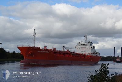
AMALIE ESSBERGER
Oil/Chemical Tanker
Current Trip
| Time Travelled | 1 day |
|---|---|
| Remaining Time | --- |
| Distance Travelled | 510.26 nm |
| Remaining Distance | --- |
| AVG Speed | 12.3 Knots |
| MAX Speed | 15.3 Knots |
| AVG Wind | 9.6 knots |
| MAX Wind | 26.8 knots |
| MIN Temp | 14.4°C / 57.92°F |
| MAX Temp | 23.3°C / 73.94°F |
| Draught | 5.2 m |
| Position Received | 3 h, 50 m ago |
Current Position
| Longitude | 23.12772° |
|---|---|
| Latitude | 36.03980° |
| Status | Under way using engine |
| Speed | 11.2 Knots |
| Course | 251.1° |
| Area | Mediterranean Sea - Eastern Basin |
| Station | T-AIS |
| Position Received | 3 h, 50 m ago |
Info
Information
The current position of AMALIE ESSBERGER is in Mediterranean Sea - Eastern Basin with coordinates 36.03980° / 23.12772° as reported on 2024-04-24 21:51 by AIS to our vessel tracker app. The vessel's current speed is 11.2 Knots and is heading at the port of HUELVA. The estimated time of arrival as calculated by MyShipTracking vessel tracking app is 2024-04-30 04:00 LT
The vessel AMALIE ESSBERGER (IMO: 9314777, MMSI: 255805370) is a Oil/Chemical Tanker that was built in 2005 ( 19 years old ). It's sailing under the flag of [PT] Portugal.
In this page you can find informations about the vessels current position, last detected port calls, and current voyage information. If the vessels is not in coverage by AIS you will find the latest position.
The current position of AMALIE ESSBERGER is detected by our AIS receivers and we are not responsible for the reliability of the data. The last position was recorded while the vessel was in Coverage by the Ais receivers of our vessel tracking app.
The current draught of AMALIE ESSBERGER as reported by AIS is 5.2 meters
Weather
| Temperature | 16.9°C / 62.42°F |
|---|---|
| Wind Speed | 17 knots |
| Direction | 280° W |
| Pressure | 1008.2 hPa |
| Humidity | 68.9 % |
| Cloud Coverage | 100 % |
Featured Company
Last Port Calls
| Port | Arrival | Departure | Time In Port |
|---|---|---|---|
| 2024-04-22 17:45 | 2024-04-23 02:56 | 9 h | |
| 2024-04-21 05:09 | 2024-04-22 17:25 | 1 d | |
| 2024-04-18 20:01 | 2024-04-19 16:45 | 20 h | |
| 2024-04-09 04:52 | 2024-04-09 19:02 | 14 h | |
| 2024-04-05 18:14 | 2024-04-07 04:29 | 1 d | |
| 2024-03-26 18:46 | 2024-03-28 03:36 | 1 d | |
| 2024-03-15 17:56 | 2024-03-17 02:54 | 1 d | |
| 2024-03-10 20:25 | 2024-03-13 15:40 | 2 d | |
| 2024-03-08 21:21 | 2024-03-09 23:54 | 1 d | |
| 2024-03-02 23:18 | 2024-03-04 23:16 | 1 d |
Last Trips
| Origin | Departure | Destination | Arrival | Distance | |
|---|---|---|---|---|---|
| 2024-04-22 20:25 | 2024-04-22 20:45 | 0.75 nm | |||
| 2024-04-19 19:45 | 2024-04-21 08:09 | 394.95 nm | |||
| 2024-04-09 21:02 | 2024-04-18 23:01 | 1721.24 nm | |||
| 2024-04-07 06:29 | 2024-04-09 06:52 | 138.13 nm | |||
| 2024-03-28 04:36 | 2024-04-05 20:14 | 904.71 nm | |||
| 2024-03-17 03:54 | 2024-03-26 19:46 | 2464.57 nm | |||
| 2024-03-13 16:40 | 2024-03-15 18:56 | 546.41 nm | |||
| 2024-03-10 00:54 | 2024-03-10 21:25 | 48.77 nm | |||
| 2024-03-04 23:16 | 2024-03-08 22:21 | 388.05 nm | |||
| 2024-02-21 03:17 | 2024-03-02 23:18 | 1530.88 nm |
Events
| Time | Event | Details | Position / Dest | Info |
|---|---|---|---|---|
| 2024-04-24 22:08 | Status Changed | Default Under way using engine |
36.02167 / 23.06500
ES HUV
|
Speed: 11.2 kn Course: 251.1° |
| 2024-04-24 21:51 | Detected in Sea | Greek part of the Mediterranean Sea - Eastern Basin |
36.03980 / 23.12772
Mediterranean Sea - Eastern Basin
ES HUV
|
Speed: 11.2 kn Course: 251.1° |
| 2024-04-24 21:51 | OUT of Coverage |
36.03980 / 23.12772
Mediterranean Sea - Eastern Basin
ES HUV
|
Speed: 11.2 kn Course: 251.1° |
|
| 2024-04-24 08:01 | ETA Changed | 2024/04/30 04:00 2024/04/30 09:00 |
38.27749 / 24.78386
ES HUV
|
Speed: 12.1 kn Course: 199.8° |
| 2024-04-24 05:06 | Status Changed | Under way using engine Default |
38.80179 / 25.10008
ES HUV
|
Speed: 11.2 kn Course: 204° |
| 2024-04-24 05:06 | IN Coverage |
38.80087 / 25.09949
Aegean Sea
ES HUV
|
Speed: 11.1 kn Course: 206.5° |
|
| 2024-04-24 02:49 | Status Changed | Default Under way using engine |
39.17668 / 25.31614
ES HUV
|
Speed: 10.3 kn Course: 204.3° |
| 2024-04-24 02:41 | OUT of Coverage |
39.19640 / 25.32792
Aegean Sea
ES HUV
|
Speed: 10.3 kn Course: 204.3° |
|
| 2024-04-23 22:21 | Change Sea Area | Greek part of the Aegean Sea Turkish part of the Aegean Sea |
39.83683 / 25.72083
Aegean Sea
ES HUV
|
Speed: 11.9 kn Course: 240.7° |
| 2024-04-23 22:21 | Status Changed | Under way using engine Default |
39.83683 / 25.72083
ES HUV
|
Speed: 11.7 kn Course: 240° |