
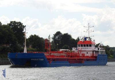
AMADEUS TITANIUM
General Cargo
Current Trip
| Time Travelled | 18 h, 45 mins |
|---|---|
| Remaining Time | 23 h, 47 mins |
| Distance Travelled | 138.55 nm |
| Remaining Distance | 175.77 nm |
| AVG Speed | 8.6 Knots |
| MAX Speed | 11 Knots |
| AVG Wind | 9.8 knots |
| MAX Wind | 19.9 knots |
| MIN Temp | 4°C / 39.2°F |
| MAX Temp | 7.6°C / 45.68°F |
| Draught | 4.5 m |
| Position Received | 1 h, 37 m ago |
Current Position
| Longitude | 4.81115° |
|---|---|
| Latitude | 53.57538° |
| Status | Under way using engine |
| Speed | 7.3 Knots |
| Course | 24.3° |
| Area | North Sea |
| Station | T-AIS |
| Position Received | 1 h, 37 m ago |
Info
Information
The current position of AMADEUS TITANIUM is in North Sea with coordinates 53.57538° / 4.81115° as reported on 2024-04-25 13:23 by AIS to our vessel tracker app. The vessel's current speed is 7.3 Knots and is heading at the port of ESBJERG. The estimated time of arrival as calculated by MyShipTracking vessel tracking app is 2024-04-26 14:47 LT
The vessel AMADEUS TITANIUM (IMO: 9350460, MMSI: 246776000) is a General Cargo that was built in 2006 ( 18 years old ). It's sailing under the flag of [NL] Netherlands.
In this page you can find informations about the vessels current position, last detected port calls, and current voyage information. If the vessels is not in coverage by AIS you will find the latest position.
The current position of AMADEUS TITANIUM is detected by our AIS receivers and we are not responsible for the reliability of the data. The last position was recorded while the vessel was in Coverage by the Ais receivers of our vessel tracking app.
The current draught of AMADEUS TITANIUM as reported by AIS is 4.5 meters
Weather
| Temperature | 7.1°C / 44.78°F |
|---|---|
| Wind Speed | 18 knots |
| Direction | 219° SW |
| Pressure | 1000.6 hPa |
| Humidity | 77.5 % |
| Cloud Coverage | 100 % |
Featured Company
Last Port Calls
| Port | Arrival | Departure | Time In Port |
|---|---|---|---|
| 2024-04-24 00:30 | 2024-04-24 20:15 | 19 h | |
| 2024-04-21 08:11 | 2024-04-21 20:53 | 12 h | |
| 2024-04-16 16:53 | 2024-04-17 11:48 | 18 h | |
| 2024-04-14 16:38 | 2024-04-15 07:01 | 14 h | |
| 2024-04-07 11:46 | 2024-04-08 09:54 | 22 h | |
| 2024-04-05 20:31 | 2024-04-05 21:21 | 50 m | |
| 2024-04-05 08:49 | |||
| 2024-04-03 05:59 | 2024-04-03 15:26 | 9 h | |
| 2024-03-26 17:07 | 2024-04-02 11:34 | 6 d | |
| 2024-03-23 16:22 | 2024-03-25 14:53 | 1 d |
Last Trips
| Origin | Departure | Destination | Arrival | Distance | |
|---|---|---|---|---|---|
| 2024-04-21 22:53 | 2024-04-24 02:30 | 446.89 nm | |||
| 2024-04-17 13:48 | 2024-04-21 10:11 | 598.65 nm | |||
| 2024-04-15 08:01 | 2024-04-16 18:53 | 291.55 nm | |||
| 2024-04-08 11:54 | 2024-04-14 17:38 | 313.39 nm | |||
| 2024-04-05 23:21 | 2024-04-07 13:46 | 309.46 nm | |||
| 2024-04-03 17:26 | 2024-04-05 22:31 | 298.31 nm | |||
| 2024-04-03 17:26 | 2024-04-05 10:49 | 296.54 nm | |||
| 2024-04-02 13:34 | 2024-04-03 07:59 | 149.54 nm | |||
| 2024-03-25 15:53 | 2024-03-26 18:07 | 227.31 nm | |||
| 2024-03-22 23:52 | 2024-03-23 17:22 | 137.59 nm |
Events
| Time | Event | Details | Position / Dest | Info |
|---|---|---|---|---|
| 2024-04-25 13:26 | Status Changed | Default Under way using engine |
53.58261 / 4.81627
DKEBJ
|
Speed: 7.3 kn Course: 24.3° |
| 2024-04-25 13:23 | Status Changed | Under way using engine Default |
53.57538 / 4.81115
DKEBJ
|
Speed: 7.3 kn Course: 22° |
| 2024-04-25 13:23 | OUT of Coverage |
53.57538 / 4.81115
North Sea
DKEBJ
|
Speed: 7.3 kn Course: 24.3° |
|
| 2024-04-25 13:11 | Status Changed | Default Under way using engine |
53.55468 / 4.79646
DKEBJ
|
Speed: 7.3 kn Course: 23.2° |
| 2024-04-25 13:09 | Status Changed | Under way using engine Default |
53.55060 / 4.79364
DKEBJ
|
Speed: 7 kn Course: 23° |
| 2024-04-25 12:56 | IN Coverage |
53.55280 / 4.79516
North Sea
DKEBJ
|
Speed: 7.3 kn Course: 23.2° |
|
| 2024-04-25 11:54 | Status Changed | Default Under way using engine |
53.40833 / 4.70833
DKEBJ
|
Speed: 7.3 kn Course: 19.1° |
| 2024-04-25 11:47 | OUT of Coverage |
53.39581 / 4.70082
North Sea
DKEBJ
|
Speed: 7.3 kn Course: 19.1° |
|
| 2024-04-25 11:36 | Status Changed | Under way using engine Default |
53.37601 / 4.68919
DKEBJ
|
Speed: 6 kn Course: 20° |
| 2024-04-25 11:30 | Status Changed | Default Under way using engine |
53.36333 / 4.68167
DKEBJ
|
Speed: 7.2 kn Course: 18.3° |