
AM HAMBURG
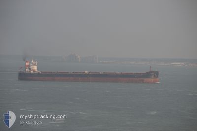
Bulk Carrier
Current Trip
| Time Travelled | 16 days |
|---|---|
| Remaining Time | 1 day |
| Distance Travelled | 3571.17 nm |
| Remaining Distance | 239.81 nm |
| AVG Speed | 8.9 Knots |
| MAX Speed | 13.1 Knots |
| AVG Wind | 12.8 knots |
| MAX Wind | 22.4 knots |
| MIN Temp | 6.6°C / 43.88°F |
| MAX Temp | 16.3°C / 61.34°F |
| Draught | 14.9 m |
| Position Received | 8 h, 35 m ago |
Current Position
| Longitude | 2.68960° |
|---|---|
| Latitude | 52.10669° |
| Status | Under way using engine |
| Speed | 6.6 Knots |
| Course | 6.3° |
| Area | North Sea |
| Station | T-AIS |
| Position Received | 8 h, 35 m ago |
Info
Information
The current position of AM HAMBURG is in North Sea with coordinates 52.10669° / 2.68960° as reported on 2024-04-23 21:16 by AIS to our vessel tracker app. The vessel's current speed is 6.6 Knots and is heading at the port of WILHELMSHAVEN. The estimated time of arrival as calculated by MyShipTracking vessel tracking app is 2024-04-25 11:59 LT
The vessel AM HAMBURG (IMO: 9624093, MMSI: 538004948) is a Bulk Carrier that was built in 2013 ( 11 years old ). It's sailing under the flag of [MH] Marshall Is.
In this page you can find informations about the vessels current position, last detected port calls, and current voyage information. If the vessels is not in coverage by AIS you will find the latest position.
The current position of AM HAMBURG is detected by our AIS receivers and we are not responsible for the reliability of the data. The last position was recorded while the vessel was in Coverage by the Ais receivers of our vessel tracking app.
The current draught of AM HAMBURG as reported by AIS is 14.9 meters
Weather
| Temperature | 6.9°C / 44.42°F |
|---|---|
| Wind Speed | 27 knots |
| Direction | 341° NNW |
| Pressure | 1012.1 hPa |
| Humidity | 67.5 % |
| Cloud Coverage | 100 % |
Featured Company
Last Port Calls
| Port | Arrival | Departure | Time In Port |
|---|---|---|---|
| 2024-04-02 16:47 | 2024-04-07 21:56 | 5 d | |
| 2024-03-03 18:01 | 2024-03-09 06:44 | 5 d | |
| 2024-02-09 23:08 | 2024-02-11 06:14 | 1 d |
Last Trips
| Origin | Departure | Destination | Arrival | Distance | |
|---|---|---|---|---|---|
| 2024-03-09 07:44 | 2024-04-02 12:47 | 4090.66 nm | |||
| 2024-02-11 01:14 | 2024-03-03 19:01 | 3548.55 nm | |||
| 2024-01-28 11:59 | 2024-02-09 18:08 | 3239.01 nm |
Events
| Time | Event | Details | Position / Dest | Info |
|---|---|---|---|---|
| 2024-04-23 21:27 | Status Changed | Default Under way using engine |
52.12667 / 2.69167
WILHELMSHAVEN
|
Speed: 6.6 kn Course: 6.3° |
| 2024-04-23 21:16 | Status Changed | Under way using engine Default |
52.10669 / 2.68960
WILHELMSHAVEN
|
Speed: 6 kn Course: 3° |
| 2024-04-23 21:16 | OUT of Coverage |
52.10669 / 2.68960
North Sea
WILHELMSHAVEN
|
Speed: 6.6 kn Course: 6.3° |
|
| 2024-04-23 21:00 | Status Changed | Default Under way using engine |
52.07667 / 2.68500
WILHELMSHAVEN
|
Speed: 6.5 kn Course: 5.4° |
| 2024-04-23 20:50 | Detected in Sea | United Kingdom part of the North Sea |
52.05792 / 2.68312
North Sea
WILHELMSHAVEN
|
Speed: 6.6 kn Course: 5.2° |
| 2024-04-23 20:50 | Status Changed | Under way using engine Default |
52.05792 / 2.68312
WILHELMSHAVEN
|
Speed: 6.6 kn Course: 4° |
| 2024-04-23 20:45 | Status Changed | Default Under way using engine |
52.04858 / 2.68174
WILHELMSHAVEN
|
Speed: 6.6 kn Course: 2.8° |
| 2024-04-23 18:37 | Change Sea Area | Dutch part of the North Sea Belgian part of the North Sea |
51.81225 / 2.64282
North Sea
WILHELMSHAVEN
|
Speed: 7.4 kn Course: 40.9° |
| 2024-04-23 15:43 | Change Sea Area | Belgian part of the North Sea French part of the North Sea |
51.50779 / 2.26614
North Sea
WILHELMSHAVEN
|
Speed: 9.5 kn Course: 47.3° |
| 2024-04-23 15:30 | Status Changed | Under way using engine Default |
51.47938 / 2.22680
WILHELMSHAVEN
|
Speed: 10.5 kn Course: 37° |