
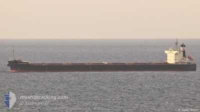
AM CONTRECOEUR
Bulk Carrier
Current Trip
SG SIN PEBGB
| Time Travelled | 41 days |
|---|---|
| Remaining Time | --- |
| Distance Travelled | 10972.35 nm |
| Remaining Distance | --- |
| AVG Speed | 10.8 Knots |
| MAX Speed | 13.4 Knots |
| AVG Wind | 15.4 knots |
| MAX Wind | 28 knots |
| MIN Temp | 13.1°C / 55.58°F |
| MAX Temp | 29.4°C / 84.92°F |
| Draught | 13.9 m |
| Position Received | 7 d ago |
Current Position
| Longitude | 55.59271° |
|---|---|
| Latitude | -20.35272° |
| Status | Under way using engine |
| Speed | 10.5 Knots |
| Course | 69.9° |
| Area | Indian Ocean |
| Station | T-AIS |
| Position Received | 7 d ago |
Info
Information
The current position of AM CONTRECOEUR is in Indian Ocean with coordinates -20.35272° / 55.59271° as reported on 2024-04-18 10:35 by AIS to our vessel tracker app. The vessel's current speed is 10.5 Knots
The vessel AM CONTRECOEUR (IMO: 9583184, MMSI: 373765000) is a Bulk Carrier that was built in 2011 ( 13 years old ). It's sailing under the flag of [PA] Panama.
In this page you can find informations about the vessels current position, last detected port calls, and current voyage information. If the vessels is not in coverage by AIS you will find the latest position.
The current position of AM CONTRECOEUR is detected by our AIS receivers and we are not responsible for the reliability of the data. The last position was recorded while the vessel was in Coverage by the Ais receivers of our vessel tracking app.
The current draught of AM CONTRECOEUR as reported by AIS is 13.9 meters
Weather
| Temperature | 26.2°C / 79.16°F |
|---|---|
| Wind Speed | 1 knots |
| Direction | 143° SE |
| Pressure | 1007.5 hPa |
| Humidity | 85.4 % |
| Cloud Coverage | 100 % |
Featured Company
Most Visited Ports (Last year)
| Port | Arrivals | |
|---|---|---|
| 2 | ||
| 2 | ||
| 2 | ||
| 1 | ||
| 1 | ||
| 1 |
Events
| Time | Event | Details | Position / Dest | Info |
|---|---|---|---|---|
| 2024-04-18 10:48 | Status Changed | Default Under way using engine |
-20.33833 / 55.63167
SG SIN PEBGB
|
Speed: 10.5 kn Course: 69.9° |
| 2024-04-18 10:35 | OUT of Coverage |
-20.35272 / 55.59271
Indian Ocean
SG SIN PEBGB
|
Speed: 10.5 kn Course: 69.9° |
|
| 2024-04-18 03:04 | Draught Changed | 13.9 14.3 |
-21.11176 / 54.55638
SG SIN PEBGB
|
Speed: 10.6 kn Course: 37.1° |
| 2024-04-18 03:04 | ETA Changed | 2024/05/03 20:00 2024/05/02 04:00 |
-21.11176 / 54.55638
SG SIN PEBGB
|
Speed: 10.6 kn Course: 37.1° |
| 2024-04-18 02:54 | Status Changed | Under way using engine Default |
-21.13200 / 54.54091
SG SIN PEBGB
|
Speed: 8.3 kn Course: 36° |
| 2024-04-18 02:48 | Status Changed | Default Under way using engine |
-21.14257 / 54.53034
SG SIN PEBGB
|
Speed: 10.7 kn Course: 36.4° |
| 2024-04-18 02:44 | Change Sea Area | R�union part of the Indian Ocean United States part of the North Atlantic Ocean |
-21.15373 / 54.52566
Indian Ocean
SG SIN PEBGB
|
Speed: 10.7 kn Course: 36.4° |
| 2024-04-18 02:43 | Status Changed | Under way using engine Default |
-21.15536 / 54.52444
SG SIN PEBGB
|
Speed: 10.7 kn Course: 36° |
| 2024-04-18 02:43 | IN Coverage |
-21.15373 / 54.52566
Indian Ocean
SG SIN PEBGB
|
Speed: 10.7 kn Course: 36.4° |