
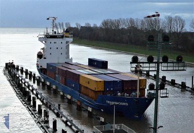
ALONDRA
General Cargo
Current Trip
| Time Travelled | 2 days |
|---|---|
| Remaining Time | 3 days |
| Distance Travelled | 899.97 nm |
| Remaining Distance | 1102.83 nm |
| AVG Speed | 12.4 Knots |
| MAX Speed | 14.5 Knots |
| AVG Wind | 10.8 knots |
| MAX Wind | 22.8 knots |
| MIN Temp | 11.8°C / 53.24°F |
| MAX Temp | 16.8°C / 62.24°F |
| Draught | 6.1 m |
| Position Received | 1 h, 57 m ago |
Current Position
| Longitude | 12.54677° |
|---|---|
| Latitude | 37.46263° |
| Status | Under way using engine |
| Speed | 13.4 Knots |
| Course | 103.4° |
| Area | Mediterranean Sea - Eastern Basin |
| Station | T-AIS |
| Position Received | 1 h, 57 m ago |
Info
Information
The current position of ALONDRA is in Mediterranean Sea - Eastern Basin with coordinates 37.46263° / 12.54677° as reported on 2024-04-24 14:56 by AIS to our vessel tracker app. The vessel's current speed is 13.4 Knots and is heading at the port of MERSIN. The estimated time of arrival as calculated by MyShipTracking vessel tracking app is 2024-04-28 02:54 LT
The vessel ALONDRA (IMO: 9113719, MMSI: 219028212) is a General Cargo that was built in 1995 ( 29 years old ). It's sailing under the flag of [DK] Denmark.
In this page you can find informations about the vessels current position, last detected port calls, and current voyage information. If the vessels is not in coverage by AIS you will find the latest position.
The current position of ALONDRA is detected by our AIS receivers and we are not responsible for the reliability of the data. The last position was recorded while the vessel was in Coverage by the Ais receivers of our vessel tracking app.
The current draught of ALONDRA as reported by AIS is 6.1 meters
Weather
| Temperature | 13.4°C / 56.12°F |
|---|---|
| Wind Speed | 12 knots |
| Direction | 302° WNW |
| Pressure | 1011.2 hPa |
| Humidity | 62.4 % |
| Cloud Coverage | 100 % |
Featured Company
Last Port Calls
| Port | Arrival | Departure | Time In Port |
|---|---|---|---|
| 2024-04-21 09:41 | 2024-04-21 18:04 | 8 h | |
| 2024-04-02 12:38 | 2024-04-09 02:35 | 6 d | |
| 2024-04-02 11:48 | 2024-04-02 12:03 | 14 m | |
| 2024-03-19 22:23 | 2024-03-20 09:50 | 11 h | |
| 2024-03-17 09:51 | 2024-03-18 22:20 | 1 d | |
| 2024-03-11 03:47 | 2024-03-11 13:02 | 9 h | |
| 2024-03-08 17:51 | 2024-03-09 07:03 | 13 h | |
| 2024-03-07 07:19 | 2024-03-07 16:16 | 8 h | |
| 2024-03-01 06:15 | 2024-03-01 19:08 | 12 h | |
| 2024-02-24 04:11 |
Most Visited Ports (Last year)
| Port | Arrivals | |
|---|---|---|
| 11 | ||
| 9 | ||
| 3 | ||
| 3 | ||
| 3 | ||
| 3 |
Last Trips
| Origin | Departure | Destination | Arrival | Distance | |
|---|---|---|---|---|---|
| 2024-04-08 22:35 | 2024-04-21 11:41 | 3467.83 nm | |||
| 2024-04-02 08:03 | 2024-04-02 08:38 | 3.46 nm | |||
| 2024-03-20 10:50 | 2024-04-02 07:48 | 3831.11 nm | |||
| 2024-03-18 23:20 | 2024-03-19 23:23 | 279.34 nm | |||
| 2024-03-09 10:03 | 2024-03-17 10:51 | 2210.13 nm | |||
| 2024-03-09 10:03 | 2024-03-11 05:47 | 400.29 nm | |||
| 2024-03-01 20:08 | 2024-03-08 20:51 | 1729.21 nm | |||
| 2024-03-01 20:08 | 2024-03-07 09:19 | 1338.34 nm | |||
| 2024-02-21 20:34 | 2024-03-01 07:15 | 2051.71 nm | |||
| 2024-02-21 20:34 | 2024-02-24 06:11 | 553.32 nm |
Events
| Time | Event | Details | Position / Dest | Info |
|---|---|---|---|---|
| 2024-04-24 15:04 | Status Changed | Default Under way using engine |
37.45500 / 12.58167
TRMER
|
Speed: 13.4 kn Course: 103.4° |
| 2024-04-24 14:56 | Status Changed | Under way using engine Default |
37.46263 / 12.54677
TRMER
|
Speed: 13 kn Course: 105° |
| 2024-04-24 14:56 | OUT of Coverage |
37.46263 / 12.54677
Mediterranean Sea - Eastern Basin
TRMER
|
Speed: 13.4 kn Course: 103.4° |
|
| 2024-04-24 14:41 | Status Changed | Default Under way using engine |
37.47790 / 12.47877
TRMER
|
Speed: 13.7 kn Course: 105.4° |
| 2024-04-24 13:59 | Change Sea Area | Italian part of the Mediterranean Sea - Eastern Basin Italian part of the Mediterranean Sea - Western Basin |
37.52784 / 12.28788
Mediterranean Sea - Eastern Basin
TRMER
|
Speed: 13.6 kn Course: 113.4° |
| 2024-04-24 13:58 | Status Changed | Under way using engine Default |
37.52902 / 12.28466
TRMER
|
Speed: 13 kn Course: 114° |
| 2024-04-24 13:52 | IN Coverage |
37.52784 / 12.28788
Mediterranean Sea - Eastern Basin
TRMER
|
Speed: 13.6 kn Course: 113.4° |
|
| 2024-04-24 11:55 | Status Changed | Default Under way using engine |
37.71833 / 11.75167
TRMER
|
Speed: 13.6 kn Course: 117.9° |
| 2024-04-24 11:39 | OUT of Coverage |
37.74630 / 11.68507
Mediterranean Sea - Western Basin
TRMER
|
Speed: 13.6 kn Course: 117.9° |
|
| 2024-04-24 11:35 | Status Changed | Under way using engine Default |
37.75328 / 11.66738
TRMER
|
Speed: 13 kn Course: 116° |