
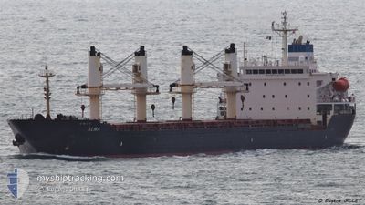
ALMA
Bulk Carrier
Current Trip
TR ISK.
| Time Travelled | 26 days |
|---|---|
| Remaining Time | --- |
| Distance Travelled | 2058.84 nm |
| Remaining Distance | --- |
| AVG Speed | 11.7 Knots |
| MAX Speed | 13.7 Knots |
| AVG Wind | 11.2 knots |
| MAX Wind | 28.3 knots |
| MIN Temp | 11°C / 51.8°F |
| MAX Temp | 30.9°C / 87.62°F |
| Draught | 9.5 m |
| Position Received | 2 h, 6 m ago |
Current Position
| Longitude | 27.24577° |
|---|---|
| Latitude | 34.84465° |
| Status | Under way using engine |
| Speed | 12.9 Knots |
| Course | 78° |
| Area | Mediterranean Sea - Eastern Basin |
| Station | T-AIS |
| Position Received | 2 h, 6 m ago |
Info
Information
The current position of ALMA is in Mediterranean Sea - Eastern Basin with coordinates 34.84465° / 27.24577° as reported on 2024-04-19 12:46 by AIS to our vessel tracker app. The vessel's current speed is 12.9 Knots
The vessel ALMA (IMO: 9231676, MMSI: 215223000) is a Bulk Carrier that was built in 2002 ( 22 years old ). It's sailing under the flag of [MT] Malta.
In this page you can find informations about the vessels current position, last detected port calls, and current voyage information. If the vessels is not in coverage by AIS you will find the latest position.
The current position of ALMA is detected by our AIS receivers and we are not responsible for the reliability of the data. The last position was recorded while the vessel was in Coverage by the Ais receivers of our vessel tracking app.
The current draught of ALMA as reported by AIS is 9.5 meters
Weather
| Temperature | 18°C / 64.4°F |
|---|---|
| Wind Speed | 10 knots |
| Direction | 218° SW |
| Pressure | 1011.9 hPa |
| Humidity | 76.9 % |
| Cloud Coverage | 41 % |
Featured Company
Last Port Calls
| Port | Arrival | Departure | Time In Port |
|---|---|---|---|
| 2024-03-15 14:44 | 2024-03-23 15:01 | 8 d | |
| 2024-03-04 12:30 | 2024-03-07 16:02 | 3 d | |
| 2024-02-21 10:38 | 2024-02-22 01:14 | 14 h | |
| 2024-02-07 08:24 | 2024-02-08 19:36 | 1 d | |
| 2024-02-04 17:20 | 2024-02-04 17:55 | 34 m | |
| 2024-02-03 14:00 | 2024-02-03 14:37 | 36 m |
Last Trips
| Origin | Departure | Destination | Arrival | Distance | |
|---|---|---|---|---|---|
| 2024-03-07 17:02 | 2024-03-15 17:44 | 1390.57 nm | |||
| 2024-02-22 02:14 | 2024-03-04 13:30 | 2726.37 nm | |||
| 2024-02-08 20:36 | 2024-02-21 11:38 | 1394.50 nm | |||
| 2024-02-04 18:55 | 2024-02-07 09:24 | 720.18 nm | |||
| 2024-02-03 15:37 | 2024-02-04 18:20 | 2.20 nm | |||
| 2024-01-12 23:33 | 2024-02-03 15:00 | 6114.37 nm |
Events
| Time | Event | Details | Position / Dest | Info |
|---|---|---|---|---|
| 2024-04-19 12:46 | OUT of Coverage |
34.84465 / 27.24577
Mediterranean Sea - Eastern Basin
TR ISK.
|
Speed: 12.9 kn Course: 78° |
|
| 2024-04-19 09:11 | IN Coverage |
34.71230 / 26.34027
Mediterranean Sea - Eastern Basin
TR ISK.
|
Speed: 12.2 kn Course: 82° |
|
| 2024-04-19 06:37 | Draught Changed | 9.5 9.4 |
34.65230 / 25.72322
TR ISK.
|
Speed: 12 kn Course: 82° |
| 2024-04-19 06:37 | Destination Changed | TR ISK. TN SFA. |
34.65230 / 25.72322
TR ISK.
|
Speed: 12 kn Course: 82° |
| 2024-04-19 06:37 | ETA Changed | 2024/04/21 03:00 2025/03/28 05:30 |
34.65230 / 25.72322
TR ISK.
|
Speed: 12 kn Course: 82° |
| 2024-04-19 06:37 | OUT of Coverage |
34.65230 / 25.72322
Mediterranean Sea - Eastern Basin
TR ISK.
|
Speed: 12 kn Course: 82° |
|
| 2024-04-19 06:29 | IN Coverage |
34.65012 / 25.69242
Mediterranean Sea - Eastern Basin
|
Speed: 12.1 kn Course: 88° |
|
| 2024-04-19 05:25 | OUT of Coverage |
34.64105 / 25.42468
Mediterranean Sea - Eastern Basin
|
Speed: 12.4 kn Course: 86° |
|
| 2024-04-19 03:00 | IN Coverage |
34.61783 / 24.81062
Mediterranean Sea - Eastern Basin
|
Speed: 12.6 kn Course: 87° |
|
| 2024-04-19 00:43 | OUT of Coverage |
34.59567 / 24.24333
Mediterranean Sea - Eastern Basin
|
Speed: 11.9 kn Course: 88° |