
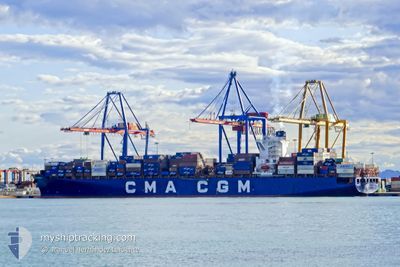
ALEXANDRA
Container Ship
Current Trip
| Time Travelled | 3 days |
|---|---|
| Remaining Time | --- |
| Distance Travelled | 1142.20 nm |
| Remaining Distance | 206.98 nm |
| AVG Speed | 14.3 Knots |
| MAX Speed | 21.2 Knots |
| AVG Wind | 11.3 knots |
| MAX Wind | 23.6 knots |
| MIN Temp | 22.8°C / 73.04°F |
| MAX Temp | 33.2°C / 91.76°F |
| Draught | 10.3 m |
| Position Received | 1 d ago |
Current Position
| Longitude | -77.14751° |
|---|---|
| Latitude | 3.83432° |
| Status | Under way using engine |
| Speed | 16.9 Knots |
| Course | 245.9° |
| Area | North Pacific Ocean |
| Station | T-AIS |
| Position Received | 1 d ago |
Info
Information
The current position of ALEXANDRA is in North Pacific Ocean with coordinates 3.83432° / -77.14751° as reported on 2024-04-15 05:25 by AIS to our vessel tracker app. The vessel's current speed is 16.9 Knots and is heading at the port of PAITA. The estimated time of arrival as calculated by MyShipTracking vessel tracking app is 2024-04-17 01:00 LT
The vessel ALEXANDRA (IMO: 9635676, MMSI: 538004912) is a Container Ship that was built in 2013 ( 11 years old ). It's sailing under the flag of [MH] Marshall Is.
In this page you can find informations about the vessels current position, last detected port calls, and current voyage information. If the vessels is not in coverage by AIS you will find the latest position.
The current position of ALEXANDRA is detected by our AIS receivers and we are not responsible for the reliability of the data. The last position was recorded while the vessel was in Coverage by the Ais receivers of our vessel tracking app.
The current draught of ALEXANDRA as reported by AIS is 10.3 meters
Weather
| Temperature | 22.9°C / 73.22°F |
|---|---|
| Wind Speed | 8 knots |
| Direction | 180° S |
| Pressure | 1009.5 hPa |
| Humidity | 85.6 % |
| Cloud Coverage | 85 % |
Featured Company
Last Port Calls
| Port | Arrival | Departure | Time In Port |
|---|---|---|---|
| 2024-04-11 22:55 | 2024-04-12 10:55 | 12 h | |
| 2024-04-09 09:39 | 2024-04-10 11:15 | 1 d | |
| 2024-04-07 08:20 | 2024-04-08 04:04 | 19 h | |
| 2024-04-05 09:47 | 2024-04-06 02:50 | 17 h | |
| 2024-03-27 23:20 | 2024-03-28 23:52 | 1 d | |
| 2024-03-20 18:28 | 2024-03-21 20:51 | 1 d | |
| 2024-03-17 22:29 | 2024-03-18 23:43 | 1 d | |
| 2024-03-14 03:57 | 2024-03-14 22:35 | 18 h | |
| 2024-03-12 12:03 | 2024-03-13 14:49 | 1 d | |
| 2024-03-11 06:00 | 2024-03-12 06:46 | 1 d |
Most Visited Ports (Last year)
| Port | Arrivals | |
|---|---|---|
| 13 | ||
| 7 | ||
| 7 | ||
| 7 | ||
| 6 | ||
| 6 |
Last Trips
| Origin | Departure | Destination | Arrival | Distance | |
|---|---|---|---|---|---|
| 2024-04-10 06:15 | 2024-04-11 17:55 | 487.08 nm | |||
| 2024-04-08 00:04 | 2024-04-09 04:39 | 442.63 nm | |||
| 2024-04-05 22:50 | 2024-04-07 04:20 | 550.12 nm | |||
| 2024-03-28 23:52 | 2024-04-05 05:47 | 3312.66 nm | |||
| 2024-03-21 21:51 | 2024-03-27 23:20 | 717.62 nm | |||
| 2024-03-19 00:43 | 2024-03-20 19:28 | 173.03 nm | |||
| 2024-03-14 23:35 | 2024-03-17 23:29 | 234.21 nm | |||
| 2024-03-13 15:49 | 2024-03-14 04:57 | 230.35 nm | |||
| 2024-03-12 07:46 | 2024-03-12 13:03 | 83.49 nm | |||
| 2024-03-09 21:27 | 2024-03-11 07:00 | 553.20 nm |
Events
| Time | Event | Details | Position / Dest | Info |
|---|---|---|---|---|
| 2024-04-15 05:32 | Status Changed | Default Under way using engine |
3.81820 / -77.17992
COBUN>PEPAI
|
Speed: 16.9 kn Course: 245.9° |
| 2024-04-15 05:25 | OUT of Coverage |
3.83432 / -77.14751
North Pacific Ocean
COBUN>PEPAI
|
Speed: 16.9 kn Course: 245.9° |
|
| 2024-04-15 05:02 | Destination Changed | COBUN>PEPAI PAPCN= PLT |
3.89125 / -77.08525
COBUN>PEPAI
|
Speed: 8.4 kn Course: 187.4° |
| 2024-04-15 05:02 | ETA Changed | 2024/04/17 01:00 2024/04/14 18:00 |
3.89125 / -77.08525
COBUN>PEPAI
|
Speed: 8.4 kn Course: 187.4° |
| 2024-04-15 05:00 | IN Coverage |
3.89347 / -77.08495
North Pacific Ocean
|
Speed: 7.2 kn Course: 188.1° |
|
| 2024-04-15 04:59 | Status Changed | Under way using engine Default |
3.89752 / -77.08463
PAPCN= PLT
|
Speed: 3.4 kn Course: 153° |
| 2024-04-15 04:56 | START Moving | 2.13 nm, North West of BUENAVENTURA |
3.90000 / -77.08580
PAPCN= PLT
|
Speed: 3.4 kn Course: 153° |
| 2024-04-14 22:25 | Status Changed | Default Moored |
3.90221 / -77.08723
PAPCN= PLT
|
Speed: Course: 131° |
| 2024-04-14 22:22 | Detected in Sea | Colombian part of the North Pacific Ocean |
3.90216 / -77.08722
North Pacific Ocean
PAPCN= PLT
|
Speed: Course: 43.3° |
| 2024-04-14 22:22 | OUT of Coverage |
3.90216 / -77.08722
North Pacific Ocean
|
Speed: Course: 43.3° |