
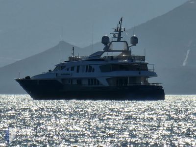
ALEXANDRA
Yacht
Current Trip
IONIO
| Time Travelled | 14 h, 50 mins |
|---|---|
| Remaining Time | --- |
| Distance Travelled | 71.90 nm |
| Remaining Distance | --- |
| AVG Speed | 13.6 Knots |
| MAX Speed | 15.9 Knots |
| AVG Wind | 6.4 knots |
| MAX Wind | 10.8 knots |
| MIN Temp | 14.9°C / 58.82°F |
| MAX Temp | 23.1°C / 73.58°F |
| Draught | 3.5 m |
| Position Received | Now |
Current Position
| Longitude | 22.77457° |
|---|---|
| Latitude | 37.55970° |
| Status | Under way sailing |
| Speed | |
| Course | 48° |
| Area | Aegean Sea |
| Station | T-AIS |
| Position Received | Now |
Info
Information
The current position of ALEXANDRA is in Aegean Sea with coordinates 37.55970° / 22.77457° as reported on 2024-04-25 02:19 by AIS to our vessel tracker app. The vessel's current speed is 0 Knots
The vessel ALEXANDRA (IMO: 9563328, MMSI: 239956000) is a Yacht that was built in 2002 ( 22 years old ). It's sailing under the flag of [GR] Greece.
In this page you can find informations about the vessels current position, last detected port calls, and current voyage information. If the vessels is not in coverage by AIS you will find the latest position.
The current position of ALEXANDRA is detected by our AIS receivers and we are not responsible for the reliability of the data. The last position was recorded while the vessel was in Coverage by the Ais receivers of our vessel tracking app.
The current draught of ALEXANDRA as reported by AIS is 3.5 meters
Weather
| Temperature | 14.8°C / 58.64°F |
|---|---|
| Wind Speed | 5 knots |
| Direction | 276° W |
| Pressure | 1005.1 hPa |
| Humidity | 44 % |
| Cloud Coverage | 100 % |
Featured Company
Last Port Calls
| Port | Arrival | Departure | Time In Port |
|---|---|---|---|
| 2024-03-20 13:40 | 2024-04-24 11:30 | ||
| 2024-02-05 10:24 | 2024-03-20 12:58 | ||
| 2024-02-05 09:36 | |||
| 2024-02-02 08:14 |
Last Trips
| Origin | Departure | Destination | Arrival | Distance | |
|---|---|---|---|---|---|
| 2024-03-20 14:58 | 2024-03-20 15:40 | 8.97 nm | |||
| 2024-02-05 11:36 | 2024-02-05 12:24 | 8.94 nm |
Events
| Time | Event | Details | Position / Dest | Info |
|---|---|---|---|---|
| 2024-04-24 16:34 | STOP Moving | 1.15 nm, South West of NAFPLIO |
37.56012 / 22.77465
IONIO
|
Speed: 0.3 kn Course: 303° |
| 2024-04-24 15:14 | IN Coverage |
37.33267 / 23.06218
Aegean Sea
|
Speed: 15.8 kn Course: 309° |
|
| 2024-04-24 13:52 | OUT of Coverage |
37.38865 / 23.46673
Aegean Sea
|
Speed: 15.8 kn Course: 236.2° |
|
| 2024-04-24 11:30 | PORT DEPARTURE |
|
37.88123 / 23.72127
IONIO
|
Speed: 5.4 kn Course: 236° |
| 2024-04-24 11:27 | START Moving |
37.87990 / 23.72513
[GR] AGIOS KOSMAS
|
Speed: 5.4 kn Course: 350° |
|
| 2024-04-24 10:59 | IN Coverage |
37.87803 / 23.72580
Aegean Sea
[GR] AGIOS KOSMAS
|
Speed: Course: 178.8° |
|
| 2024-04-24 08:28 | OUT of Coverage |
37.87803 / 23.72578
Aegean Sea
[GR] AGIOS KOSMAS
|
Speed: Course: 178.8° |
|
| 2024-04-21 01:22 | ETA Changed | 2024/07/18 10:13 2025/01/01 10:13 |
37.87802 / 23.72582
[GR] AGIOS KOSMAS
|
Speed: Course: 336° |
| 2024-04-21 01:16 | ETA Changed | 2025/01/01 10:13 2024/07/18 10:13 |
37.87802 / 23.72583
[GR] AGIOS KOSMAS
|
Speed: Course: 335° |
| 2024-04-20 09:15 | ETA Changed | 2024/07/18 10:13 2025/01/01 10:13 |
37.87802 / 23.72580
[GR] AGIOS KOSMAS
|
Speed: Course: 336° |