
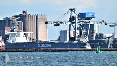
FRIEDRICH OLDENDORFF
Cargo
Current Trip
| Time Travelled | 5 days |
|---|---|
| Remaining Time | --- |
| Distance Travelled | 1393.52 nm |
| Remaining Distance | --- |
| AVG Speed | 10.4 Knots |
| MAX Speed | 11.6 Knots |
| AVG Wind | 16 knots |
| MAX Wind | 20 knots |
| MIN Temp | 23.9°C / 75.02°F |
| MAX Temp | 29°C / 84.2°F |
| Draught | 17.8 m |
| Position Received | 5 d ago |
Current Position
| Longitude | -42.93541° |
|---|---|
| Latitude | -23.59719° |
| Status | Under way using engine |
| Speed | 9.4 Knots |
| Course | 99.1° |
| Area | South Atlantic Ocean |
| Station | T-AIS |
| Position Received | 5 d ago |
Info
Information
The current position of FRIEDRICH OLDENDORFF is in South Atlantic Ocean with coordinates -23.59719° / -42.93541° as reported on 2024-04-14 07:59 by AIS to our vessel tracker app. The vessel's current speed is 9.4 Knots and is heading at the port of ROTTERDAM. The estimated time of arrival as calculated by MyShipTracking vessel tracking app is 2024-05-03 04:00 LT
The vessel FRIEDRICH OLDENDORFF (IMO: 9889265, MMSI: 374052000) is a Cargo It's sailing under the flag of [PA] Panama.
In this page you can find informations about the vessels current position, last detected port calls, and current voyage information. If the vessels is not in coverage by AIS you will find the latest position.
The current position of FRIEDRICH OLDENDORFF is detected by our AIS receivers and we are not responsible for the reliability of the data. The last position was recorded while the vessel was in Coverage by the Ais receivers of our vessel tracking app.
The current draught of FRIEDRICH OLDENDORFF as reported by AIS is 17.8 meters
Weather
| Temperature | 28.6°C / 83.48°F |
|---|---|
| Wind Speed | 11 knots |
| Direction | 122° ESE |
| Pressure | 1010 hPa |
| Humidity | 77.4 % |
| Cloud Coverage | 56 % |
Featured Company
Most Visited Ports (Last year)
| Port | Arrivals | |
|---|---|---|
| 3 | ||
| 1 | ||
| 1 |
Last Trips
| Origin | Departure | Destination | Arrival | Distance |
|---|
Events
| Time | Event | Details | Position / Dest | Info |
|---|---|---|---|---|
| 2024-04-14 08:05 | Status Changed | Default Under way using engine |
-23.59977 / -42.91714
ROTTERDAM NETHERLAND
|
Speed: 9.4 kn Course: 99.1° |
| 2024-04-14 07:59 | OUT of Coverage |
-23.59719 / -42.93541
South Atlantic Ocean
ROTTERDAM NETHERLAND
|
Speed: 9.4 kn Course: 99.1° |
|
| 2024-04-14 07:53 | Status Changed | Under way using engine Default |
-23.59433 / -42.95171
ROTTERDAM NETHERLAND
|
Speed: 9.5 kn Course: 101° |
| 2024-04-14 07:46 | Status Changed | Default Under way using engine |
-23.59123 / -42.97051
ROTTERDAM NETHERLAND
|
Speed: 9.5 kn Course: 98.5° |
| 2024-04-14 07:38 | Status Changed | Under way using engine Default |
-23.58728 / -42.99400
ROTTERDAM NETHERLAND
|
Speed: 9 kn Course: 99° |
| 2024-04-14 07:25 | Status Changed | Default Under way using engine |
-23.58000 / -43.02833
ROTTERDAM NETHERLAND
|
Speed: 9.7 kn Course: 101.2° |
| 2024-04-14 05:03 | Status Changed | Under way using engine Default |
-23.53441 / -43.45730
ROTTERDAM NETHERLAND
|
Speed: 9.9 kn Course: 92° |
| 2024-04-14 04:57 | Status Changed | Default Under way using engine |
-23.53383 / -43.47547
ROTTERDAM NETHERLAND
|
Speed: 10.1 kn Course: 94.5° |
| 2024-04-14 04:31 | Destination Changed | ROTTERDAM NETHERLAND BR SPB |
-23.53030 / -43.55152
ROTTERDAM NETHERLAND
|
Speed: 10 kn Course: 93.5° |
| 2024-04-14 04:31 | ETA Changed | 2024/05/03 04:00 2025/03/27 09:00 |
-23.53030 / -43.55152
ROTTERDAM NETHERLAND
|
Speed: 10 kn Course: 93.5° |