
ALASA
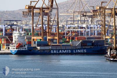
Container Ship
Current Trip
| Time Travelled | 1 day |
|---|---|
| Remaining Time | 2 h, 40 mins |
| Distance Travelled | 484.29 nm |
| Remaining Distance | 36.26 nm |
| AVG Speed | 13 Knots |
| MAX Speed | 15.1 Knots |
| AVG Wind | 12 knots |
| MAX Wind | 26.8 knots |
| MIN Temp | 17.5°C / 63.5°F |
| MAX Temp | 25.8°C / 78.44°F |
| Draught | 0 m |
| Position Received | 1 m ago |
Current Position
| Longitude | 24.08866° |
|---|---|
| Latitude | 37.58022° |
| Status | Under way using engine |
| Speed | 12.5 Knots |
| Course | 285.6° |
| Area | Aegean Sea |
| Station | T-AIS |
| Position Received | 1 m ago |
Info
Information
The current position of ALASA is in Aegean Sea with coordinates 37.58022° / 24.08866° as reported on 2024-04-25 05:20 by AIS to our vessel tracker app. The vessel's current speed is 12.5 Knots and is heading at the port of PIRAEUS. The estimated time of arrival as calculated by MyShipTracking vessel tracking app is 2024-04-25 08:01 LT
The vessel ALASA (IMO: 9162681, MMSI: 210001000) is a Container Ship that was built in 1998 ( 26 years old ). It's sailing under the flag of [CY] Cyprus.
In this page you can find informations about the vessels current position, last detected port calls, and current voyage information. If the vessels is not in coverage by AIS you will find the latest position.
The current position of ALASA is detected by our AIS receivers and we are not responsible for the reliability of the data. The last position was recorded while the vessel was in Coverage by the Ais receivers of our vessel tracking app.
Weather
| Temperature | 17.5°C / 63.5°F |
|---|---|
| Wind Speed | 6 knots |
| Direction | 226° SW |
| Pressure | 1005.1 hPa |
| Humidity | 75.1 % |
| Cloud Coverage | 100 % |
Featured Company
Last Port Calls
| Port | Arrival | Departure | Time In Port |
|---|---|---|---|
| 2024-04-22 19:02 | 2024-04-23 16:19 | 21 h | |
| 2024-04-19 15:29 | 2024-04-21 00:02 | 1 d | |
| 2024-04-11 15:34 | 2024-04-12 00:52 | 9 h | |
| 2024-04-08 17:06 | 2024-04-09 15:34 | 22 h | |
| 2024-04-05 15:47 | 2024-04-06 19:07 | 1 d | |
| 2024-03-28 16:33 | 2024-03-29 10:16 | 17 h | |
| 2024-03-26 01:04 | 2024-03-26 14:42 | 13 h | |
| 2024-03-23 10:01 | 2024-03-23 23:07 | 13 h | |
| 2024-03-15 19:46 | 2024-03-16 12:54 | 17 h | |
| 2024-03-13 05:05 | 2024-03-13 11:59 | 6 h |
Last Trips
| Origin | Departure | Destination | Arrival | Distance | |
|---|---|---|---|---|---|
| 2024-04-21 03:02 | 2024-04-22 22:02 | 527.64 nm | |||
| 2024-04-12 03:52 | 2024-04-19 18:29 | 30.76 nm | |||
| 2024-04-09 18:34 | 2024-04-11 18:34 | 530.53 nm | |||
| 2024-04-06 22:07 | 2024-04-08 20:06 | 531.63 nm | |||
| 2024-03-29 12:16 | 2024-04-05 18:47 | 19.86 nm | |||
| 2024-03-26 16:42 | 2024-03-28 18:33 | 554.39 nm | |||
| 2024-03-24 01:07 | 2024-03-26 03:04 | 532.49 nm | |||
| 2024-03-16 14:54 | 2024-03-23 12:01 | 29.37 nm | |||
| 2024-03-13 13:59 | 2024-03-15 21:46 | 687.71 nm | |||
| 2024-03-12 16:01 | 2024-03-13 07:05 | 202.12 nm |
Events
| Time | Event | Details | Position / Dest | Info |
|---|---|---|---|---|
| 2024-04-24 14:14 | Status Changed | Under way using engine Default |
36.47837 / 27.80345
GRPIR
|
Speed: 13.4 kn Course: 279° |
| 2024-04-24 13:56 | Status Changed | Default Under way using engine |
36.46894 / 27.88530
GRPIR
|
Speed: 13.3 kn Course: 275.1° |
| 2024-04-24 13:40 | Change Sea Area | Greek part of the Aegean Sea Turkish part of the Aegean Sea |
36.46964 / 27.95752
Aegean Sea
GRPIR
|
Speed: 13.2 kn Course: 264° |
| 2024-04-24 13:28 | Change Sea Area | Turkish part of the Aegean Sea Greek part of the Aegean Sea |
36.47495 / 28.01252
Aegean Sea
GRPIR
|
Speed: 13.3 kn Course: 261° |
| 2024-04-24 12:44 | Change Sea Area | Greek part of the Aegean Sea Greek part of the Mediterranean Sea - Eastern Basin |
36.49123 / 28.21258
Aegean Sea
GRPIR
|
Speed: 12.4 kn Course: 277.3° |
| 2024-04-24 11:17 | Change Sea Area | Greek part of the Mediterranean Sea - Eastern Basin Turkish part of the Mediterranean Sea - Eastern Basin |
36.39041 / 28.56881
Mediterranean Sea - Eastern Basin
GRPIR
|
Speed: 12.9 kn Course: 294.3° |
| 2024-04-24 07:58 | Detected in Sea | Turkish part of the Mediterranean Sea - Eastern Basin |
36.12776 / 29.41024
Mediterranean Sea - Eastern Basin
GRPIR
|
Speed: 13.5 kn Course: 291° |
| 2024-04-24 06:55 | Detected in Sea | Greek part of the Mediterranean Sea - Eastern Basin |
36.01724 / 29.66896
Mediterranean Sea - Eastern Basin
GRPIR
|
Speed: 13.8 kn Course: 300.2° |
| 2024-04-24 05:33 | Status Changed | Under way using engine Default |
35.86297 / 29.99451
GRPIR
|
Speed: 13.1 kn Course: 300° |
| 2024-04-24 04:46 | Status Changed | Default Under way using engine |
35.77604 / 30.17960
GRPIR
|
Speed: 13.6 kn Course: 302.8° |