
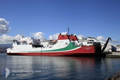
AL ANDALUS EXPRESS
Ro-Ro/Passenger Ship
Current Trip
| Trip Time | 36 mins |
|---|---|
| Trip Distance | 2.96 nm |
| AVG Speed | 3.6 Knots |
| MAX Speed | 5.2 Knots |
| Draught | 5.4 m |
| AVG Wind | 1.3 knots |
| MAX Wind | 1.8 knots |
| MIN Temp | 12.9°C / 55.22°F |
| MAX Temp | 14.5°C / 58.1°F |
| Position Received | 2 m ago |
Current Position
| Longitude | -5.35483° |
|---|---|
| Latitude | 36.12517° |
| Status | Under way using engine |
| Speed | |
| Course | --- |
| Area | Strait of Gibraltar |
| Station | T-AIS |
| Position Received | 2 m ago |
Info
Information
The current position of AL ANDALUS EXPRESS is in Strait of Gibraltar with coordinates 36.12517° / -5.35483° as reported on 2024-04-25 17:27 by AIS to our vessel tracker app. The vessel's current speed is 0 Knots and is currently inside the port of GIBRALTAR.
The vessel AL ANDALUS EXPRESS (IMO: 8512152, MMSI: 209011000) is a Ro-Ro/Passenger Ship that was built in 1987 ( 37 years old ). It's sailing under the flag of [CY] Cyprus.
In this page you can find informations about the vessels current position, last detected port calls, and current voyage information. If the vessels is not in coverage by AIS you will find the latest position.
The current position of AL ANDALUS EXPRESS is detected by our AIS receivers and we are not responsible for the reliability of the data. The last position was recorded while the vessel was in Coverage by the Ais receivers of our vessel tracking app.
The current draught of AL ANDALUS EXPRESS as reported by AIS is 5.4 meters
Weather
| Temperature | 19.6°C / 67.28°F |
|---|---|
| Wind Speed | 15 knots |
| Direction | 262° W |
| Pressure | 1009.4 hPa |
| Humidity | 51.6 % |
| Cloud Coverage | 45 % |
Featured Company
Last Port Calls
| Port | Arrival | Departure | Time In Port |
|---|---|---|---|
| 2024-04-22 07:47 | |||
| 2024-04-14 14:14 | 2024-04-22 07:11 | 7 d | |
| 2024-04-01 17:10 | 2024-04-14 14:06 | 12 d | |
| 2024-03-21 23:26 | 2024-04-01 17:07 | 10 d | |
| 2024-03-21 19:07 | 2024-03-21 22:03 | 2 h | |
| 2024-03-21 15:23 | 2024-03-21 17:07 | 1 h | |
| 2024-03-21 12:02 | 2024-03-21 14:10 | 2 h | |
| 2024-03-20 23:43 | 2024-03-21 10:50 | 11 h | |
| 2024-03-20 18:50 | 2024-03-20 22:18 | 3 h | |
| 2024-03-20 16:01 | 2024-03-20 17:42 | 1 h |
Most Visited Ports (Last year)
| Port | Arrivals | |
|---|---|---|
| 206 | ||
| 152 | ||
| 138 | ||
| 97 | ||
| 22 | ||
| 22 |
Last Trips
| Origin | Departure | Destination | Arrival | Distance | |
|---|---|---|---|---|---|
| 2024-04-22 09:11 | 2024-04-22 09:47 | 2.96 nm | |||
| 2024-04-14 16:06 | 2024-04-14 16:14 | 0.91 nm | |||
| 2024-04-01 19:07 | 2024-04-01 19:10 | 0.84 nm | |||
| 2024-03-21 22:03 | 2024-03-22 00:26 | 18.30 nm | |||
| 2024-03-21 18:07 | 2024-03-21 19:07 | 18.99 nm | |||
| 2024-03-21 14:10 | 2024-03-21 16:23 | 19.06 nm | |||
| 2024-03-21 11:50 | 2024-03-21 12:02 | 18.16 nm | |||
| 2024-03-20 22:18 | 2024-03-21 00:43 | 19.86 nm | |||
| 2024-03-20 18:42 | 2024-03-20 18:50 | 17.90 nm | |||
| 2024-03-20 14:50 | 2024-03-20 17:01 | 19.39 nm |
Events
| Time | Event | Details | Position / Dest | Info |
|---|---|---|---|---|
| 2024-04-25 15:04 | IN Coverage |
36.12523 / -5.35488
Strait of Gibraltar
[GI] GIBRALTAR
|
Speed: Course: 187.1° |
|
| 2024-04-22 08:57 | OUT of Coverage |
36.12515 / -5.35485
Strait of Gibraltar
[GI] GIBRALTAR
|
Speed: Course: 218° |
|
| 2024-04-22 08:24 | STOP Moving |
36.12531 / -5.35498
[GI] GIBRALTAR
|
Speed: 0.3 kn Course: 142° |
|
| 2024-04-22 07:47 | PORT ARRIVAL |
|
36.14546 / -5.36977
[GI] GIBRALTAR
|
Speed: 4.4 kn Course: 124° |
| 2024-04-22 07:38 | Change Sea Area | Gibraltarian part of the Strait of Gibraltar Spanish part of the Strait of Gibraltar |
36.14814 / -5.38408
Strait of Gibraltar
GIBRALTAR
|
Speed: 5 kn Course: 91° |
| 2024-04-22 07:20 | ETA Changed | 2024/04/22 09:00 2025/03/22 00:00 |
36.14681 / -5.40911
GIBRALTAR
|
Speed: 6.6 kn Course: 102° |
| 2024-04-22 07:14 | Destination Changed | GIBRALTAR ESALG-MAPTM-ESALG |
36.14891 / -5.42252
GIBRALTAR
|
Speed: 5.9 kn Course: 95° |
| 2024-04-22 07:12 | Status Changed | Under way using engine Moored |
36.14896 / -5.42500
ESALG-MAPTM-ESALG
|
Speed: 6.5 kn Course: 85° |
| 2024-04-22 07:11 | PORT DEPARTURE |
|
36.14882 / -5.42684
ESALG-MAPTM-ESALG
|
Speed: 6.7 kn Course: 84° |
| 2024-04-22 07:07 | START Moving |
36.14201 / -5.43129
[ES] ALGECIRAS
|
Speed: 4 kn Course: 348° |