
IOANNIS
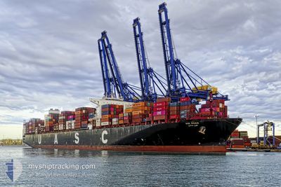
Cargo
Current Trip
| Time Travelled | 10 days |
|---|---|
| Remaining Time | --- |
| Distance Travelled | 2135.90 nm |
| Remaining Distance | --- |
| AVG Speed | 11.8 Knots |
| MAX Speed | 11.8 Knots |
| AVG Wind | 8.9 knots |
| MAX Wind | 17 knots |
| MIN Temp | 14°C / 57.2°F |
| MAX Temp | 32.3°C / 90.14°F |
| Draught | 12.9 m |
| Position Received | 4 d ago |
Current Position
| Longitude | 39.00538° |
|---|---|
| Latitude | 18.97713° |
| Status | Under way using engine |
| Speed | 13.5 Knots |
| Course | 154.7° |
| Area | Red Sea |
| Station | T-AIS |
| Position Received | 4 d ago |
Info
Information
The current position of IOANNIS is in Red Sea with coordinates 18.97713° / 39.00538° as reported on 2024-04-20 22:47 by AIS to our vessel tracker app. The vessel's current speed is 13.5 Knots and is heading at the port of CHITTAGONG. The estimated time of arrival as calculated by MyShipTracking vessel tracking app is 2024-05-02 06:00 LT
The vessel IOANNIS (IMO: 9760158, MMSI: 256603000) is a Cargo It's sailing under the flag of [MT] Malta.
In this page you can find informations about the vessels current position, last detected port calls, and current voyage information. If the vessels is not in coverage by AIS you will find the latest position.
The current position of IOANNIS is detected by our AIS receivers and we are not responsible for the reliability of the data. The last position was recorded while the vessel was in Coverage by the Ais receivers of our vessel tracking app.
The current draught of IOANNIS as reported by AIS is 12.9 meters
Weather
| Temperature | 29.1°C / 84.38°F |
|---|---|
| Wind Speed | 12 knots |
| Direction | 135° SE |
| Pressure | 1006.8 hPa |
| Humidity | 82.7 % |
| Cloud Coverage | 75 % |
Featured Company
Last Port Calls
| Port | Arrival | Departure | Time In Port |
|---|---|---|---|
| 2024-04-18 03:49 | 2024-04-18 13:07 | 9 h | |
| 2024-04-14 14:33 | 2024-04-14 15:46 | 1 h | |
| 2024-03-27 04:36 | 2024-03-27 13:45 | 9 h | |
| 2024-02-16 07:27 | 2024-02-19 15:04 | 3 d | |
| 2024-02-07 10:24 | 2024-02-12 10:10 | 4 d | |
| 2024-02-05 03:02 |
Most Visited Ports (Last year)
| Port | Arrivals | |
|---|---|---|
| 3 | ||
| 2 | ||
| 1 | ||
| 1 | ||
| 1 | ||
| 1 |
Last Trips
| Origin | Departure | Destination | Arrival | Distance | |
|---|---|---|---|---|---|
| 2024-04-14 18:46 | 2024-04-18 05:49 | 825.68 nm | |||
| 2024-02-19 22:04 | 2024-04-14 17:33 | 9550.42 nm | |||
| 2024-02-19 22:04 | 2024-03-27 06:36 | 6875.65 nm | |||
| 2024-02-12 18:10 | 2024-02-16 14:27 | 949.37 nm | |||
| 2024-02-05 11:02 | 2024-02-07 18:24 | 739.97 nm |
Events
| Time | Event | Details | Position / Dest | Info |
|---|---|---|---|---|
| 2024-04-20 23:07 | Status Changed | Default Under way using engine |
18.88048 / 39.05459
CHITTAGONG
|
Speed: 13.5 kn Course: 154.7° |
| 2024-04-20 22:47 | OUT of Coverage |
18.97713 / 39.00538
Red Sea
CHITTAGONG
|
Speed: 13.5 kn Course: 154.7° |
|
| 2024-04-20 22:31 | Status Changed | Under way using engine Default |
19.01325 / 38.98701
CHITTAGONG
|
Speed: 13.6 kn Course: 154° |
| 2024-04-20 22:25 | Status Changed | Default Under way using engine |
19.02515 / 38.98085
CHITTAGONG
|
Speed: 13.7 kn Course: 154° |
| 2024-04-20 21:52 | Status Changed | Under way using engine Default |
19.13872 / 38.92215
CHITTAGONG
|
Speed: 13.8 kn Course: 154° |
| 2024-04-20 21:42 | Status Changed | Default Under way using engine |
19.17243 / 38.90459
CHITTAGONG
|
Speed: 13.9 kn Course: 151.7° |
| 2024-04-20 21:08 | Status Changed | Under way using engine Default |
19.28745 / 38.84068
CHITTAGONG
|
Speed: 13.6 kn Course: 154° |
| 2024-04-20 20:58 | Status Changed | Default Under way using engine |
19.31988 / 38.82391
CHITTAGONG
|
Speed: 13.6 kn Course: 153.9° |
| 2024-04-20 20:48 | Status Changed | Under way using engine Default |
19.35560 / 38.80560
CHITTAGONG
|
Speed: 13.5 kn Course: 154° |
| 2024-04-20 20:42 | Status Changed | Default Under way using engine |
19.37547 / 38.79553
CHITTAGONG
|
Speed: 13.4 kn Course: 153.6° |