
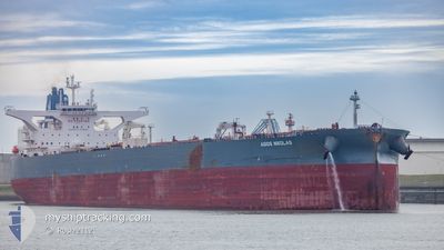
AGIOS NIKOLAS
Tanker
Current Trip
| Time Travelled | 20 days |
|---|---|
| Remaining Time | --- |
| Distance Travelled | 5736.32 nm |
| Remaining Distance | --- |
| AVG Speed | 11.3 Knots |
| MAX Speed | 13.6 Knots |
| AVG Wind | 15.5 knots |
| MAX Wind | 36 knots |
| MIN Temp | 5.4°C / 41.72°F |
| MAX Temp | 30°C / 86°F |
| Draught | 20.1 m |
| Position Received | 2 d ago |
Current Position
| Longitude | -0.77161° |
|---|---|
| Latitude | -13.69940° |
| Status | Under way using engine |
| Speed | 11.4 Knots |
| Course | 145.5° |
| Area | South Atlantic Ocean |
| Station | T-AIS |
| Position Received | 2 d ago |
Info
Information
The current position of AGIOS NIKOLAS is in South Atlantic Ocean with coordinates -13.69940° / -0.77161° as reported on 2024-04-21 02:04 by AIS to our vessel tracker app. The vessel's current speed is 11.4 Knots and is heading at the port of RIZHAO. The estimated time of arrival as calculated by MyShipTracking vessel tracking app is 2024-05-23 11:00 LT
The vessel AGIOS NIKOLAS (IMO: 9845506, MMSI: 215281000) is a Tanker It's sailing under the flag of [MT] Malta.
In this page you can find informations about the vessels current position, last detected port calls, and current voyage information. If the vessels is not in coverage by AIS you will find the latest position.
The current position of AGIOS NIKOLAS is detected by our AIS receivers and we are not responsible for the reliability of the data. The last position was recorded while the vessel was in Coverage by the Ais receivers of our vessel tracking app.
The current draught of AGIOS NIKOLAS as reported by AIS is 20.1 meters
Weather
| Temperature | 21.1°C / 69.98°F |
|---|---|
| Wind Speed | 15 knots |
| Direction | 152° SSE |
| Pressure | 1018.1 hPa |
| Humidity | 74.9 % |
| Cloud Coverage | 1 % |
Featured Company
Last Port Calls
| Port | Arrival | Departure | Time In Port |
|---|---|---|---|
| 2024-03-25 13:36 | 2024-04-03 07:12 | 8 d | |
| 2024-03-15 14:29 | 2024-03-17 15:30 | 2 d | |
| 2024-02-25 19:36 | 2024-02-27 19:45 | 2 d |
Most Visited Ports (Last year)
| Port | Arrivals | |
|---|---|---|
| 3 | ||
| 3 | ||
| 3 | ||
| 1 | ||
| 1 | ||
| 1 |
Events
| Time | Event | Details | Position / Dest | Info |
|---|---|---|---|---|
| 2024-04-21 02:08 | Status Changed | Default Under way using engine |
-13.70833 / -.76500
GB HPT>CNRZH
|
Speed: 11.4 kn Course: 145.5° |
| 2024-04-21 02:04 | Status Changed | Under way using engine Default |
-13.69940 / -.77161
GB HPT>CNRZH
|
Speed: 11.5 kn Course: 146° |
| 2024-04-21 02:04 | IN Coverage |
-13.69940 / -.77161
South Atlantic Ocean
|
Speed: 11.4 kn Course: 145.5° |
|
| 2024-04-21 02:04 | OUT of Coverage |
-13.69940 / -.77161
South Atlantic Ocean
|
Speed: 11.4 kn Course: 145.5° |
|
| 2024-04-20 22:14 | Status Changed | Default Under way using engine |
-13.06333 / -1.18333
GB HPT>CNRZH
|
Speed: 11.8 kn Course: 146.2° |
| 2024-04-20 22:10 | Status Changed | Under way using engine Default |
-13.05338 / -1.19187
GB HPT>CNRZH
|
Speed: 11.8 kn Course: 145° |
| 2024-04-20 22:10 | OUT of Coverage |
-13.05338 / -1.19187
South Atlantic Ocean
|
Speed: 11.8 kn Course: 146.2° |
|
| 2024-04-20 22:04 | Status Changed | Default Under way using engine |
-13.03817 / -1.20206
GB HPT>CNRZH
|
Speed: 12 kn Course: 147.5° |
| 2024-04-20 21:53 | Change Sea Area | High seas of the South Atlantic Ocean Western Saharan part of the North Atlantic Ocean |
-13.00518 / -1.22353
South Atlantic Ocean
|
Speed: 12 kn Course: 147.4° |
| 2024-04-20 21:51 | Status Changed | Under way using engine Default |
-13.00043 / -1.22661
GB HPT>CNRZH
|
Speed: 12 kn Course: 148° |