
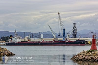
AFRICAN KALMIA
Cargo
Current Trip
| Time Travelled | 29 days |
|---|---|
| Remaining Time | 2 days |
| Distance Travelled | 5815.98 nm |
| Remaining Distance | 576.71 nm |
| AVG Speed | 11 Knots |
| MAX Speed | 15.1 Knots |
| AVG Wind | 13 knots |
| MAX Wind | 26 knots |
| MIN Temp | 6.1°C / 42.98°F |
| MAX Temp | 29.9°C / 85.82°F |
| Draught | 6 m |
| Position Received | 6 h, 53 m ago |
Current Position
| Longitude | 4.81545° |
|---|---|
| Latitude | 53.60604° |
| Status | Under way using engine |
| Speed | 11.2 Knots |
| Course | 23.4° |
| Area | North Sea |
| Station | T-AIS |
| Position Received | 6 h, 53 m ago |
Info
Information
The current position of AFRICAN KALMIA is in North Sea with coordinates 53.60604° / 4.81545° as reported on 2024-04-24 16:58 by AIS to our vessel tracker app. The vessel's current speed is 11.2 Knots and is heading at the port of SZCZECIN. The estimated time of arrival as calculated by MyShipTracking vessel tracking app is 2024-04-27 03:19 LT
The vessel AFRICAN KALMIA (IMO: 9666431, MMSI: 636015892) is a Cargo It's sailing under the flag of [LR] Liberia.
In this page you can find informations about the vessels current position, last detected port calls, and current voyage information. If the vessels is not in coverage by AIS you will find the latest position.
The current position of AFRICAN KALMIA is detected by our AIS receivers and we are not responsible for the reliability of the data. The last position was recorded while the vessel was in Coverage by the Ais receivers of our vessel tracking app.
The current draught of AFRICAN KALMIA as reported by AIS is 6 meters
Weather
| Temperature | 6.2°C / 43.16°F |
|---|---|
| Wind Speed | 15 knots |
| Direction | 339° NNW |
| Pressure | 1006.6 hPa |
| Humidity | 70.9 % |
| Cloud Coverage | 76 % |
Featured Company
Last Port Calls
| Port | Arrival | Departure | Time In Port |
|---|---|---|---|
| 2024-03-20 06:59 | 2024-03-26 01:48 | 5 d | |
| 2024-03-12 16:23 | 2024-03-18 12:45 | 5 d | |
| 2024-03-11 12:33 | |||
| 2024-02-23 15:34 | 2024-02-24 03:01 | 11 h | |
| 2024-02-08 08:31 | 2024-02-13 20:17 | 5 d |
Most Visited Ports (Last year)
| Port | Arrivals | |
|---|---|---|
| 3 | ||
| 2 | ||
| 2 | ||
| 1 | ||
| 1 | ||
| 1 |
Last Trips
| Origin | Departure | Destination | Arrival | Distance | |
|---|---|---|---|---|---|
| 2024-03-18 13:45 | 2024-03-20 07:59 | 233.11 nm | |||
| 2024-03-11 13:33 | 2024-03-12 17:23 | 272.60 nm | |||
| 2024-02-13 21:17 | 2024-02-23 15:34 | 2749.72 nm | |||
| 2024-01-25 14:30 | 2024-02-08 09:31 | 153.06 nm |
Events
| Time | Event | Details | Position / Dest | Info |
|---|---|---|---|---|
| 2024-04-24 17:02 | Status Changed | Default Under way using engine |
53.61833 / 4.82333
PL SZZ
|
Speed: 11.2 kn Course: 23.4° |
| 2024-04-24 16:58 | OUT of Coverage |
53.60604 / 4.81545
North Sea
PL SZZ
|
Speed: 11.2 kn Course: 23.4° |
|
| 2024-04-24 16:51 | Status Changed | Under way using engine Default |
53.58504 / 4.80135
PL SZZ
|
Speed: 10 kn Course: 20° |
| 2024-04-24 16:41 | Status Changed | Default Under way using engine |
53.55667 / 4.78167
PL SZZ
|
Speed: 11.1 kn Course: 22.7° |
| 2024-04-24 15:39 | START Moving | 16.12 nm, West of VLIELAND |
53.38303 / 4.65884
PL SZZ
|
Speed: 10.5 kn Course: 26.4° |
| 2024-04-24 15:39 | STOP Moving | 16.13 nm, West of VLIELAND |
53.38074 / 4.65717
PL SZZ
|
Speed: Course: 0° |
| 2024-04-24 15:34 | START Moving | 16.21 nm, West of VLIELAND |
53.36976 / 4.64920
PL SZZ
|
Speed: 10.5 kn Course: 22.9° |
| 2024-04-24 15:34 | STOP Moving | 16.23 nm, West of VLIELAND |
53.36750 / 4.64763
PL SZZ
|
Speed: Course: 0° |
| 2024-04-24 15:25 | START Moving | 16.45 nm, West of VLIELAND |
53.34470 / 4.63274
PL SZZ
|
Speed: 10.7 kn Course: 21.3° |
| 2024-04-24 15:24 | STOP Moving | 16.48 nm, West of VLIELAND |
53.34192 / 4.63090
PL SZZ
|
Speed: Course: 0° |