
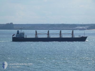
AEOLOS
Bulk Carrier
Current Trip
| Time Travelled | 1 day |
|---|---|
| Remaining Time | --- |
| Distance Travelled | 75.40 nm |
| Remaining Distance | --- |
| AVG Speed | 8.8 Knots |
| MAX Speed | 12.8 Knots |
| AVG Wind | 5.8 knots |
| MAX Wind | 11 knots |
| MIN Temp | 13.7°C / 56.66°F |
| MAX Temp | 18.6°C / 65.48°F |
| Draught | 6.9 m |
| Position Received | 25 d ago |
Current Position
| Longitude | 29.17563° |
|---|---|
| Latitude | 41.42052° |
| Status | Under way using engine |
| Speed | 12.7 Knots |
| Course | 334.7° |
| Area | Black Sea |
| Station | T-AIS |
| Position Received | 25 d ago |
Info
Information
The current position of AEOLOS is in Black Sea with coordinates 41.42052° / 29.17563° as reported on 2024-03-30 19:01 by AIS to our vessel tracker app. The vessel's current speed is 12.7 Knots and is heading at the port of ISTANBUL.
The vessel AEOLOS (IMO: 9228382, MMSI: 538003275) is a Bulk Carrier that was built in 2001 ( 23 years old ). It's sailing under the flag of [MH] Marshall Is.
In this page you can find informations about the vessels current position, last detected port calls, and current voyage information. If the vessels is not in coverage by AIS you will find the latest position.
The current position of AEOLOS is detected by our AIS receivers and we are not responsible for the reliability of the data. The last position was recorded while the vessel was in Coverage by the Ais receivers of our vessel tracking app.
The current draught of AEOLOS as reported by AIS is 6.9 meters
Weather
| Temperature | 14.5°C / 58.1°F |
|---|---|
| Wind Speed | 5 knots |
| Direction | 97° E |
| Pressure | 1005.2 hPa |
| Humidity | 86.2 % |
| Cloud Coverage | 100 % |
Featured Company
Last Port Calls
| Port | Arrival | Departure | Time In Port |
|---|---|---|---|
| 2024-04-01 07:01 | 2024-04-24 05:36 | 22 d | |
| 2024-03-30 16:27 | 2024-03-30 17:49 | 1 h | |
| 2024-03-23 13:45 | 2024-03-26 12:00 | 2 d | |
| 2024-03-07 22:46 | 2024-03-08 18:37 | 19 h | |
| 2024-02-04 04:22 | 2024-02-06 22:10 | 2 d |
Most Visited Ports (Last year)
| Port | Arrivals | |
|---|---|---|
| 3 | ||
| 2 | ||
| 2 | ||
| 1 | ||
| 1 | ||
| 1 |
Last Trips
| Origin | Departure | Destination | Arrival | Distance | |
|---|---|---|---|---|---|
| 2024-03-30 20:49 | 2024-04-01 10:01 | 173.60 nm | |||
| 2024-03-26 14:00 | 2024-03-30 19:27 | 782.54 nm | |||
| 2024-03-08 20:37 | 2024-03-23 15:45 | 24.91 nm | |||
| 2024-02-06 19:10 | 2024-03-08 00:46 | 7477.49 nm | |||
| 2024-01-11 19:44 | 2024-02-04 01:22 | 1207.88 nm |
Events
| Time | Event | Details | Position / Dest | Info |
|---|---|---|---|---|
| 2024-04-25 09:00 | START Moving | 21.58 nm, South of KAVARNA |
43.06898 / 28.50410
TR IST
|
Speed: 4.3 kn Course: 230° |
| 2024-04-24 19:16 | STOP Moving | 19.5 nm, South East of KAVARNA |
43.19333 / 28.68333
TR IST
|
Speed: Course: -1° |
| 2024-04-24 16:00 | START Moving | 17.2 nm, South East of KAVARNA |
43.22013 / 28.64563
TR IST
|
Speed: 4.6 kn Course: 342° |
| 2024-04-24 11:37 | STOP Moving | 20.5 nm, South East of KAVARNA |
43.22833 / 28.74833
TR IST
|
Speed: Course: -1° |
| 2024-04-24 05:36 | START Moving | 0.71 nm, South East of VARNA |
43.18492 / 27.92580
TR IST
|
Speed: 5.2 kn Course: 81° |
| 2024-04-24 05:36 | PORT DEPARTURE |
|
43.18492 / 27.92580
TR IST
|
Speed: 2.8 kn Course: 95° |