
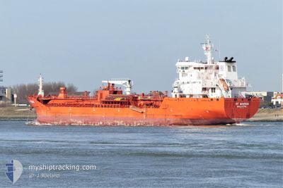
RF MARINA
Oil/Chemical Tanker
Current Trip
| Time Travelled | 3 days |
|---|---|
| Remaining Time | --- |
| Distance Travelled | 577.23 nm |
| Remaining Distance | --- |
| AVG Speed | 10.5 Knots |
| MAX Speed | 13.3 Knots |
| AVG Wind | 14.6 knots |
| MAX Wind | 22.8 knots |
| MIN Temp | 22.2°C / 71.96°F |
| MAX Temp | 25.6°C / 78.08°F |
| Draught | 7.4 m |
| Position Received | 1 m ago |
Current Position
| Longitude | -93.70283° |
|---|---|
| Latitude | 29.59593° |
| Status | Under way using engine |
| Speed | |
| Course | 90° |
| Area | Gulf of Mexico |
| Station | T-AIS |
| Position Received | 1 m ago |
Info
Information
The current position of RF MARINA is in Gulf of Mexico with coordinates 29.59593° / -93.70283° as reported on 2024-04-19 13:53 by AIS to our vessel tracker app. The vessel's current speed is 0 Knots and is heading at the port of PORT ARTHUR.
The vessel RF MARINA (IMO: 9580986, MMSI: 256770000) is a Oil/Chemical Tanker that was built in 2011 ( 13 years old ). It's sailing under the flag of [MT] Malta.
In this page you can find informations about the vessels current position, last detected port calls, and current voyage information. If the vessels is not in coverage by AIS you will find the latest position.
The current position of RF MARINA is detected by our AIS receivers and we are not responsible for the reliability of the data. The last position was recorded while the vessel was in Coverage by the Ais receivers of our vessel tracking app.
The current draught of RF MARINA as reported by AIS is 7.4 meters
Weather
| Temperature | 22.9°C / 73.22°F |
|---|---|
| Wind Speed | 6 knots |
| Direction | 184° S |
| Pressure | 1016.4 hPa |
| Humidity | 93.9 % |
| Cloud Coverage | 100 % |
Featured Company
Last Port Calls
| Port | Arrival | Departure | Time In Port |
|---|---|---|---|
| 2024-04-13 19:28 | 2024-04-15 19:42 | 2 d | |
| 2024-03-30 04:49 | 2024-04-01 18:22 | 2 d | |
| 2024-03-16 16:55 | 2024-03-18 12:16 | 1 d | |
| 2024-03-09 12:57 | 2024-03-11 10:16 | 1 d | |
| 2024-02-29 07:36 | 2024-03-02 04:16 | 1 d | |
| 2024-02-25 01:26 | 2024-02-27 19:09 | 2 d | |
| 2024-02-17 20:37 | 2024-02-20 12:34 | 2 d | |
| 2024-02-13 15:46 | 2024-02-15 15:07 | 1 d | |
| 2024-02-09 10:12 | 2024-02-11 03:59 | 1 d | |
| 2024-02-06 16:08 | 2024-02-08 08:02 | 1 d |
Last Trips
| Origin | Departure | Destination | Arrival | Distance | |
|---|---|---|---|---|---|
| 2024-04-01 14:22 | 2024-04-13 14:28 | 3469.27 nm | |||
| 2024-03-18 13:16 | 2024-03-30 00:49 | 3354.78 nm | |||
| 2024-03-11 11:16 | 2024-03-16 17:55 | 1484.29 nm | |||
| 2024-03-02 05:16 | 2024-03-09 13:57 | 1869.27 nm | |||
| 2024-02-27 20:09 | 2024-02-29 08:36 | 271.33 nm | |||
| 2024-02-20 13:34 | 2024-02-25 02:26 | 977.20 nm | |||
| 2024-02-15 15:07 | 2024-02-17 21:37 | 635.27 nm | |||
| 2024-02-11 04:59 | 2024-02-13 15:46 | 733.86 nm | |||
| 2024-02-08 09:02 | 2024-02-09 11:12 | 90.26 nm | |||
| 2024-02-06 16:23 | 2024-02-06 17:08 | 5.59 nm |
Events
| Time | Event | Details | Position / Dest | Info |
|---|---|---|---|---|
| 2024-04-19 12:34 | STOP Moving | 13.69 nm, South East of SABINE PASS |
29.59631 / -93.70245
MXATM>USPOA
|
Speed: 0.3 kn Course: 82° |
| 2024-04-19 09:48 | Draught Changed | 7.4 6.6 |
29.35384 / -94.10983
MXATM>USPOA
|
Speed: 11.5 kn Course: 48.2° |
| 2024-04-19 09:48 | Destination Changed | MXATM>USPOA MXATM>USMSY |
29.35384 / -94.10983
MXATM>USPOA
|
Speed: 11.5 kn Course: 48.2° |
| 2024-04-19 09:48 | ETA Changed | 2025/03/19 12:30 2024/04/18 18:00 |
29.35384 / -94.10983
MXATM>USPOA
|
Speed: 11.5 kn Course: 48.2° |
| 2024-04-19 09:16 | Status Changed | Under way using engine Default |
29.28207 / -94.19706
MXATM>USMSY
|
Speed: 11.6 kn Course: 47° |
| 2024-04-19 09:06 | IN Coverage |
29.28207 / -94.19706
Gulf of Mexico
|
Speed: 11.7 kn Course: 46.6° |
|
| 2024-04-19 07:41 | Status Changed | Default Under way using engine |
29.17056 / -94.47868
MXATM>USMSY
|
Speed: 11.6 kn Course: 128.7° |
| 2024-04-19 07:34 | OUT of Coverage |
29.18479 / -94.49891
Gulf of Mexico
|
Speed: 11.6 kn Course: 128.7° |
|
| 2024-04-19 06:01 | START Moving | 2.51 nm, South East of BOLIVAR |
29.34524 / -94.75101
MXATM>USMSY
|
Speed: 6.2 kn Course: 135.2° |
| 2024-04-19 05:52 | Status Changed | Under way using engine At anchor |
29.34834 / -94.75414
MXATM>USMSY
|
Speed: 0.3 kn Course: 280° |