
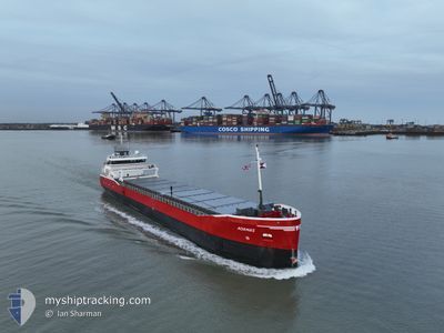
ADAMAS
General Cargo
Current Trip
| Time Travelled | 24 days |
|---|---|
| Remaining Time | --- |
| Distance Travelled | 3794.59 nm |
| Remaining Distance | --- |
| AVG Speed | 8.7 Knots |
| MAX Speed | 12.9 Knots |
| AVG Wind | 11.4 knots |
| MAX Wind | 39.5 knots |
| MIN Temp | 3°C / 37.4°F |
| MAX Temp | 26°C / 78.8°F |
| Draught | 4 m |
| Position Received | 19 h, 1 m ago |
Current Position
| Longitude | 29.20536° |
|---|---|
| Latitude | 41.38105° |
| Status | Under way using engine |
| Speed | 8.8 Knots |
| Course | 340° |
| Area | Black Sea |
| Station | T-AIS |
| Position Received | 19 h, 1 m ago |
Info
Information
The current position of ADAMAS is in Black Sea with coordinates 41.38105° / 29.20536° as reported on 2024-04-18 11:17 by AIS to our vessel tracker app. The vessel's current speed is 8.8 Knots
The vessel ADAMAS (IMO: 9489558, MMSI: 246667000) is a General Cargo that was built in 2010 ( 14 years old ). It's sailing under the flag of [NL] Netherlands.
In this page you can find informations about the vessels current position, last detected port calls, and current voyage information. If the vessels is not in coverage by AIS you will find the latest position.
The current position of ADAMAS is detected by our AIS receivers and we are not responsible for the reliability of the data. The last position was recorded while the vessel was in Coverage by the Ais receivers of our vessel tracking app.
The current draught of ADAMAS as reported by AIS is 4 meters
Weather
| Temperature | 11.9°C / 53.42°F |
|---|---|
| Wind Speed | 13 knots |
| Direction | 346° NNW |
| Pressure | 1005.3 hPa |
| Humidity | 87.6 % |
| Cloud Coverage | 85 % |
Featured Company
Last Port Calls
| Port | Arrival | Departure | Time In Port |
|---|---|---|---|
| 2024-03-24 13:09 | 2024-03-25 12:17 | 23 h | |
| 2024-03-22 08:38 | 2024-03-23 14:52 | 1 d | |
| 2024-03-18 17:01 | 2024-03-20 12:12 | 1 d | |
| 2024-03-13 18:22 | 2024-03-13 20:07 | 1 h | |
| 2024-03-06 13:20 | 2024-03-09 02:14 | 2 d | |
| 2024-02-28 05:58 | 2024-02-28 15:31 | 9 h | |
| 2024-02-24 12:56 | 2024-02-26 13:01 | 2 d | |
| 2024-02-22 10:17 | 2024-02-23 21:35 | 1 d | |
| 2024-02-16 19:05 | 2024-02-21 23:40 | 5 d | |
| 2024-02-08 04:00 | 2024-02-09 11:48 | 1 d |
Last Trips
| Origin | Departure | Destination | Arrival | Distance | |
|---|---|---|---|---|---|
| 2024-03-23 15:52 | 2024-03-24 14:09 | 231.75 nm | |||
| 2024-03-20 13:12 | 2024-03-22 09:38 | 480.34 nm | |||
| 2024-03-13 21:07 | 2024-03-18 18:01 | 522.12 nm | |||
| 2024-03-09 02:14 | 2024-03-13 19:22 | 955.75 nm | |||
| 2024-02-28 16:31 | 2024-03-06 13:20 | 1034.63 nm | |||
| 2024-02-26 14:01 | 2024-02-28 06:58 | 223.23 nm | |||
| 2024-02-23 22:35 | 2024-02-24 13:56 | 153.99 nm | |||
| 2024-02-22 00:40 | 2024-02-22 11:17 | 111.39 nm | |||
| 2024-02-09 12:48 | 2024-02-16 20:05 | 505.99 nm | |||
| 2024-02-07 15:15 | 2024-02-08 05:00 | 131.24 nm |
Events
| Time | Event | Details | Position / Dest | Info |
|---|---|---|---|---|
| 2024-04-18 12:04 | Status Changed | Default Under way using engine |
41.49492 / 29.15856
VARNA
|
Speed: 8.8 kn Course: 340° |
| 2024-04-18 11:17 | OUT of Coverage |
41.38105 / 29.20536
Black Sea
|
Speed: 8.8 kn Course: 340° |
|
| 2024-04-18 10:11 | Change Sea Area | Turkish part of the Black Sea Turkish part of the Sea of Marmara |
41.23637 / 29.14287
Black Sea
VARNA
|
Speed: 8.8 kn Course: 26° |
| 2024-04-18 05:07 | START Moving | 12.72 nm, South West of MALTEPE |
40.75395 / 28.94703
VARNA
|
Speed: 3.3 kn Course: 112° |
| 2024-04-17 05:48 | STOP Moving | 8.22 nm, South East of YESILKOY |
40.82970 / 28.89750
VARNA
|
Speed: 0.2 kn Course: 258° |
| 2024-04-17 00:20 | Status Changed | Under way using engine Default |
40.80633 / 28.46177
VARNA
|
Speed: 10.4 kn Course: 83° |
| 2024-04-17 00:04 | IN Coverage |
40.80690 / 28.46929
Sea of Marmara
VARNA
|
Speed: 10.3 kn Course: 83.1° |
|
| 2024-04-16 22:38 | Status Changed | Default Under way using engine |
40.76499 / 28.07444
VARNA
|
Speed: 10.3 kn Course: 81.2° |
| 2024-04-16 22:35 | OUT of Coverage |
40.76366 / 28.06243
Sea of Marmara
VARNA
|
Speed: 10.3 kn Course: 81.2° |
|
| 2024-04-16 18:45 | Status Changed | Under way using engine Default |
40.58787 / 27.24439
VARNA
|
Speed: 9.6 kn Course: 68° |