
WILMOT
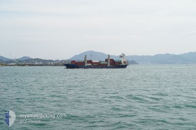
Container Ship
Current Trip
| Time Travelled | 9 days |
|---|---|
| Remaining Time | --- |
| Distance Travelled | 1436.48 nm |
| Remaining Distance | --- |
| AVG Speed | 7.4 Knots |
| MAX Speed | 15.4 Knots |
| AVG Wind | 12.4 knots |
| MAX Wind | 31.2 knots |
| MIN Temp | 21.1°C / 69.98°F |
| MAX Temp | 28.2°C / 82.76°F |
| Draught | 7 m |
| Position Received | 1 d ago |
Current Position
| Longitude | 57.05060° |
|---|---|
| Latitude | 25.59435° |
| Status | Under way using engine |
| Speed | 5 Knots |
| Course | --- |
| Area | Gulf of Oman |
| Station | T-AIS |
| Position Received | 1 d ago |
Info
Information
The current position of WILMOT is in Gulf of Oman with coordinates 25.59435° / 57.05060° as reported on 2024-04-17 13:29 by AIS to our vessel tracker app. The vessel's current speed is 5 Knots and is heading at the port of SOHAR. The estimated time of arrival as calculated by MyShipTracking vessel tracking app is 2024-04-14 23:00 LT
The vessel WILMOT (IMO: 9124689, MMSI: 355027000) is a Container Ship that was built in 1995 ( 29 years old ). It's sailing under the flag of [PA] Panama.
In this page you can find informations about the vessels current position, last detected port calls, and current voyage information. If the vessels is not in coverage by AIS you will find the latest position.
The current position of WILMOT is detected by our AIS receivers and we are not responsible for the reliability of the data. The last position was recorded while the vessel was in Coverage by the Ais receivers of our vessel tracking app.
The current draught of WILMOT as reported by AIS is 7 meters
Weather
| Temperature | 26.4°C / 79.52°F |
|---|---|
| Wind Speed | 16 knots |
| Direction | 279° W |
| Pressure | 1007.3 hPa |
| Humidity | 68.5 % |
| Cloud Coverage | --- |
Featured Company
Last Port Calls
| Port | Arrival | Departure | Time In Port |
|---|---|---|---|
| 2024-04-09 08:41 | 2024-04-10 00:13 | 15 h | |
| 2024-03-28 20:44 | 2024-03-29 12:05 | 15 h | |
| 2024-03-14 13:34 | 2024-03-15 03:09 | 13 h | |
| 2024-03-02 22:16 | 2024-03-03 16:15 | 17 h | |
| 2024-02-22 12:35 | 2024-02-25 22:04 | 3 d | |
| 2024-02-17 05:15 |
Last Trips
| Origin | Departure | Destination | Arrival | Distance | |
|---|---|---|---|---|---|
| 2024-03-29 17:35 | 2024-04-09 14:11 | 2301.66 nm | |||
| 2024-03-15 08:39 | 2024-03-29 02:14 | 2183.67 nm | |||
| 2024-03-03 21:45 | 2024-03-14 19:04 | 2413.29 nm | |||
| 2024-02-26 02:04 | 2024-03-03 03:46 | 1433.41 nm | |||
| 2024-02-17 09:15 | 2024-02-22 16:35 | 153.46 nm |
Events
| Time | Event | Details | Position / Dest | Info |
|---|---|---|---|---|
| 2024-04-17 13:50 | Status Changed | Default Under way using engine |
25.57067 / 57.06300
SOHAR
|
Speed: 5 kn Course: 0° |
| 2024-04-17 13:29 | Status Changed | Under way using engine Default |
25.59435 / 57.05060
SOHAR
|
Speed: 5 kn Course: 0° |
| 2024-04-17 13:29 | IN Coverage |
25.59435 / 57.05060
Gulf of Oman
|
Speed: 5 kn Course: 0° |
|
| 2024-04-17 13:29 | OUT of Coverage |
25.59435 / 57.05060
Gulf of Oman
|
Speed: 5 kn Course: 0° |
|
| 2024-04-17 12:26 | Status Changed | Default Under way using engine |
25.66635 / 57.01293
SOHAR
|
Speed: 5 kn Course: 0° |
| 2024-04-17 12:19 | IN Coverage |
25.67449 / 57.00855
Gulf of Oman
|
Speed: 5 kn Course: 0° |
|
| 2024-04-17 12:19 | OUT of Coverage |
25.67449 / 57.00855
Gulf of Oman
|
Speed: 5 kn Course: 0° |
|
| 2024-04-17 10:12 | OUT of Coverage |
25.81839 / 56.93329
Gulf of Oman
|
Speed: 5 kn Course: 0° |
|
| 2024-04-17 10:05 | Status Changed | Under way using engine Default |
25.82668 / 56.92890
SOHAR
|
Speed: 5 kn Course: 0° |
| 2024-04-17 09:45 | Status Changed | Default Under way using engine |
25.84822 / 56.91764
SOHAR
|
Speed: 5 kn Course: 0° |