
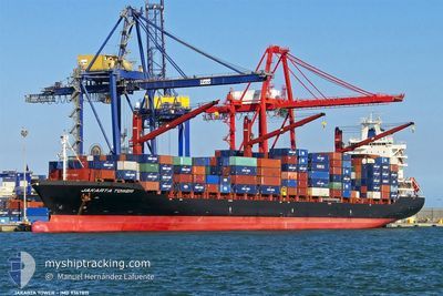
CMA CGM MOMBASA
Container Ship
Current Trip
MYPKG
| Time Travelled | 4 days |
|---|---|
| Remaining Time | --- |
| Distance Travelled | 1678.08 nm |
| Remaining Distance | --- |
| AVG Speed | 14.6 Knots |
| MAX Speed | 18.1 Knots |
| AVG Wind | 6.6 knots |
| MAX Wind | 12.3 knots |
| MIN Temp | 26.5°C / 79.7°F |
| MAX Temp | 30.3°C / 86.54°F |
| Draught | 11.4 m |
| Position Received | 3 d ago |
Current Position
| Longitude | 95.19473° |
|---|---|
| Latitude | 6.20205° |
| Status | Moored |
| Speed | 14.4 Knots |
| Course | 275° |
| Area | Andaman or Burma Sea |
| Station | T-AIS |
| Position Received | 3 d ago |
Info
Information
The current position of CMA CGM MOMBASA is in Andaman or Burma Sea with coordinates 6.20205° / 95.19473° as reported on 2024-04-21 05:56 by AIS to our vessel tracker app. The vessel's current speed is 14.4 Knots
The vessel CMA CGM MOMBASA (IMO: 9367815, MMSI: 229750000) is a Container Ship that was built in 2008 ( 16 years old ). It's sailing under the flag of [MT] Malta.
In this page you can find informations about the vessels current position, last detected port calls, and current voyage information. If the vessels is not in coverage by AIS you will find the latest position.
The current position of CMA CGM MOMBASA is detected by our AIS receivers and we are not responsible for the reliability of the data. The last position was recorded while the vessel was in Coverage by the Ais receivers of our vessel tracking app.
The current draught of CMA CGM MOMBASA as reported by AIS is 11.4 meters
Weather
| Temperature | 29.3°C / 84.74°F |
|---|---|
| Wind Speed | 5 knots |
| Direction | 254° WSW |
| Pressure | 1006.4 hPa |
| Humidity | 71.3 % |
| Cloud Coverage | 100 % |
Featured Company
Last Port Calls
| Port | Arrival | Departure | Time In Port |
|---|---|---|---|
| 2024-04-19 17:28 | 2024-04-20 01:28 | 7 h | |
| 2024-04-18 00:53 | 2024-04-18 19:58 | 19 h | |
| 2024-04-16 17:25 | 2024-04-17 22:31 | 1 d | |
| 2024-04-10 06:25 | 2024-04-11 05:34 | 23 h | |
| 2024-03-30 23:58 | 2024-04-02 09:30 | 2 d | |
| 2024-02-20 17:35 | 2024-02-21 02:11 | 8 h | |
| 2024-02-19 06:50 | 2024-02-19 15:33 | 8 h | |
| 2024-02-18 02:48 | 2024-02-19 04:43 | 1 d | |
| 2024-02-13 01:54 | 2024-02-13 18:27 | 16 h |
Most Visited Ports (Last year)
| Port | Arrivals | |
|---|---|---|
| 23 | ||
| 12 | ||
| 11 | ||
| 8 | ||
| 2 | ||
| 2 |
Last Trips
| Origin | Departure | Destination | Arrival | Distance | |
|---|---|---|---|---|---|
| 2024-04-19 03:58 | 2024-04-20 01:28 | 178.76 nm | |||
| 2024-04-18 06:31 | 2024-04-18 08:53 | 22.32 nm | |||
| 2024-04-11 11:04 | 2024-04-17 01:25 | 1604.18 nm | |||
| 2024-04-02 12:30 | 2024-04-10 11:55 | 2584.09 nm | |||
| 2024-02-21 10:11 | 2024-03-31 02:58 | 4062.46 nm | |||
| 2024-02-19 23:33 | 2024-02-21 01:35 | 183.68 nm | |||
| 2024-02-19 12:43 | 2024-02-19 14:50 | 24.31 nm | |||
| 2024-02-14 02:27 | 2024-02-18 10:48 | 1448.86 nm | |||
| 2023-12-30 21:49 | 2024-02-13 09:54 | 2290.64 nm |
Events
| Time | Event | Details | Position / Dest | Info |
|---|---|---|---|---|
| 2024-04-21 06:03 | Status Changed | Default Moored |
6.20485 / 95.16820
MYPKG
|
Speed: 14.4 kn Course: 275° |
| 2024-04-21 05:56 | OUT of Coverage |
6.20205 / 95.19473
Andaman or Burma Sea
|
Speed: 14.4 kn Course: 275° |
|
| 2024-04-21 05:54 | Status Changed | Moored Default |
6.20116 / 95.20294
MYPKG
|
Speed: 14.6 kn Course: 275° |
| 2024-04-21 05:50 | Status Changed | Default Moored |
6.19957 / 95.21768
MYPKG
|
Speed: 14.3 kn Course: 276° |
| 2024-04-21 05:46 | Status Changed | Moored Default |
6.19758 / 95.23625
MYPKG
|
Speed: 14.3 kn Course: 276° |
| 2024-04-21 05:21 | Status Changed | Default Moored |
6.18167 / 95.33325
MYPKG
|
Speed: 14.3 kn Course: 279° |
| 2024-04-21 04:31 | Change Sea Area | Indonesian part of the Andaman or Burma Sea Malaysian part of the Singapore Strait |
6.16571 / 95.53324
Andaman or Burma Sea
|
Speed: 14.7 kn Course: 279° |
| 2024-04-21 04:31 | Status Changed | Moored Default |
6.16552 / 95.53443
MYPKG
|
Speed: 15.6 kn Course: 281° |
| 2024-04-21 04:17 | IN Coverage |
6.16571 / 95.53324
Andaman or Burma Sea
|
Speed: 14.7 kn Course: 279° |
|
| 2024-04-20 01:28 | PORT DEPARTURE |
|
2.89842 / 101.26413
MYPKG
|
Speed: 13.7 kn Course: 220° |