
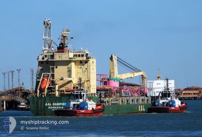
AAL DAMPIER
General Cargo
Current Trip
| Time Travelled | 2 days |
|---|---|
| Remaining Time | 9 days |
| Distance Travelled | 506.15 nm |
| Remaining Distance | 3773.38 nm |
| AVG Speed | 13.1 Knots |
| MAX Speed | 15 Knots |
| AVG Wind | 10.1 knots |
| MAX Wind | 19.9 knots |
| MIN Temp | 27.1°C / 80.78°F |
| MAX Temp | 28.7°C / 83.66°F |
| Draught | 8.9 m |
| Position Received | 1 d ago |
Current Position
| Longitude | 120.35010° |
|---|---|
| Latitude | 22.02907° |
| Status | Under way using engine |
| Speed | 13.3 Knots |
| Course | 148.2° |
| Area | South China Sea |
| Station | T-AIS |
| Position Received | 1 d ago |
Info
Information
The current position of AAL DAMPIER is in South China Sea with coordinates 22.02907° / 120.35010° as reported on 2024-04-21 17:26 by AIS to our vessel tracker app. The vessel's current speed is 13.3 Knots and is heading at the port of BRISBANE. The estimated time of arrival as calculated by MyShipTracking vessel tracking app is 2024-05-02 21:10 LT
The vessel AAL DAMPIER (IMO: 9521540, MMSI: 210418000) is a General Cargo that was built in 2011 ( 13 years old ). It's sailing under the flag of [CY] Cyprus.
In this page you can find informations about the vessels current position, last detected port calls, and current voyage information. If the vessels is not in coverage by AIS you will find the latest position.
The current position of AAL DAMPIER is detected by our AIS receivers and we are not responsible for the reliability of the data. The last position was recorded while the vessel was in Coverage by the Ais receivers of our vessel tracking app.
The current draught of AAL DAMPIER as reported by AIS is 8.9 meters
Weather
| Temperature | 28.2°C / 82.76°F |
|---|---|
| Wind Speed | 8 knots |
| Direction | 116° ESE |
| Pressure | 1012.6 hPa |
| Humidity | 71.3 % |
| Cloud Coverage | 7 % |
Featured Company
Last Port Calls
| Port | Arrival | Departure | Time In Port |
|---|---|---|---|
| 2024-04-18 14:40 | 2024-04-21 14:37 | 2 d | |
| 2024-04-12 01:36 | 2024-04-13 15:50 | 1 d | |
| 2024-04-04 02:08 | 2024-04-08 09:32 | 4 d | |
| 2024-02-28 04:26 | 2024-03-09 14:28 | 10 d | |
| 2024-02-24 01:39 | 2024-02-25 05:00 | 1 d | |
| 2024-02-18 14:12 | 2024-02-20 09:33 | 1 d |
Most Visited Ports (Last year)
| Port | Arrivals | |
|---|---|---|
| 7 | ||
| 5 | ||
| 2 | ||
| 2 | ||
| 2 | ||
| 1 |
Last Trips
| Origin | Departure | Destination | Arrival | Distance | |
|---|---|---|---|---|---|
| 2024-04-13 22:50 | 2024-04-18 22:40 | 1664.16 nm | |||
| 2024-04-08 16:32 | 2024-04-12 08:36 | 1228.64 nm | |||
| 2024-03-10 01:28 | 2024-04-04 09:08 | 5833.21 nm | |||
| 2024-02-25 15:30 | 2024-02-28 15:26 | 949.67 nm | |||
| 2024-02-20 20:33 | 2024-02-24 12:09 | 521.25 nm | |||
| 2024-01-26 20:07 | 2024-02-19 01:12 | 5750.30 nm |
Events
| Time | Event | Details | Position / Dest | Info |
|---|---|---|---|---|
| 2024-04-21 17:31 | Status Changed | Default Under way using engine |
22.01064 / 120.36219
AUBNE
|
Speed: 13.3 kn Course: 148.2° |
| 2024-04-21 17:26 | OUT of Coverage |
22.02907 / 120.35010
South China Sea
AUBNE
|
Speed: 13.3 kn Course: 148.2° |
|
| 2024-04-21 16:28 | Status Changed | Under way using engine Default |
22.20895 / 120.21191
AUBNE
|
Speed: 14.3 kn Course: 144° |
| 2024-04-21 16:20 | Status Changed | Default Under way using engine |
22.23705 / 120.18997
AUBNE
|
Speed: 14.5 kn Course: 148.7° |
| 2024-04-21 16:12 | Status Changed | Under way using engine Default |
22.26199 / 120.17223
AUBNE
|
Speed: 14.6 kn Course: 148° |
| 2024-04-21 16:08 | Status Changed | Default Under way using engine |
22.27501 / 120.16339
AUBNE
|
Speed: 14.9 kn Course: 159.7° |
| 2024-04-21 14:37 | PORT DEPARTURE |
|
22.54719 / 120.27993
AUBNE
|
Speed: 10.4 kn Course: 269° |
| 2024-04-21 14:16 | Status Changed | Under way using engine Moored |
22.55826 / 120.32621
[TW] KAOHSIUNG
|
Speed: 3.4 kn Course: 232° |
| 2024-04-21 14:16 | START Moving |
22.55837 / 120.32636
[TW] KAOHSIUNG
|
Speed: 3.4 kn Course: 232° |
|
| 2024-04-21 14:05 | Status Changed | Moored Default |
22.55954 / 120.32938
[TW] KAOHSIUNG
|
Speed: Course: 231° |