
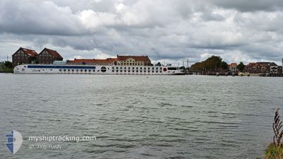
A ROSA AQUA
Passenger
Current Trip
| Time Travelled | 3 days |
|---|---|
| Remaining Time | 46 mins |
| Distance Travelled | 247.00 nm |
| Remaining Distance | 8.73 nm |
| AVG Speed | 5.9 Knots |
| MAX Speed | 8.2 Knots |
| AVG Wind | 6.4 knots |
| MAX Wind | 12.7 knots |
| MIN Temp | -0.5°C / 31.1°F |
| MAX Temp | 10.6°C / 51.08°F |
| Draught | 1.8 m |
| Position Received | 18 m ago |
Current Position
| Longitude | 7.50869° |
|---|---|
| Latitude | 47.70002° |
| Status | Under way using engine |
| Speed | 8.1 Knots |
| Course | 191.2° |
| Area | North Sea |
| Station | T-AIS |
| Position Received | 18 m ago |
Info
Information
The current position of A ROSA AQUA is in North Sea with coordinates 47.70002° / 7.50869° as reported on 2024-04-24 05:22 by AIS to our vessel tracker app. The vessel's current speed is 8.1 Knots and is heading at the port of BASEL. The estimated time of arrival as calculated by MyShipTracking vessel tracking app is 2024-04-24 06:27 LT
The vessel A ROSA AQUA (MMSI: 211488640) is a Passenger It's sailing under the flag of [DE] Germany.
In this page you can find informations about the vessels current position, last detected port calls, and current voyage information. If the vessels is not in coverage by AIS you will find the latest position.
The current position of A ROSA AQUA is detected by our AIS receivers and we are not responsible for the reliability of the data. The last position was recorded while the vessel was in Coverage by the Ais receivers of our vessel tracking app.
The current draught of A ROSA AQUA as reported by AIS is 1.8 meters
Weather
| Temperature | -0.3°C / 31.46°F |
|---|---|
| Wind Speed | 5 knots |
| Direction | 175° S |
| Pressure | 1015.7 hPa |
| Humidity | 86 % |
| Cloud Coverage | 65 % |
Featured Company
Last Port Calls
| Port | Arrival | Departure | Time In Port |
|---|---|---|---|
| 2024-04-19 23:50 | 2024-04-20 17:13 | 17 h | |
| 2024-04-19 03:59 | 2024-04-19 10:00 | 6 h | |
| 2024-04-17 05:52 | 2024-04-17 17:20 | 11 h | |
| 2024-04-12 01:29 | 2024-04-13 17:02 | 1 d | |
| 2024-04-10 11:35 | 2024-04-10 21:14 | 9 h | |
| 2024-04-10 03:58 | 2024-04-10 09:43 | 5 h | |
| 2024-04-09 02:39 | 2024-04-09 15:52 | 13 h | |
| 2024-04-08 08:25 | 2024-04-08 09:29 | 1 h | |
| 2024-04-08 00:47 | 2024-04-08 03:19 | 2 h | |
| 2024-04-07 09:39 | 2024-04-07 21:08 | 11 h |
Most Visited Ports (Last year)
| Port | Arrivals | |
|---|---|---|
| 38 | ||
| 31 | ||
| 26 | ||
| 23 | ||
| 22 | ||
| 20 |
Last Trips
| Origin | Departure | Destination | Arrival | Distance | |
|---|---|---|---|---|---|
| 2024-04-19 12:00 | 2024-04-20 01:50 | 85.70 nm | |||
| 2024-04-17 19:20 | 2024-04-19 05:59 | 165.68 nm | |||
| 2024-04-13 19:02 | 2024-04-17 07:52 | 257.76 nm | |||
| 2024-04-10 23:14 | 2024-04-12 03:29 | 152.77 nm | |||
| 2024-04-10 11:43 | 2024-04-10 13:35 | 16.23 nm | |||
| 2024-04-09 17:52 | 2024-04-10 05:58 | 132.80 nm | |||
| 2024-04-08 11:29 | 2024-04-09 04:39 | 99.32 nm | |||
| 2024-04-08 05:19 | 2024-04-08 10:25 | 59.11 nm | |||
| 2024-04-07 23:08 | 2024-04-08 02:47 | 30.57 nm | |||
| 2024-04-07 06:44 | 2024-04-07 11:39 | 16.92 nm |
Events
| Time | Event | Details | Position / Dest | Info |
|---|---|---|---|---|
| 2024-04-24 05:11 | IN Coverage |
47.71869 / 7.52909
North Sea
BASEL
|
Speed: 8 kn Course: 223° |
|
| 2024-04-22 22:51 | OUT of Coverage |
48.87120 / 8.12462
North Sea
BASEL
|
Speed: 5.1 kn Course: 196.5° |
|
| 2024-04-22 16:24 | START Moving | 6.08 nm, North East of GERMERSHEIM |
49.31417 / 8.45469
BASEL
|
Speed: 4.7 kn Course: 145° |
| 2024-04-22 16:16 | STOP Moving | 5.98 nm, North East of GERMERSHEIM |
49.31136 / 8.45729
BASEL
|
Speed: 0.3 kn Course: 70° |
| 2024-04-22 16:15 | IN Coverage |
49.31130 / 8.45726
North Sea
BASEL
|
Speed: 0.8 kn Course: 193.5° |
|
| 2024-04-22 04:56 | OUT of Coverage |
49.31810 / 8.45152
North Sea
BASEL
|
Speed: 5.2 kn Course: 162.4° |
|
| 2024-04-21 18:13 | START Moving | 10.44 nm, West of SCHIERSTEIN |
49.97628 / 7.94123
BASEL
|
Speed: 4.5 kn Course: 88° |
| 2024-04-21 07:58 | STOP Moving | 10.53 nm, West of SCHIERSTEIN |
49.97684 / 7.93833
BASEL
|
Speed: 0.3 kn Course: 76° |
| 2024-04-21 07:36 | IN Coverage |
49.97183 / 7.89832
North Sea
BASEL
|
Speed: 6 kn Course: 97.3° |
|
| 2024-04-20 23:00 | OUT of Coverage |
50.47087 / 7.34896
North Sea
BASEL
|
Speed: 4.9 kn Course: 153.6° |