
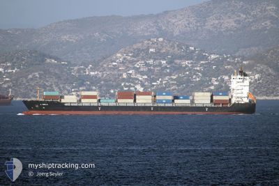
A. OBELIX
Container Ship
Current Trip
| Trip Time | 1 day |
|---|---|
| Trip Distance | 517.95 nm |
| AVG Speed | 10.9 Knots |
| MAX Speed | 13.3 Knots |
| Draught | 9.7 m |
| AVG Wind | 16.3 knots |
| MAX Wind | 32.2 knots |
| MIN Temp | 18.1°C / 64.58°F |
| MAX Temp | 28.4°C / 83.12°F |
| Position Received | 5 h, 4 m ago |
Current Position
| Longitude | 29.61567° |
|---|---|
| Latitude | 31.43141° |
| Status | Under way using engine |
| Speed | 10.2 Knots |
| Course | 144.9° |
| Area | Mediterranean Sea - Eastern Basin |
| Station | T-AIS |
| Position Received | 5 h, 4 m ago |
Info
Information
The current position of A. OBELIX is in Mediterranean Sea - Eastern Basin with coordinates 31.43141° / 29.61567° as reported on 2024-04-24 07:58 by AIS to our vessel tracker app. The vessel's current speed is 10.2 Knots and is currently inside the port of EL DEKHEILA.
The vessel A. OBELIX (IMO: 9354674, MMSI: 256432000) is a Container Ship that was built in 2008 ( 16 years old ). It's sailing under the flag of [MT] Malta.
In this page you can find informations about the vessels current position, last detected port calls, and current voyage information. If the vessels is not in coverage by AIS you will find the latest position.
The current position of A. OBELIX is detected by our AIS receivers and we are not responsible for the reliability of the data. The last position was recorded while the vessel was in Coverage by the Ais receivers of our vessel tracking app.
The current draught of A. OBELIX as reported by AIS is 9.7 meters
Weather
| Temperature | 21.6°C / 70.88°F |
|---|---|
| Wind Speed | 13 knots |
| Direction | 305° NW |
| Pressure | 1006.7 hPa |
| Humidity | 77.3 % |
| Cloud Coverage | 98 % |
Featured Company
Last Port Calls
| Port | Arrival | Departure | Time In Port |
|---|---|---|---|
| 2024-04-24 11:24 | |||
| 2024-04-21 14:26 | 2024-04-22 12:09 | 21 h | |
| 2024-04-10 16:37 | 2024-04-11 18:00 | 1 d | |
| 2024-04-09 10:22 | 2024-04-09 21:33 | 11 h | |
| 2024-04-07 21:55 | 2024-04-08 04:46 | 6 h | |
| 2024-04-07 05:52 | 2024-04-07 15:05 | 9 h | |
| 2024-04-06 10:49 | 2024-04-07 00:18 | 13 h | |
| 2024-04-03 08:46 | 2024-04-04 03:40 | 18 h | |
| 2024-03-29 12:43 | 2024-03-30 14:23 | 1 d | |
| 2024-03-26 18:22 | 2024-03-27 23:41 | 1 d |
Last Trips
| Origin | Departure | Destination | Arrival | Distance | |
|---|---|---|---|---|---|
| 2024-04-22 15:09 | 2024-04-24 13:24 | 517.95 nm | |||
| 2024-04-11 21:00 | 2024-04-21 17:26 | 27.95 nm | |||
| 2024-04-10 00:33 | 2024-04-10 19:37 | 191.19 nm | |||
| 2024-04-08 07:46 | 2024-04-09 13:22 | 279.42 nm | |||
| 2024-04-07 18:05 | 2024-04-08 00:55 | 74.40 nm | |||
| 2024-04-07 03:18 | 2024-04-07 08:52 | 64.90 nm | |||
| 2024-04-04 06:40 | 2024-04-06 13:49 | 356.96 nm | |||
| 2024-03-30 15:23 | 2024-04-03 11:46 | 516.88 nm | |||
| 2024-03-28 01:41 | 2024-03-29 13:43 | 498.43 nm | |||
| 2024-03-24 10:46 | 2024-03-26 20:22 | 742.48 nm |
Events
| Time | Event | Details | Position / Dest | Info |
|---|---|---|---|---|
| 2024-04-24 11:47 | STOP Moving |
31.14061 / 29.79543
[EG] EL DEKHEILA
|
Speed: Course: 213° |
|
| 2024-04-24 11:24 | PORT ARRIVAL |
|
31.14768 / 29.80455
[EG] EL DEKHEILA
|
Speed: 5.2 kn Course: 172° |
| 2024-04-24 10:56 | START Moving | 3.09 nm, North of EL DEKHEILA |
31.19530 / 29.78712
EGALY
|
Speed: 3.4 kn Course: 152° |
| 2024-04-24 10:24 | STOP Moving | 3.29 nm, North of EL DEKHEILA |
31.19889 / 29.78740
EGALY
|
Speed: 0.3 kn Course: 183° |
| 2024-04-24 08:04 | Status Changed | Default Under way using engine |
31.41661 / 29.62783
EGALY
|
Speed: 10.2 kn Course: 144.9° |
| 2024-04-24 07:58 | OUT of Coverage |
31.43141 / 29.61567
Mediterranean Sea - Eastern Basin
EGALY
|
Speed: 10.2 kn Course: 144.9° |
|
| 2024-04-24 07:45 | Status Changed | Under way using engine Default |
31.46109 / 29.59113
EGALY
|
Speed: 10.2 kn Course: 144° |
| 2024-04-24 07:28 | IN Coverage |
31.45797 / 29.59373
Mediterranean Sea - Eastern Basin
EGALY
|
Speed: 10.2 kn Course: 143.8° |
|
| 2024-04-24 06:04 | Status Changed | Default Under way using engine |
31.70721 / 29.39973
EGALY
|
Speed: 10.6 kn Course: 145.3° |
| 2024-04-24 05:59 | OUT of Coverage |
31.72052 / 29.38928
Mediterranean Sea - Eastern Basin
EGALY
|
Speed: 10.6 kn Course: 145.3° |